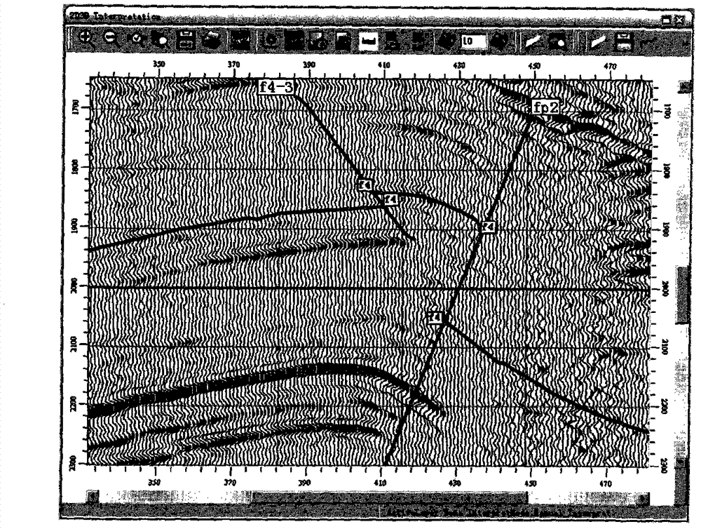
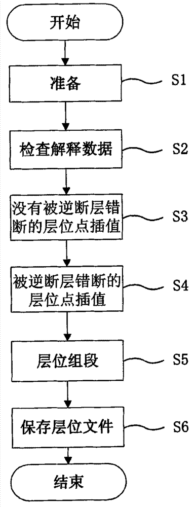
Method for carrying out horizon interpolation on three-dimensional seismic interpretation under condition of reverse-fault containing complex geological structure
A 3D seismic and complex geology technology, applied in seismic signal processing, seismic signal receivers, etc., can solve problems such as horizon interpolation in 3D seismic interpretation
- Summary
- Abstract
- Description
- Claims
- Application Information
AI Technical Summary
Problems solved by technology
Method used
Image
Examples
Embodiment Construction
[0016] The present invention is described below with reference to exemplary embodiments of the invention and the accompanying drawings.
[0017] Before introducing the horizon interpolation method for 3D seismic interpretation of complex geological structures with reverse faults proposed by the present invention, first introduce the physical meanings of several data in this method:
[0018] Point: Each data point in the interpreted data describes the time or depth of a horizon or fault along the trace. Since the seismic data is also recorded in the way of sampling at equal intervals in practice or depth, the position of the data interpretation point on the track can be simply described by the sampling point position of the seismic data.
[0019] Segment: Explain that the concept of a data segment refers to consecutive data points that do not overlap on a trace. The introduction of segments is mainly due to two factors. The first is that segments can accurately describe the ho...
PUM
 Abstract
Description
Claims
Application Information
 - R&D
- Intellectual Property
- Life Sciences
- Materials
- Tech Scout
- Unparalleled Data Quality
- Higher Quality Content
- 60% Fewer Hallucinations
Browse by: Latest US Patents, China's latest patents, Technical Efficacy Thesaurus, Application Domain, Technology Topic, Popular Technical Reports.
© 2025 PatSnap. All rights reserved.Legal|Privacy policy|Modern Slavery Act Transparency Statement|Sitemap|About US| Contact US: help@patsnap.com


