Method for determining equivalence of elevation estimation precisions of satellite-borne multi-frequency and multi-baseline InSARs (interferometric synthetic aperture radars)
A determination method, multi-frequency technology, applied in the field of signal processing, can solve the problem of limited DEM acquisition accuracy and so on
- Summary
- Abstract
- Description
- Claims
- Application Information
AI Technical Summary
Problems solved by technology
Method used
Image
Examples
Embodiment Construction
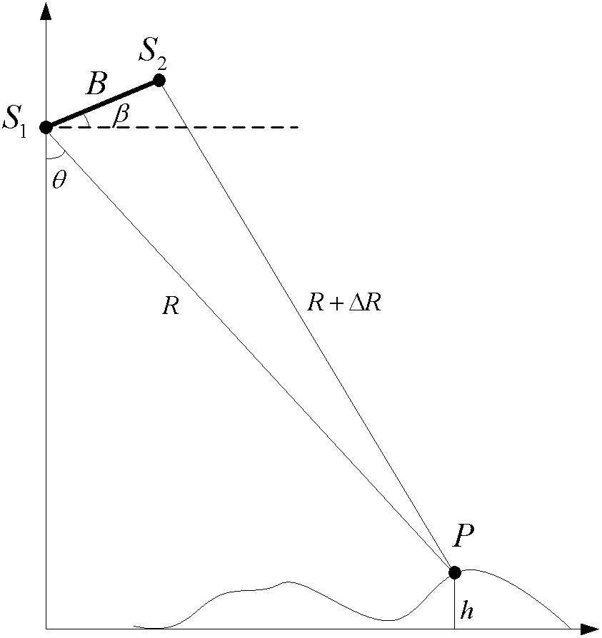
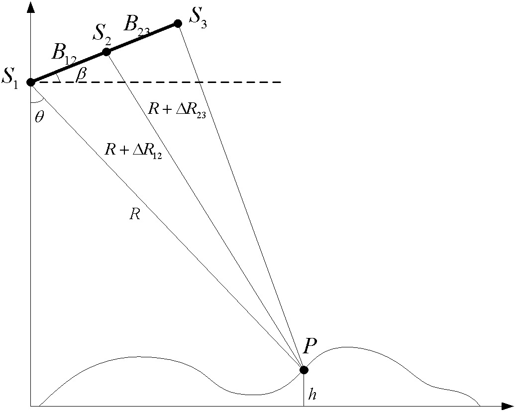
[0092] according to figure 1 and figure 2 InSAR elevation estimation model in and image 3 The equivalence determination method of the space-borne multi-frequency and multi-baseline InSAR elevation estimation accuracy described in the present invention uses specific InSAR altimetry system parameters to conduct experiments to verify the equivalence of multi-frequency InSAR and multi-baseline InSAR elevation estimation accuracy, and at the same time Verify the validity of the equivalent conditions. Table 1 below gives the simulated InSAR system parameters.
[0093] Table 1 Simulation system parameters
[0094]
[0095]
[0096] according to image 3 As shown, the steps of the present invention when determining the equivalence of multi-frequency InSAR and multi-baseline InSAR elevation estimation accuracy are as follows:
[0097] Step (1): The baseline length of the InSAR system is limited to vary between 200-650 meters, and the correlation coefficient of the InSAR sy...
PUM
 Abstract
Description
Claims
Application Information
 - R&D
- Intellectual Property
- Life Sciences
- Materials
- Tech Scout
- Unparalleled Data Quality
- Higher Quality Content
- 60% Fewer Hallucinations
Browse by: Latest US Patents, China's latest patents, Technical Efficacy Thesaurus, Application Domain, Technology Topic, Popular Technical Reports.
© 2025 PatSnap. All rights reserved.Legal|Privacy policy|Modern Slavery Act Transparency Statement|Sitemap|About US| Contact US: help@patsnap.com


