
Geosynchronous orbit synthetic aperture radar velocity spatial variability compensating method

A synthetic aperture radar, geosynchronous orbit technology, used in the direction of reflection/re-radiation of radio waves, utilization of re-radiation, measurement devices, etc.

Inactive Publication Date: 2015-05-06
BEIJING INSTITUTE OF TECHNOLOGYGY
View PDF5 Cites 0 Cited by
  • Summary
  • Abstract
  • Description
  • Claims
  • Application Information

AI Technical Summary

Problems solved by technology

[0005] In view of this, the present invention provides a method for compensating the spatial variability of geosynchronous orbit synthetic aperture radar velocity, which can realize the compensation of spatial velocity variability through adaptive phase compensation processing, and solve the core problem of synthetic aperture radar large-scene imaging ——Compensation of velocity and spatial variability, realizing the focusing processing of GEO SAR large scene imaging at any position

Method used

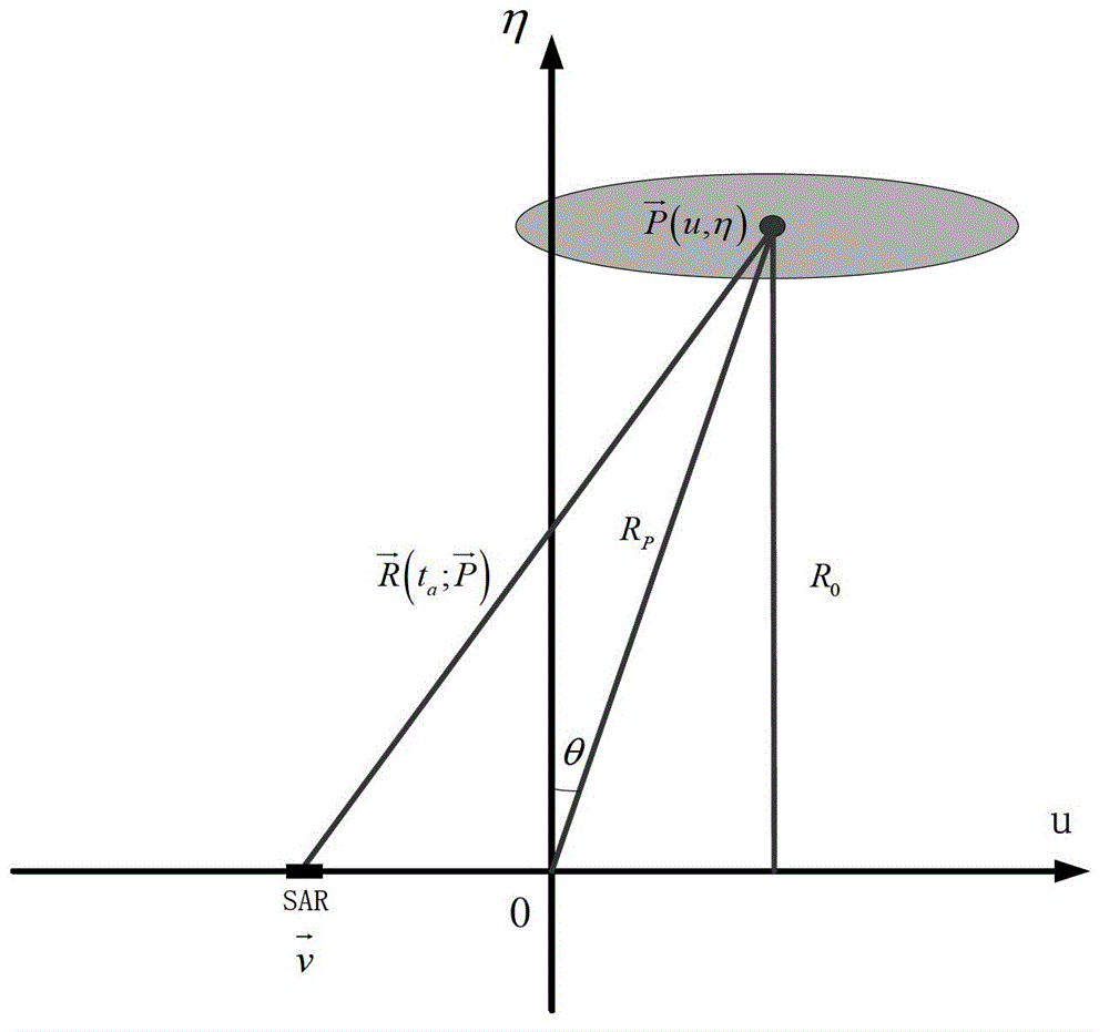
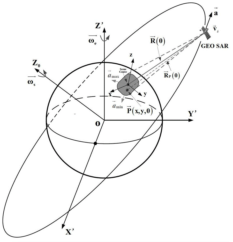

Image

  • Geosynchronous orbit synthetic aperture radar velocity spatial variability compensating method
  • Geosynchronous orbit synthetic aperture radar velocity spatial variability compensating method
  • Geosynchronous orbit synthetic aperture radar velocity spatial variability compensating method

Examples


Embodiment

[0171] In this example, the relevant parameters are as follows:

[0172]Orbital semi-major axis: 42164.17Km, orbital inclination: 53°, orbital eccentricity: 0.07, argument of perigee: 270°; right ascension of ascending node: 265°, antenna size: 30m, frequency band: L band (0.24m wavelength), Sampling rate: 18MHz, bandwidth 20MHz, pulse repetition frequency PRF: 200.

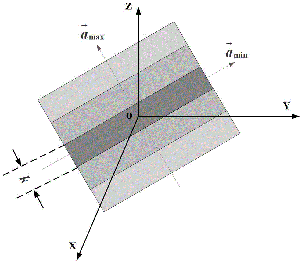
[0173] We substitute the relevant parameters into equations (36), (37) and (38) respectively to find k bound-RCM =1.34×10 14 Km,k bound-SRC =4.9×10 4 Km,k bound-a = 3.14Km. Therefore we choose k bound =k bound-a =3.14Km as the value of k, such as image 3 Shown is the division result of the final compensation area.

[0174] Figure 5 The imaging results of the lattice target of the traditional SRC algorithm and the improved SRC algorithm of the present invention are shown. It can be seen that the traditional SRC algorithm does not compensate for the spatial variability of the velocity, resulting in the ...


PUM


Abstract

The invention discloses a geosynchronous orbit synthetic aperture radar velocity spatial variability compensating method. According to the method, the velocity spatial variability is compensated through self-adaptive phase compensation processing, so that a core problem, i.e. a velocity spatial variability compensation problem, of geosynchronous orbit synthetic aperture radar (GEO SAR) large-scale scene imaging is solved, the GEO SAR large-scale scene imaging focusing processing of arbitrary position is realized, and a good effect is obtained.

Description

technical field [0001] The invention relates to the technical field of synthetic aperture radar, in particular to a method for compensating the spatial variability of the velocity of a geosynchronous orbit synthetic aperture radar. Background technique [0002] Synthetic Aperture Radar (SAR) is an all-weather, all-time high-resolution microwave remote sensing imaging radar that can be installed on aircraft, satellites, missiles and other flying platforms. Since its invention in the 1950s, it has been widely used in many fields, such as disaster control, vegetation analysis, microwave remote sensing and other fields. [0003] Geosynchronous Orbit Synthetic Aperture Radar (GEO SAR) is a SAR satellite operating on a geosynchronous elliptical orbit at a height of 36000km. Compared with low-orbit SAR (LEO SAR, the orbit height is lower than 1000Km), GEO SAR has the characteristics of large imaging range, short revisit time, and strong anti-strike and anti-destruction capabilitie...

Claims


Application Information

Patent Timeline
Patent Type & Authority Patents(China)
IPC IPC(8): G01S13/90
Inventor 胡程龙腾田野刘飞锋曾涛丁泽刚
Owner BEIJING INSTITUTE OF TECHNOLOGYGY
Learn More