
A Registration Method for 2.5D Maps

A map and registration technology, applied in the field of geographic information, can solve the problems of inconvenient use, the inability to transfer regions to other cities in the form of dragging, and it is not convenient for users to consult maps in different places, so as to achieve the effect of convenient use

Inactive Publication Date: 2017-05-10
HANGZHOU ALADDIN INFORMATION & TECH
View PDF3 Cites 0 Cited by
  • Summary
  • Abstract
  • Description
  • Claims
  • Application Information

AI Technical Summary

Problems solved by technology

However, through the above calibration maps, especially the current maps, the city is used as the site. There are architectural models in the city center and two-dimensional maps without architectural models in the urban fringes. The displayed area cannot be transferred to other cities in the form of drag and drop. Realize the national unified roaming of the simulated 3D map, which is not conducive to users to consult the maps of different places, and it is very inconvenient to use

Method used


Image

  • A Registration Method for 2.5D Maps
  • A Registration Method for 2.5D Maps
  • A Registration Method for 2.5D Maps

Examples


Embodiment Construction

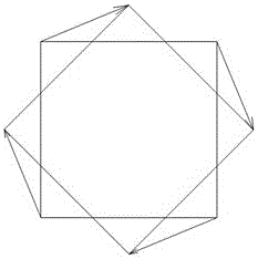
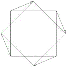
[0019] Such as Figure 1 to Figure 4 As shown, a 2.5-dimensional map registration method, S1, converts the two-dimensional vector map or image map in the base map into a Mercator projection map in JPG format (WGS 84 Web mercator);

[0020] S2, after the above S1, it is necessary to rotate the vector data and raster data by an angle in the ArcMap module of ArcGIS, the range of the angle is 30-80 degrees, and perform longitudinal compression in proportion, and the proportion of longitudinal compression in proportion The value range is 20% to 80%. The rotation and compression of vector data are corrected by the geometric correction tool of ArcMap. The rotation and compression of raster data are corrected by the geometric registration tool of ArcMap. The rotation and compression of vector data and raster data The compression ratio parameters are consistent. The rotation and compression operations of vector data and raster data in the ArcMap module of ArcGIS are completely differen...


PUM


Abstract

The invention discloses a registration method of 2.5D (two and a half dimensional) maps. The method includes: converting a two-dimensional vector graph in a base graph, or a photographic map into a Mercator projection of JPG (joint picture group) format, rotating and compressing vector and raster data of the Mercator projection of JPG format in an ArcMap module, rotating and compressing a photographic file in the base graph not rotated and compressed, in 3Dsmax to generate a 3D rendering, setting the width and height of the 3D rendering to be equal to that of an original image of the rendering, rotating and compressing the new 3D rendering of new width and height to generate a JPG image of same height and width, replacing an original JPG image file of the rendering by a JPG file of the new 3D rendering, reading the new 3D rendering into the ArcMap module, and performing adjusting to generate a 2.5D map. The method has the advantages that seamless integration and splicing of 2D and 3D maps is achieved, a simulation 3D map registered and integrated allows national roaming on the same map, geographical coordinates are located and queried on the same map, and using is more convenient.

Description

technical field [0001] The invention relates to the technical field of geographic information, in particular to a registration method for a 2.5-dimensional map. Background technique [0002] With the rapid development and integration of modern surveying and mapping technology, computer technology, network communication technology and the Internet, the applications related to geospatial space are growing rapidly. The 3D map shows the reality more intuitively and truly through the intuitive representation of geospatial real scene simulation. scenarios are widely used. The existing 3D map is generated by combining the vector data from different sources of the same geographical location but with different projection methods and distortions, through geometric correction based on a polynomial, and the existing 3D map or through image processing. Registration, registration of remote sensing images from different sources in the same geographical location but with different projecti...

Claims


Application Information

Patent Timeline
Patent Type & Authority Patents(China)
IPC IPC(8): G06T3/00G06T3/60
Inventor 汤愈卓
Owner HANGZHOU ALADDIN INFORMATION & TECH
Learn More