Spatial internet information service system and method

A technology for Internet information and service methods, applied in transmission systems, radio transmission systems, electrical components, etc., can solve problems such as limited satellite capabilities

Active Publication Date: 2015-05-20
TSINGHUA UNIV
View PDF4 Cites 13 Cited by
  • Summary
  • Abstract
  • Description
  • Claims
  • Application Information

AI Technical Summary

Problems solved by technology

However, the capabilities of satellites are limited. How to dynamically allocate and use wireless channels according to the changing business needs during operation with the least human intervention, and use the limited capabilities of satellites to provide on-demand services to users and achieve the maximum service value. It is the core problem that the industry needs to solve

Method used


Image

  • Spatial internet information service system and method
  • Spatial internet information service system and method
  • Spatial internet information service system and method

Examples


Embodiment Construction

[0029] The spatio-temporal reference-based spatial Internet information service system and method provided by the present invention will be further described in detail below in conjunction with the accompanying drawings and specific embodiments.

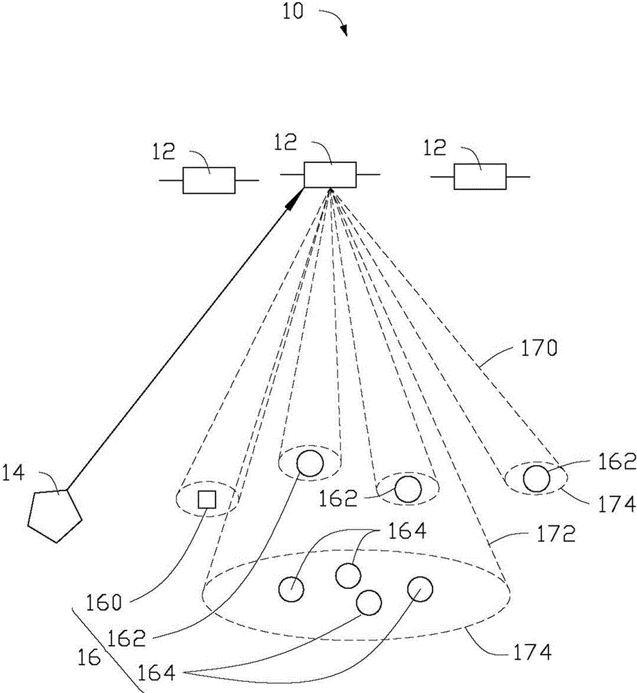
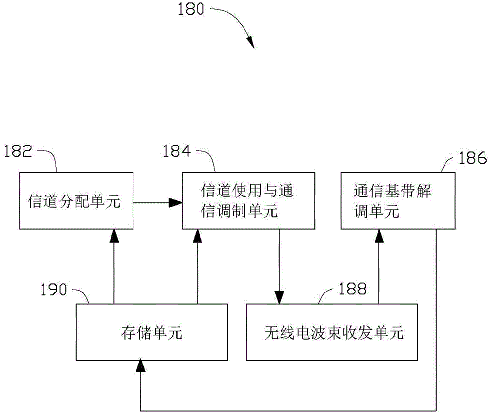
[0030] See figure 1 , the present invention provides a spatial Internet information service system 10 based on a space-time reference, comprising a plurality of communication satellites 12, a ground data center 14 and a plurality of ground user terminals 16, the ground user terminals 16 including at least one ground position fixed data terminal 160 , at least one general communication terminal 162 and at least one broadcast terminal 164 . The connection relationship between the communication satellite 12, the ground data center 14 and the ground user terminal 16 is: the communication satellite 12 with the mobile communication load 180 is connected with the ground user terminal 16 through a wireless link, and the communication satelli...


PUM


Abstract

The invention relates to a spatial internet information service method. The method comprises the following steps of providing a spatial internet information service system, wherein the spatial internet information service system comprises a plurality of communication satellites with movable communication load, a ground data center and a plurality of ground user terminals, each ground user terminal comprises at least one ground position fixed data terminal, at least one communication terminal and at least one broadcasting terminal; allocating wireless signal channels and utilizing the wireless signal channels by adopting default setting by virtue of mobile communication load after the spatial internet information service system is powered on or reset; acquiring useful information for optimizing the allocation and application of the wireless signal channel by virtue of the mobile communication load; allocating the signal channels according to the acquired useful information by virtue of the mobile communication load, and acquiring a signal channel allocation result; utilizing the signal channels according to the signal channel allocation result by virtue of the mobile communication load.

Description

technical field [0001] The present invention relates to an information service system and method, in particular to a spatial Internet information service system and method based on time-space reference. Background technique [0002] The low-orbit satellite constellation is a dozen to dozens of small satellites operating in low orbits, divided into several orbits, each orbit has several satellites, and revolves around the earth on several orbital planes, and the two adjacent orbital planes have a longitude equal distance. As a mobile communication relay station, the low-orbit satellite mobile communication system is like installing a terrestrial cellular mobile communication system on a satellite, forming wireless cellular coverage on the ground, covering the entire earth's surface, and providing services such as telephone, data and multimedia. With the rapid development of the mobile Internet, the core application of the low-orbit satellite mobile communication system is ch...

Claims


Application Information

Patent Timeline
Patent Type & Authority Applications(China)
IPC IPC(8): H04L29/08H04B7/185
Inventor 陆建华陈曦王梦璐
Owner TSINGHUA UNIV
Why Eureka
Try Eureka