
A method for identifying parking spaces in residential areas to match social parking needs based on open source data

A technology of data identification and parking spaces, applied in the field of parking matching, can solve the problems of neglect and incomplete utilization of parking resources, and achieve the effect of resource allocation

Active Publication Date: 2018-04-13
SOUTH CHINA UNIV OF TECH
View PDF5 Cites 0 Cited by
  • Summary
  • Abstract
  • Description
  • Claims
  • Application Information

AI Technical Summary

Problems solved by technology

However, the above technical solutions ignore the search for potential residential areas of parking space information sources, and have not yet fully solved the problem of fully utilizing parking resources.

Method used


Image

  • A method for identifying parking spaces in residential areas to match social parking needs based on open source data
  • A method for identifying parking spaces in residential areas to match social parking needs based on open source data
  • A method for identifying parking spaces in residential areas to match social parking needs based on open source data

Examples


Embodiment

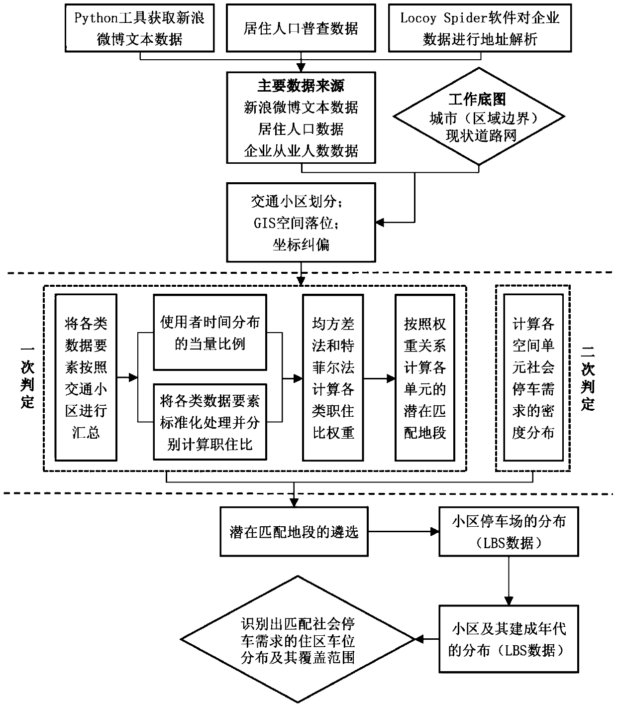
[0086] Such as figure 1 As shown, the method for identifying residential parking spaces to match social parking needs based on open source data in this embodiment includes the following steps:

[0087] (1) Prepare the work base map and divide the traffic area;

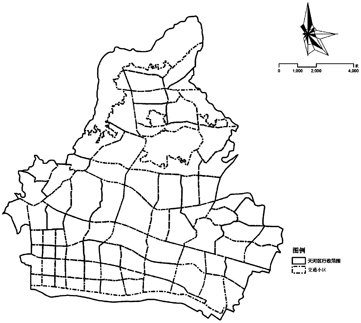
[0088] The present invention uses the boundary of the city (or region) as the working base map, superimposes the center line of the current road network in CAD, and further divides the traffic area according to the technical standard.

[0089] With reference to the domestic and international traffic community classification standards, the general urban center area traffic area is 1-3 square kilometers, and the urban fringe area traffic area is 5-15 square kilometers. In addition, the relatively high population density and more complex urban areas in China The nature of land use, in this research method, each block is divided according to the actual situation. The area of ​​the traffic area in the local center built-up area c...


PUM


Abstract

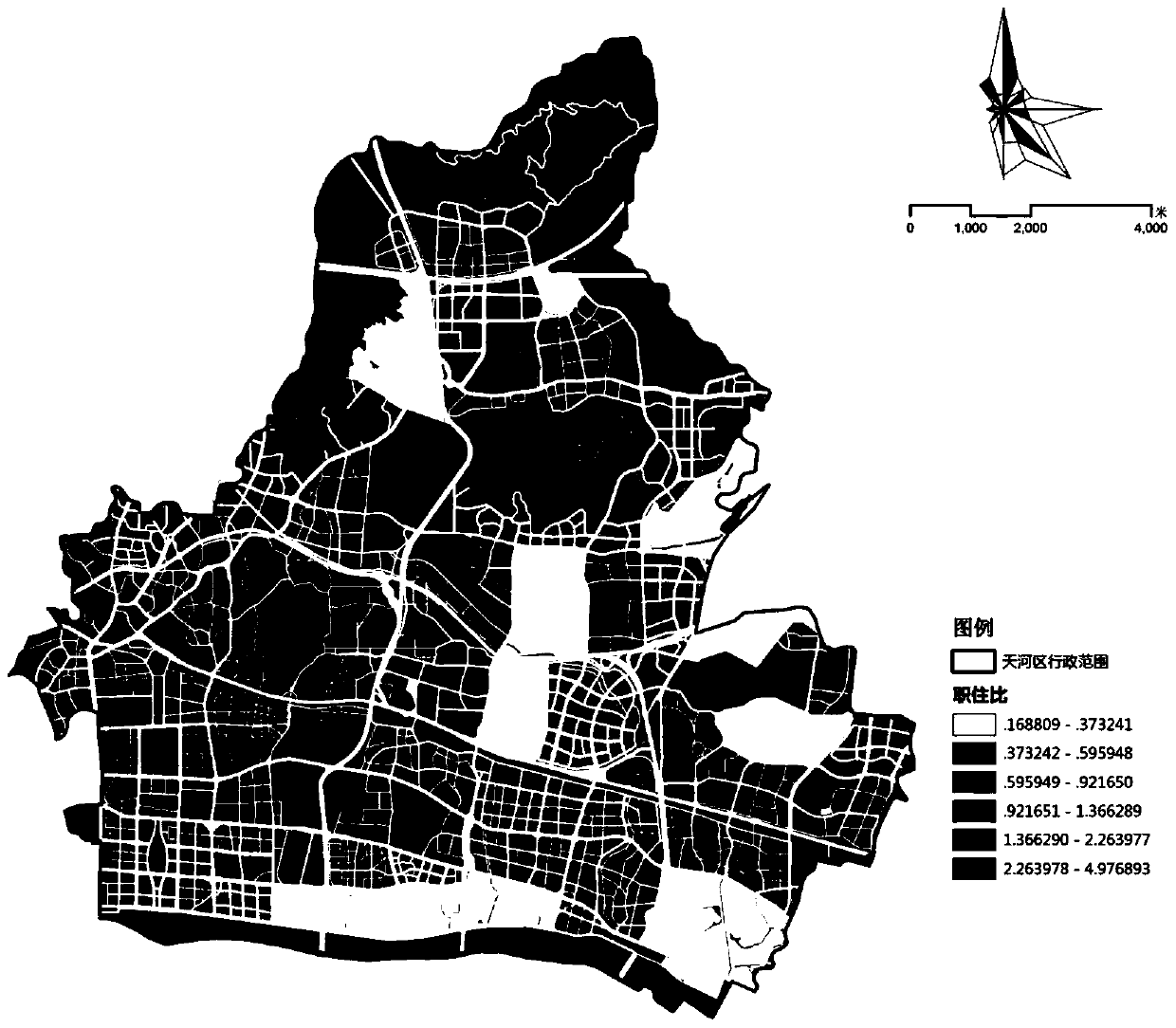
The invention discloses a method for recognizing settlement parking spaces meeting the social parking requirement on the basis of open source data. The method includes the following steps of firstly, mining and arranging research data; secondly, conducting address analysis on employment data through the Baidu LBS open platform; thirdly, conducting primary judgment, wherein spatial positioning is conducted on data of all types in a traffic zone base map through a GIS, and row coordinate correction and collection are conducted on the data; fourthly, conducting secondary judgment, wherein potential districts meeting the job-house matching requirement are obtained by screening spatial units with the job-house ratios higher than a preset value and spatial units with the employee number distribution densities higher than the whole-region average density; fifthly, recognizing settlement parking space distribution meeting the social parking requirement and the coverage of the settlement parking space distribution. The potential matching districts of cities are recognized through the open source data, and therefore settlement parking spaces can meet the social parking requirement, the social cost spent when an information issuing party searches potential target settlements is saved, and the space resource optimization in the staggered parking process is assisted.

Description

Technical field [0001] The invention relates to the research field of parking matching, in particular to a method for identifying residential parking spaces to match social parking needs based on open source data and saving the social cost of information issuers searching for potential target residential areas. Background technique [0002] In the context of the increasing number of cars, high-density employment areas in cities generally face the problem of insufficient daytime parking spaces, and the relatively vacant parking spaces in residential communities during the day provide the possibility to alleviate the urban parking problem. The main problem of the existing parking APP is the lack of information sources of parking spaces, and the supply-demand relationship of day parking between potential target communities and employment areas cannot be resolved, which makes it difficult for information publishers to search for potential target residential areas and restricts time sh...

Claims


Application Information

Patent Timeline
Patent Type & Authority Patents(China)
IPC IPC(8): G06F17/30
Inventor 段阳钟烨赵渺希郭振松李欣建梁景宇
Owner SOUTH CHINA UNIV OF TECH
Learn More