Unmanned vehicle planning control method based on topology map

A topological map and planning control technology, applied in two-dimensional position/channel control, vehicle position/route/height control, non-electric variable control, etc., can solve problems such as difficult integration of sparse environmental maps

Active Publication Date: 2017-02-01
ZHEJIANG UNIV
View PDF9 Cites 35 Cited by
  • Summary
  • Abstract
  • Description
  • Claims
  • Application Information

AI Technical Summary

Problems solved by technology

[0003] The technical problem to be solved by the present invention is to provide a topological map-based unmanned vehicle planni

Method used


Image

  • Unmanned vehicle planning control method based on topology map
  • Unmanned vehicle planning control method based on topology map
  • Unmanned vehicle planning control method based on topology map

Examples


Example Embodiment

[0065] In order to better understand the technical solution of the present invention, further description will be given below in conjunction with the accompanying drawings.
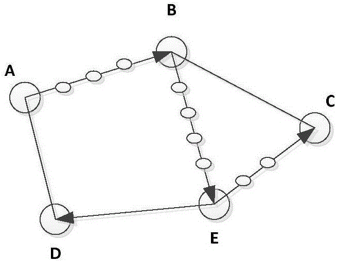
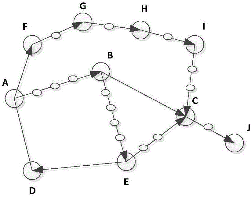
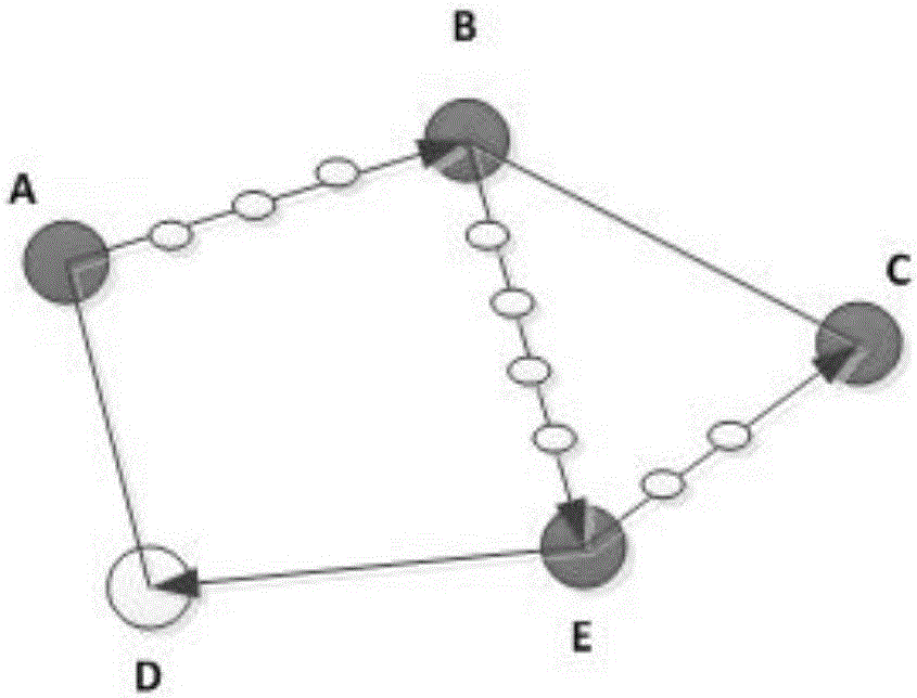
[0066] An unmanned vehicle planning control method based on a topology map includes the following steps: an unmanned vehicle planning control method based on a topology map includes the following steps:

[0067] Step 1. The unmanned vehicle builds a map several times and stores the key frame coordinate sequence. The process of creating a map each time is as follows: start the unmanned vehicle, the unmanned vehicle is equipped with binocular cameras, and the unmanned vehicle is set to random exploration The automatic operation mode of the environment; start the binocular camera, collect the environment image, establish the sparse visual feature map, and store the key frame pose sequence in the form of a text file to the local disk of the on-board computer;

[0068] The process of creating a map each time is as fo...


PUM


Abstract

The invention discloses an unmanned vehicle planning control method based on a topology map. An unmanned vehicle runs multiple times in an established map mode, and a different key frame coordinate sequence is obtained for each running. The geographical proximity between different key frame coordinates is calculated based on Euclidean distance so as to identify the intersections of the different key frame coordinate sequences, the intersections are used as the nodes of a topology map, and multiple tracks are connected into an entire map. A path intersection sequence can be obtained by performing path planning based on a heuristic graph search algorithm on the topology map, original dense key frame coordinates can be indexed by use of the path intersection sequence, and the coordinates are input to an unmanned vehicle control execution system as the result of track planning, thus realizing location tracking of the unmanned vehicle.

Description

technical field [0001] The invention belongs to the technical field of autonomous navigation of mobile robots, in particular to an unmanned vehicle position tracking method based on a sparse visual feature map. Background technique [0002] With the development of mobile robot technology, independent establishment of environmental maps for unstructured scenes and safe navigation control based on the established environmental maps have become increasingly urgent core requirements, which are the basis for achieving high-level tasks for mobile robots support. In order to improve the efficiency of map creation, the general method is to extract the sparse feature information of the environment for calculation, and the final generated map is also a sparse expression form, so it is difficult to be directly used for path planning and control of autonomous mobile platforms. Contents of the invention [0003] The technical problem to be solved by the present invention is to provide...

Claims


Application Information

Patent Timeline
IPC IPC(8): G05D1/02
CPCG05D1/0246G05D1/0257G05D1/0274G05D2201/0207
Inventor 刘勇张高明张涛
Owner ZHEJIANG UNIV
Why Eureka
Try Eureka