A monitoring system and method for subgrade settlement
A monitoring system and roadbed technology, applied in measurement devices, surveying and navigation, altitude/level measurement, etc., can solve the problems of slow information transmission, low measurement accuracy, inconvenient installation and use, and achieve the effect of improving convenience
- Summary
- Abstract
- Description
- Claims
- Application Information
AI Technical Summary
Problems solved by technology
Method used
Image
Examples
Embodiment 1
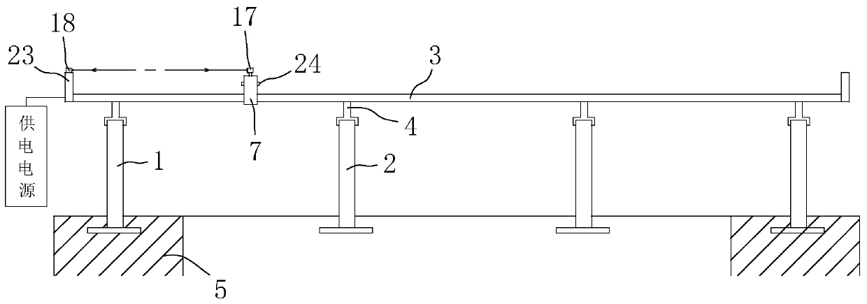
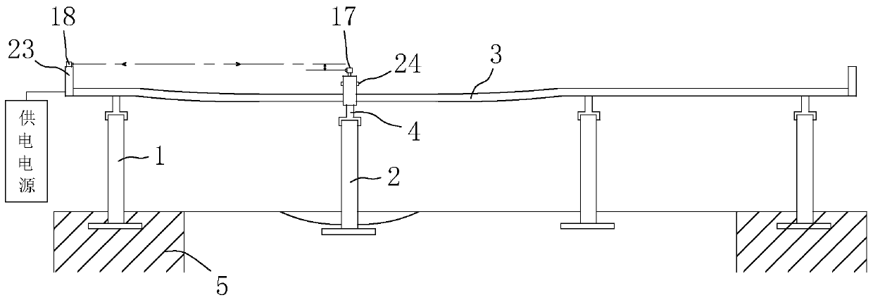
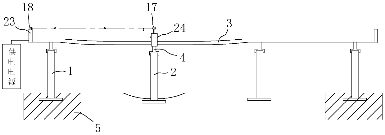
[0052] Based on the above content, this embodiment provides a monitoring system for subgrade settlement, combining figure 1 , figure 2 and image 3 As shown, it includes reference piles 1 arranged on the bedrock 5 at both ends of a section of roadbed, and several settlement piles 2 are arranged at equal intervals between the two reference piles 1 of the road foundation, and the reference piles 1 are arranged within the range of bedrock 5 of the roadbed , which does not undergo settlement deformation, the settlement pile 2 is arranged on the roadbed, and its height changes with the settlement deformation of the roadbed. In this embodiment, the height of the reference pile 1 and the settlement pile 2 above the ground is between 10 cm and 20 cm. The distance between two adjacent settlement piles 2 is distributed according to the soil quality of the subgrade, and is between 20m and 25m.
[0053] combine Figure 4 and Figure 5 As shown, the subgrade settlement monitoring sys...
Embodiment 2
[0072] Based on the foregoing, the present embodiment provides a method for monitoring subgrade settlement, comprising the following steps:
[0073] Arrangement steps: install benchmark piles 1 on the bedrock 5 at both ends of a section of roadbed, arrange a number of settlement piles 2 at equal intervals between the two benchmark piles 1, and erect guide rails 3 on the benchmark piles 1 and settlement piles 2 through support rods 4 superior;
[0074] Monitoring steps: control the monitoring vehicle to travel along the guide rail 3, the monitoring vehicle stays on the guide rail 3 above each settlement pile 2 one by one to obtain the vehicle body height value, and send the obtained vehicle body height value to the monitoring center for real-time monitoring;
[0075] Circulation steps: After the monitoring vehicle completes the section of roadbed along the guide rail 3, it restarts after a preset period and moves in the reverse direction along the guide rail 3 to repeat the monit...
PUM
 Abstract
Description
Claims
Application Information
 - R&D
- Intellectual Property
- Life Sciences
- Materials
- Tech Scout
- Unparalleled Data Quality
- Higher Quality Content
- 60% Fewer Hallucinations
Browse by: Latest US Patents, China's latest patents, Technical Efficacy Thesaurus, Application Domain, Technology Topic, Popular Technical Reports.
© 2025 PatSnap. All rights reserved.Legal|Privacy policy|Modern Slavery Act Transparency Statement|Sitemap|About US| Contact US: help@patsnap.com


