A geographical information interaction method, system and storage medium based on VR technology
A technology of geographic information and interaction methods, applied in the field of VR display, can solve the problems of unable to display areas, users cannot effectively obtain image changes, etc., to achieve the effect of convenient observation and processing
- Summary
- Abstract
- Description
- Claims
- Application Information
AI Technical Summary
Problems solved by technology
Method used
Image

Examples
Embodiment Construction
[0044] In order to make the purposes, technical solutions and advantages of the embodiments of the present invention clearer, the technical solutions in the embodiments of the present invention will be clearly and completely described below with reference to the accompanying drawings in the embodiments of the present invention. Obviously, the described embodiments These are some embodiments of the present invention, but not all of the embodiments. Based on the embodiments of the present invention, all other embodiments obtained by those of ordinary skill in the art without creative work fall within the protection scope of the present invention.
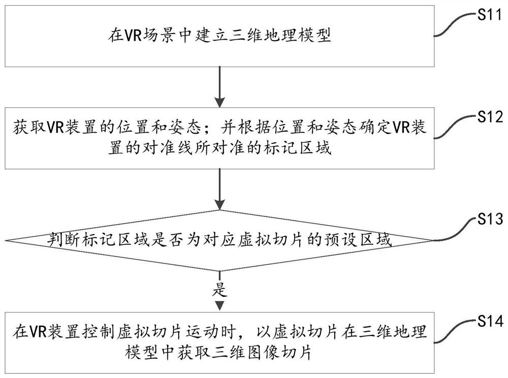
[0045] like figure 1 As shown, an embodiment of the present invention provides a geographic information interaction method based on VR technology, the interaction method includes:
[0046] S11, establishing a three-dimensional geographic model in the VR scene.
[0047] In this embodiment, VR is virtual reality technology. Virtual re...
PUM
 Abstract
Description
Claims
Application Information