Map updating method, map fusion updating method, terminal and server

A map update and server technology, applied in the field of information processing, can solve problems such as difficulty in applying update frequency, and achieve the effects of ensuring map update efficiency, improving efficiency and accuracy, and reducing computing pressure and communication pressure.

Pending Publication Date: 2020-05-08
北京易控智驾科技有限公司
View PDF9 Cites 22 Cited by
  • Summary
  • Abstract
  • Description
  • Claims
  • Application Information

AI Technical Summary

Problems solved by technology

The existing high-precision map update is often a low-frequency update of the public environment, which is difficult to apply to environments with a relatively fast update frequency (such as minutes or even seconds) (such as open areas in mining areas such as loading areas, dumps, etc.)

Method used


Image

  • Map updating method, map fusion updating method, terminal and server
  • Map updating method, map fusion updating method, terminal and server
  • Map updating method, map fusion updating method, terminal and server

Examples


Embodiment Construction

[0030] In order to make the objectives, technical solutions and advantages of the present invention clearer, the present invention will be further described in detail below in conjunction with specific embodiments and with reference to the accompanying drawings.

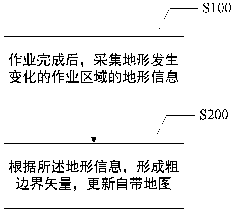
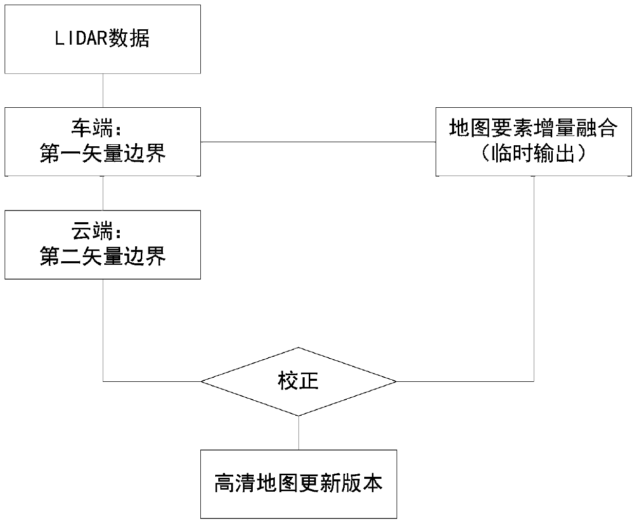
[0031] As mentioned earlier, the existing map update method usually takes a long period of time to update. The update is mainly based on comprehensive information collection, such as traffic information stations, satellites, user manual feedback data, user terminals, especially high-frequency changes in terrain In the scenario where there is no better update method, there is a hidden danger of driving. Moreover, since the map data is usually large, it takes a long time and a large amount of data to be transmitted during the interaction process of the cloud server, and the update efficiency and terminal memory cannot be effectively guaranteed.

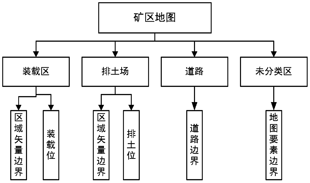
[0032] The embodiment of the present disclosure provides a map update method. ...


PUM


Abstract

The invention provides a map updating method, a map fusion updating method, a terminal and a server, and the map updating method comprises the steps: collecting the terrain information of an operationregion with a changed terrain after the operation is completed; and forming a first vector boundary according to the topographic information, and updating the current map. Aiming at the situation that the terrain is changed after operation, the map is automatically updated by collecting the changed terrain information, and the map updating efficiency is ensured; furthermore, the collected topographic information is uploaded to the server side and is accurately calculated by the server side, the map element increment accurate vector boundary is returned, the map is further updated, and the mapupdating accuracy is improved.

Description

Technical field [0001] The present disclosure relates to the field of information processing, and further relates to map update applied to automatic driving in mining areas, and also relates to a map update method, a map fusion update method, a terminal for implementing the map update method, and a server for implementing map fusion update. Background technique [0002] In today’s society, electronic maps are like another pair of eyes to facilitate people’s life and work, such as automatic driving or manual driving on public roads, or driving in a closed environment. For example, a relatively closed environment in a mining area is autonomous driving. One of the best choices for technology landing scenarios. The key technologies of autonomous driving involve environment perception, high-precision positioning, decision-making planning, execution control, etc. Among them, high-precision maps are highly accurate due to their high-precision, high-granularity, and real-time characterist...

Claims


Application Information

Patent Timeline
Patent Type & Authority Applications(China)
IPC IPC(8): G06F16/23G06F16/29
CPCG06F16/23G06F16/29
Inventor 王方建张磊盛家良王大伟李机智
Owner 北京易控智驾科技有限公司
Why Eureka
Try Eureka