Unmanned aerial vehicle inertial navigation and GPS mixed height measurement method

An altitude measurement, UAV technology, applied in altitude/level measurement, radio wave measurement system, navigation through speed/acceleration measurement, etc. , good dynamic characteristics, avoid the effect of divergent characteristics

Active Publication Date: 2020-12-15
NAVAL AVIATION UNIV
View PDF11 Cites 2 Cited by
  • Summary
  • Abstract
  • Description
  • Claims
  • Application Information

AI Technical Summary

Problems solved by technology

[0004] The purpose of the present invention is to provide a method for measuring the height of UAV inertial navigation and GPS hybrid, and then at least to a certain extent overcome the low accuracy of height measurement or the accumulation of errors over time due to the limitations and defects of related technologies. The problem

Method used


Image

  • Unmanned aerial vehicle inertial navigation and GPS mixed height measurement method
  • Unmanned aerial vehicle inertial navigation and GPS mixed height measurement method
  • Unmanned aerial vehicle inertial navigation and GPS mixed height measurement method

Examples


Embodiment Construction

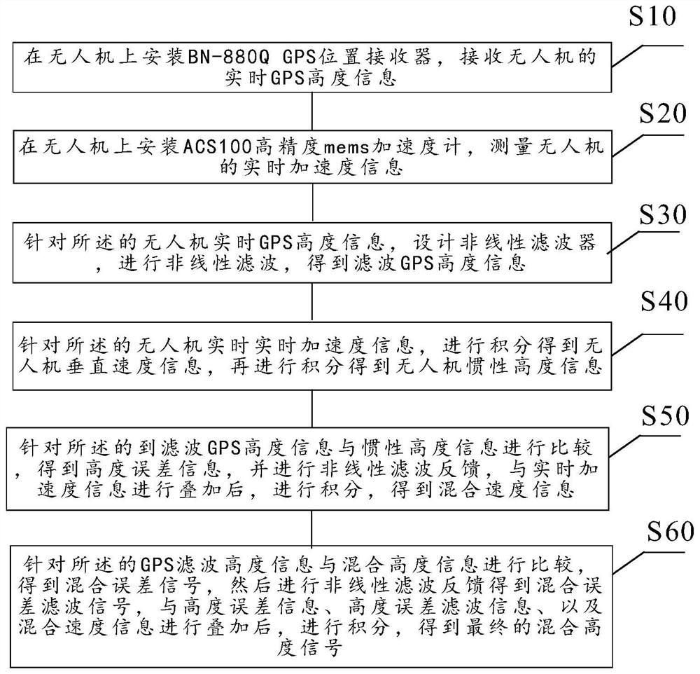
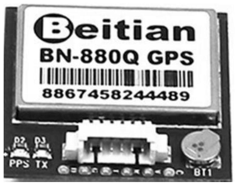
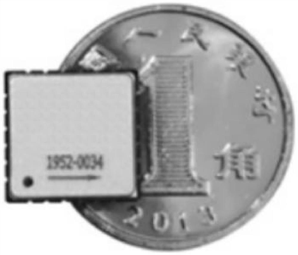
[0046] Example embodiments will now be described more fully with reference to the accompanying drawings. Example embodiments may, however, be embodied in many forms and should not be construed as limited to the examples set forth herein; rather, these embodiments are provided so that this disclosure will be thorough and complete and fully convey the concept of example embodiments to those skilled in the art. The described features, structures, or characteristics may be combined in any suitable manner in one or more embodiments. In the following description, numerous specific details are provided in order to give a thorough understanding of embodiments of the invention. However, those skilled in the art will appreciate that the technical solution of the present invention may be practiced without one or more of the specific details, or other methods, components, devices, steps, etc. may be adopted. In other instances, well-known technical solutions have not been shown or descr...


PUM


Abstract

The invention relates to a design method of an unmanned aerial vehicle inertial navigation and GPS mixed height measurement device. The method comprises the following steps of: firstly, installing a BN-880Q GPS position receiver, receiving real-time GPS height information of the unmanned aerial vehicle, then installing an ACS100 high-precision Mems accelerometer, measuring real-time acceleration information of the unmanned aerial vehicle, designing a nonlinear filter to obtain GPS filtering height information, and then carrying out twice integration on the implemented acceleration informationto obtain inertia height; comparing the inertia height with the filtering height to obtain height error information, performing nonlinear filtering to obtain filtering error information, introducing inertia acceleration and speed compensation feedback, performing integration to obtain a mixed speed and a mixed height, and comparing the mixed height with a GPS height to form an error signal to further compensate generation of the mixed height; thus finally obtaining the inertial navigation and GPS composite measurement method. The method has the advantages that measurement errors are not accumulated and diverged along with time, and the precision is higher than that of single measurement.

Description

technical field [0001] The invention relates to the field of high-precision height measurement of unmanned aerial vehicles, in particular to a design method for a hybrid height measurement method of UAV inertial navigation and GPS. Background technique [0002] During the low-altitude flight of the UAV, especially the low-altitude sea-skimming flight, the information measured by the height sensor is used as the feedback signal of the height control system, so the accuracy of the height measurement will directly affect the height control of the UAV. GPS single-point positioning refers to the use of GPS receivers to directly determine the position of a point in the earth coordinate system. When the receiver is located on a moving carrier, the GPS dynamic positioning method is used, which is now widely used on mobile carriers such as aircraft and vehicles. However, on the basis of precise positioning information, civilian GPS signals will be superimposed with random interferen...

Claims


Application Information

Patent Timeline
Patent Type & Authority Applications(China)
IPC IPC(8): G01C21/16G01C21/20G01C5/00G01S19/47
CPCG01C21/165G01C21/20G01C5/00G01S19/47
Inventor 雷军委晋玉强寇昆湖陆珂珂
Owner NAVAL AVIATION UNIV
Why Eureka
Try Eureka