

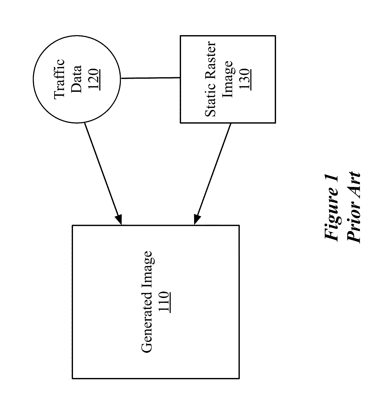
Encoded Representation of Traffic Data
a traffic data and encoded technology, applied in the field of encoded representation of traffic data, can solve the problems of tight coupling of traffic data b>120/b>, traffic data not always perfectly matching the layout of the road, and the representation of traffic data often occludes the detail (e.g., the name and structure of the road) that is part of the static road image, so as to reduce the compressed route to send
- Summary
- Abstract
- Description
- Claims
- Application Information
AI Technical Summary
Benefits of technology
Problems solved by technology
Method used
Image

Examples
Embodiment Construction
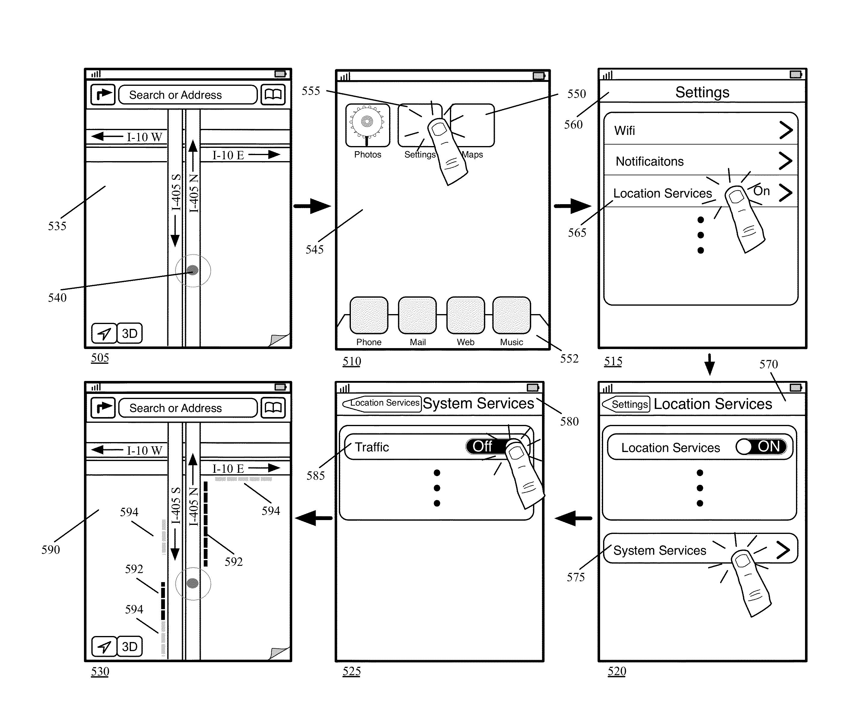
[0053]In the following detailed description of the invention, numerous details, examples, and embodiments of the invention are set forth and described. However, it will be clear and apparent to one skilled in the art that the invention is not limited to the embodiments set forth and that the invention may be practiced without some of the specific details and examples discussed.
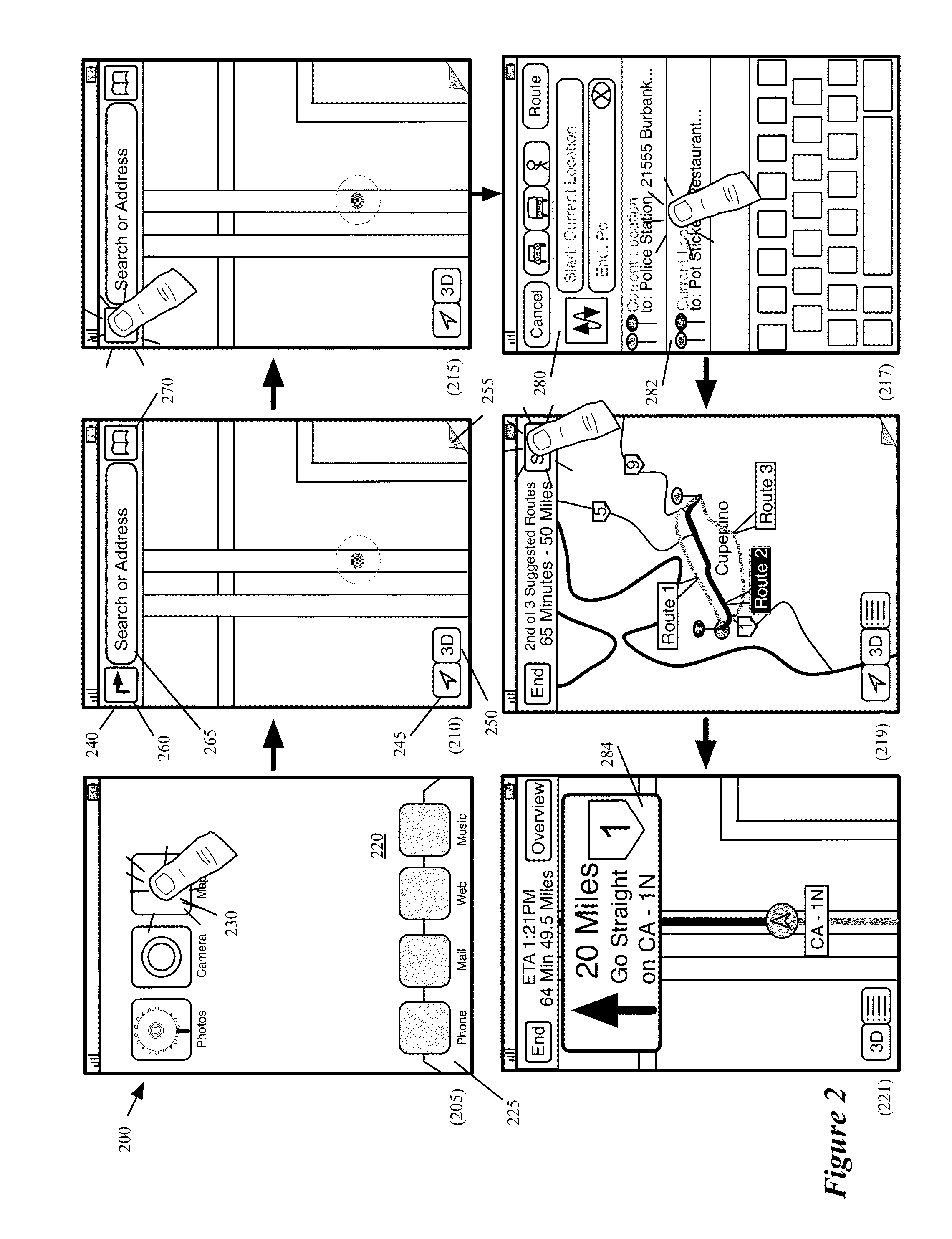
[0054]Some embodiments of the invention provide a mapping application that includes several novel techniques to provide traffic data. In some embodiments, the application executes on a device (e.g., a mobile device) that has a touch-sensitive screen that displays the output of the application, and a multi-touch interface that allows a user to provide touch and gestural inputs through the screen to interact with the application. In other embodiments, the application executes on a device that does not have a touch-sensitive screen.
[0055]In some embodiments, the novel features of the mapping application include (...
PUM
 Abstract
Description
Claims
Application Information