Methods, systems, and devices for cartographic alerts

a cartographic alert and navigation system technology, applied in the field of navigational devices, can solve problems such as inadvertent overlooking of one or more hazards by users

Active Publication Date: 2007-09-11
GARMIN
View PDF51 Cites 161 Cited by
  • Summary
  • Abstract
  • Description
  • Claims
  • Application Information

AI Technical Summary

Problems solved by technology

In addition, a user may inadvertently overlook

Method used


Image

  • Methods, systems, and devices for cartographic alerts
  • Methods, systems, and devices for cartographic alerts
  • Methods, systems, and devices for cartographic alerts

Examples


Embodiment Construction

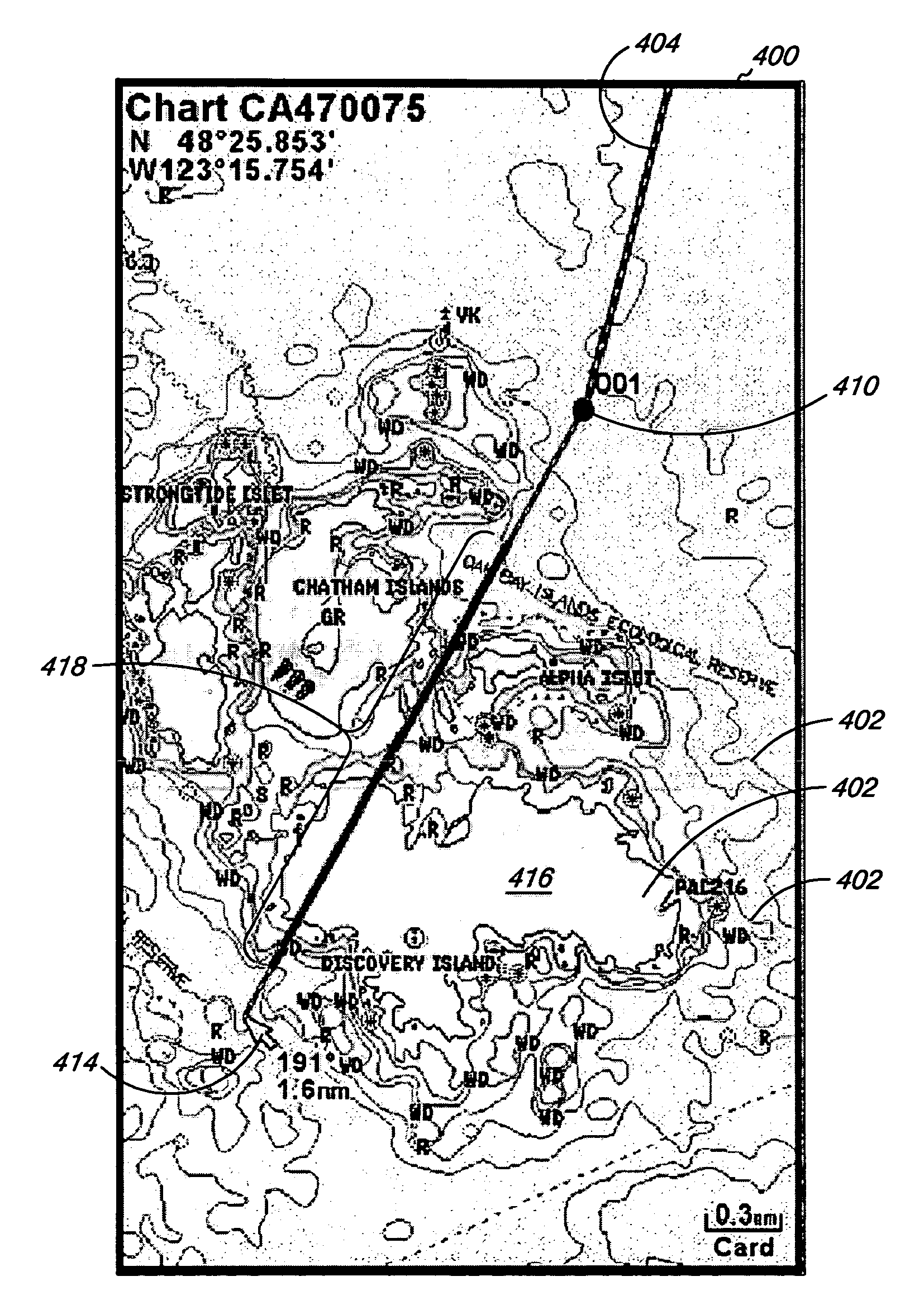
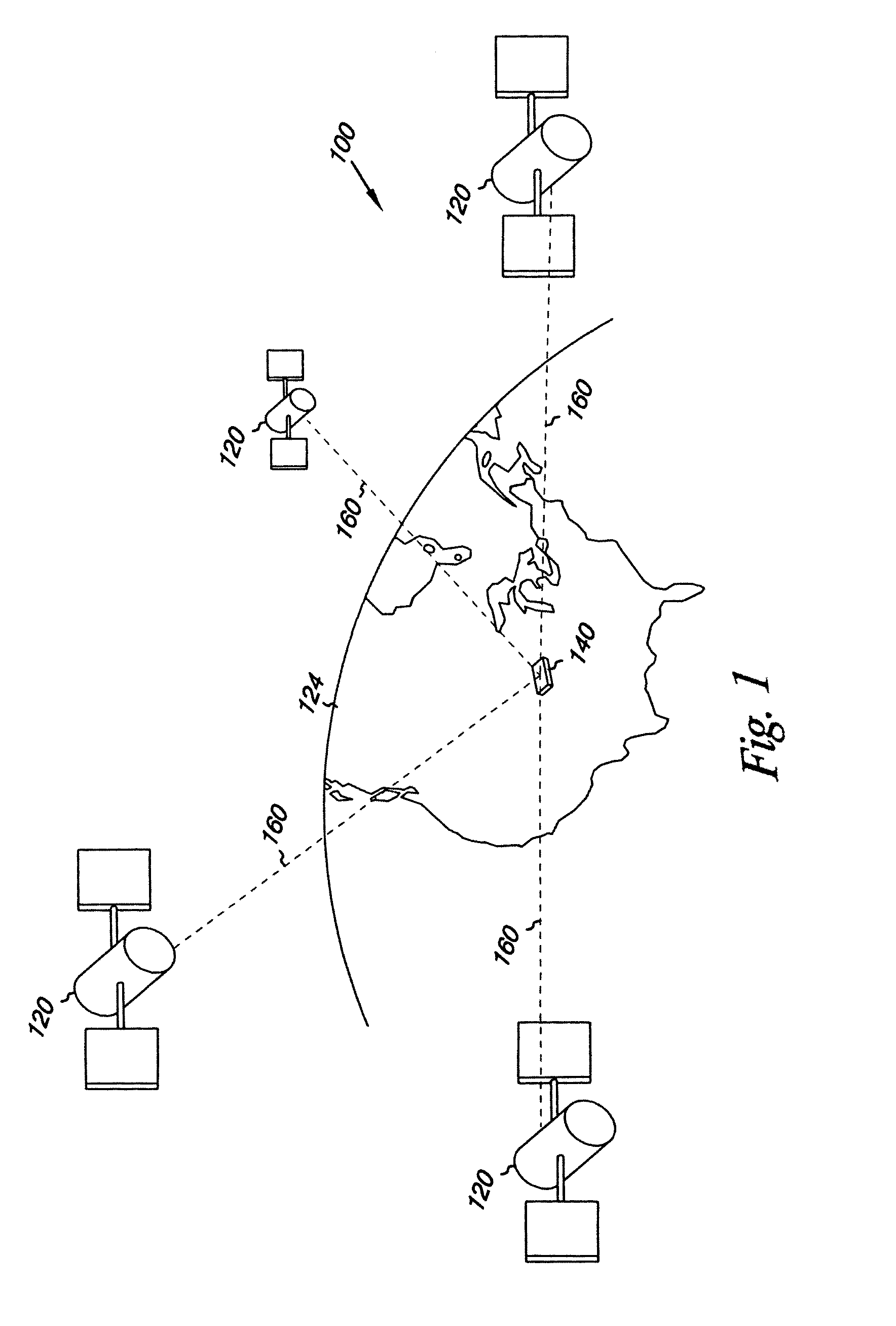
[0009]Embodiments of the present invention include marine navigational methods, systems, and devices having course calculation and analysis capabilities. The marine navigational methods, systems, and devices can use any number of devices for determining one or more positions. For example, the marine navigational device can include devices for receiving signals (e.g., radio signals) from which positional triangulation can be performed to determine the one or more positions. In additional embodiments, a global positioning system (GPS) enabled marine navigational device can be used for determining one or more positions. Such GPS systems are known and have a variety of uses.

[0010]Although the term marine navigation is used in the present application, one of ordinary skill in the art will appreciate from reading the disclosure that the techniques described herein could equally be applied for use in non-street based navigation. So, the use of the word “marine” in the embodiments of the pr...


PUM


Abstract

Systems, devices, and methods are provided for marine navigation and course calculation for avoiding preselected conditions. An electronic marine navigation device with marine course calculation capabilities includes a processor connected to a memory that includes cartographic data. A potential waypoint can be identified and a marine route calculation algorithm can be preformed to calculate a course between a first location and the potential waypoint in view of preselected conditions. Performing the marine route calculation algorithm includes analyzing the cartographic data for the area between the first location and the potential waypoint with a preference for providing a course that avoids preselected conditions. A display is connected to the processor and is capable of displaying the calculated course and cartographic data. The device is also adapted to dynamically analyze an area surrounding the first location for preselected conditions and display the results of the analysis.

Description

FIELD OF THE INVENTION[0001]The present invention relates generally to navigational devices, and in particular to marine navigational devices with cartographic alert capabilities.BACKGROUND OF THE INVENTION[0002]Boating is an activity enjoyed by many people. Safe boating, however, requires common sense and the ability to remain alert to the prevailing boating conditions. A variety of equipment is available to boaters to aid them in these endeavors. For example, boats can be equipped with radios, radar systems, cameras, and sensors for providing a variety of information to the boater. The boater can then use the information from these devices in planning and navigating a course for the boat.[0003]Many times, however, there can be quite a lot of information for the boater to consider in planning and navigating a course for the boat. For example, which courses might be preferable, or even available, for the size and type of boat being used. In addition, a user may inadvertently overloo...

Claims


Application Information

Patent Timeline
IPC IPC(8): B60L3/00G06F17/10G06F7/00G08B23/00
CPCG01C21/203
Inventor KABEL, DARRIN W.MYERS, STEVEN J.
Owner GARMIN
Why Eureka
Try Eureka