Eureka AIR delivers breakthrough ideas for toughest innovation challenges, trusted by R&D personnel around the world.

Navigation device assisting road traffic congestion management

a navigation device and road traffic technology, applied in the direction of navigation instruments, instruments, analogue processes for specific applications, etc., can solve the problems of congestion affecting traffic flow and average speed in the vicinity, and traffic on connecting roads is heavier

Active Publication Date: 2012-12-11
TOMTOM NAVIGATION BV
View PDF11 Cites 27 Cited by
  • Summary
  • Abstract
  • Description
  • Claims
  • Application Information

AI Technical Summary

Benefits of technology

[0010]The inventors aim at improving navigational guidance to an individual user of a road vehicle. The inventors further intend to improve traffic management so as to avoid or reduce traffic congestion.

Problems solved by technology

The scaling finds its origin that congestion on one road may lead to heavier traffic on connecting roads.
That is, the congestion affects traffic flow and average speeds in the vicinity.

Method used

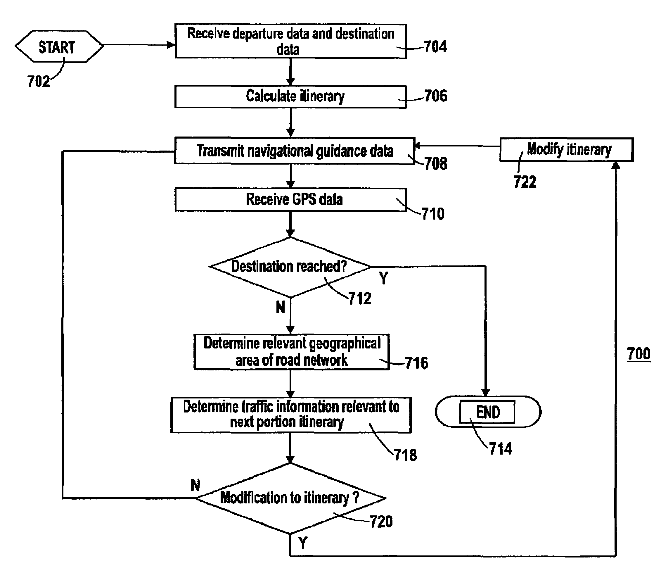
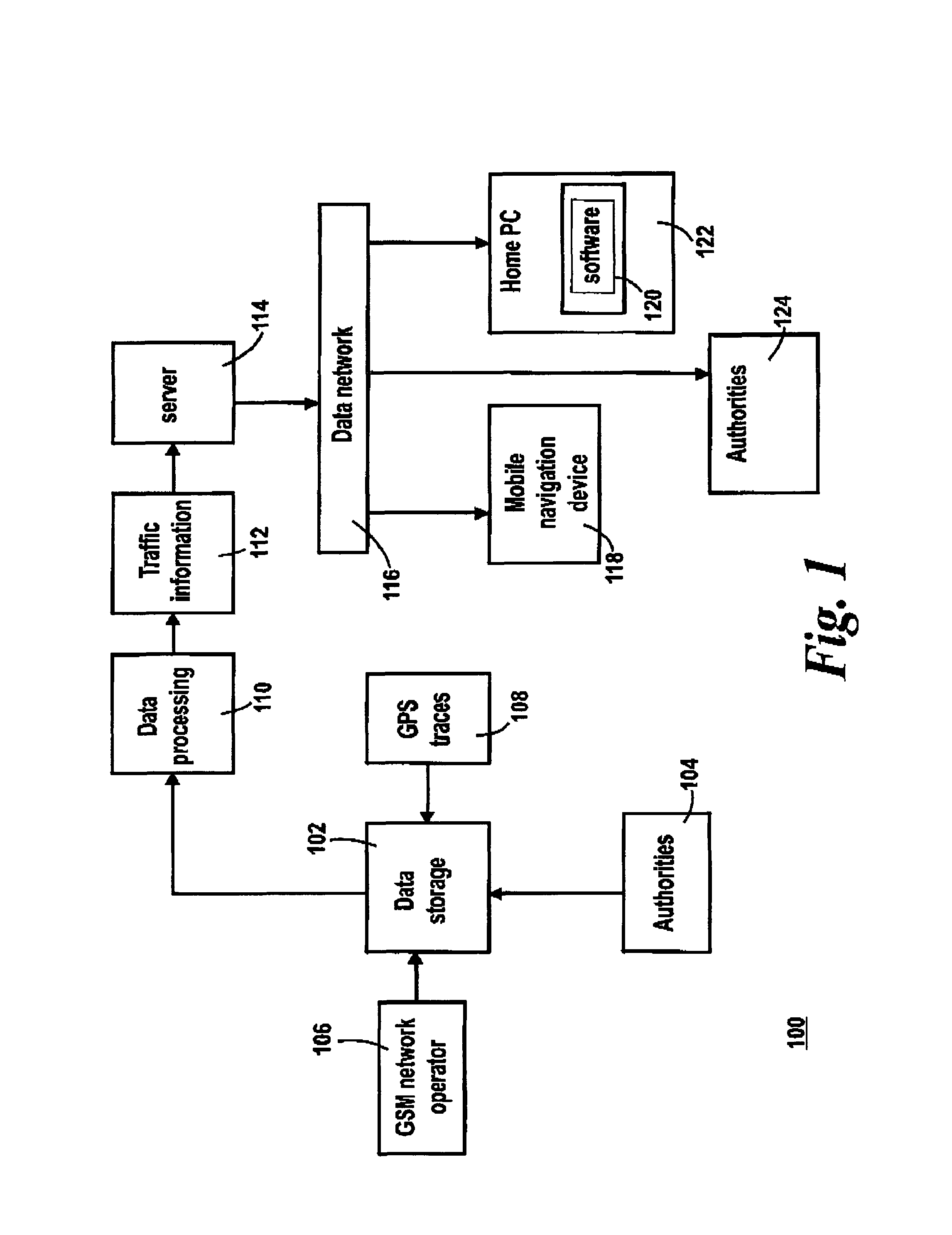
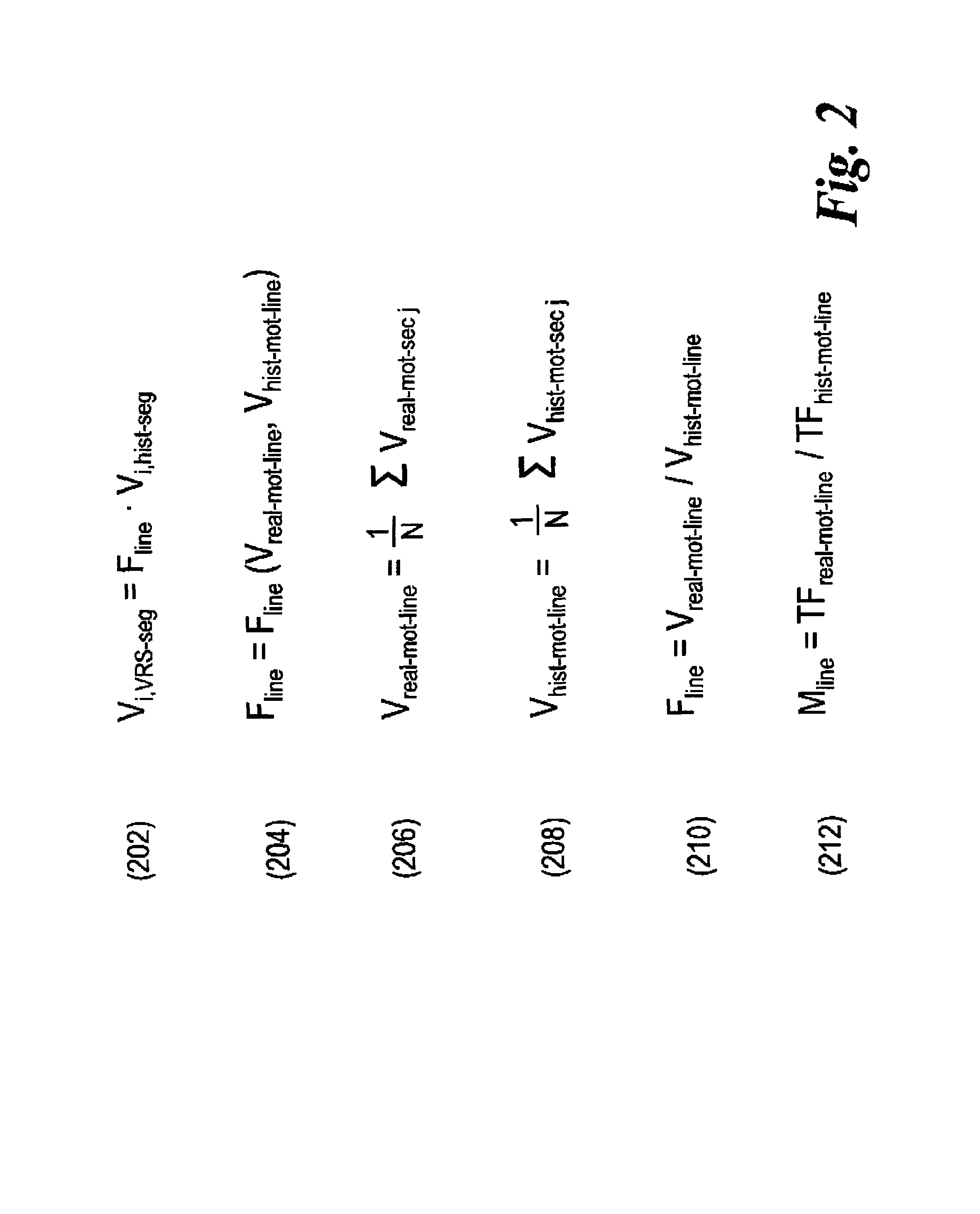

Image

  • Navigation device assisting road traffic congestion management
  • Navigation device assisting road traffic congestion management
  • Navigation device assisting road traffic congestion management

Examples


Embodiment Construction

[0029]According to some studies, about 25% of traffic monitored on a specific road or highway consists of vehicles driving a longer, inter-regional route. This is a significant group which could take quite easily an alternative to the specific road or highway. The question is how to inform of the alternative? Authorities could inform all drivers driving in the region north of the city of Amsterdam that today it is better to use the Enkhuizen—Lelystad dike road if they intend to go to Flevoland or beyond. Drivers coming from the Amstelveen / Schiphol region could be advised to drive via the city of Utrecht. However, it is extremely difficult to inform these drivers and even more so to convince them that they should take the advice. The drivers need more detailed information in order to be able to accept the alternative route.

[0030]The system in the invention proposes the alternative routes to a driver via the mobile navigation device onboard the driver's vehicle. The alternative routes...


PUM


Abstract

A navigation device has a GPRS receiver for receiving real-time information about slow traffic flow or slow average speed on a stretch of motorway, indicating congestion. The device calculates a new itinerary to avoid the congestion, based on historically recorded speeds on secondary roads weighed by the current average speed in the congestion area.

Description

PRIORITY STATEMENT[0001]The present application hereby claims priority under 35 U.S.C. §119(e) on U.S. Provisional Patent Application No. 60 / 905,894 filed Mar. 9, 2007, the entire contents of which is hereby incorporated herein by reference.FIELD OF THE INVENTION[0002]The invention relates to a mobile electronic navigation device, software for implementing a functionality of the device, and, a method of providing a service to a user of such as device.BACKGROUND ART[0003]Advances in technology and the increasing pressures of congested road environments have encouraged the development and adoption of Personal Navigation Devices (PND). The abbreviation PND is sometimes used to refer to a “portable navigation device”, but in this specification will be given its more expansive definition, covering any kind of personal navigation device that is either portable (e.g., can be fixed to an auto windscreen using a suction mount), or embedded (e.g. permanently fixed into an automobile). PNDs ca...

Claims


Application Information

Patent Timeline
Patent Type & Authority Patents(United States)
IPC IPC(8): G06F19/00G01C21/34
CPCG01C21/3415G01C21/3492G08G1/091
Inventor GROENHUIJZEN, LUCIENRUTTEN, BENSCHUURBIERE, ROB
Owner TOMTOM NAVIGATION BV
Why Eureka
Eureka Blog
Learn More