

Spatially referenced multi-sensory data digitally encoded in a voxel database
a multi-sensory data and database technology, applied in the field of simulation systems and geographic information systems, can solve the problems of significant detracting from the user experience provided by simulation, increasing the difficulty of acquiring and implementing geospatially correct information for simulated environments, and increasing the difficulty of implementing geospatially correct information, etc., and achieve accurate mapping to voxels
- Summary
- Abstract
- Description
- Claims
- Application Information
AI Technical Summary
Benefits of technology
Problems solved by technology
Method used
Image

Examples
Embodiment Construction
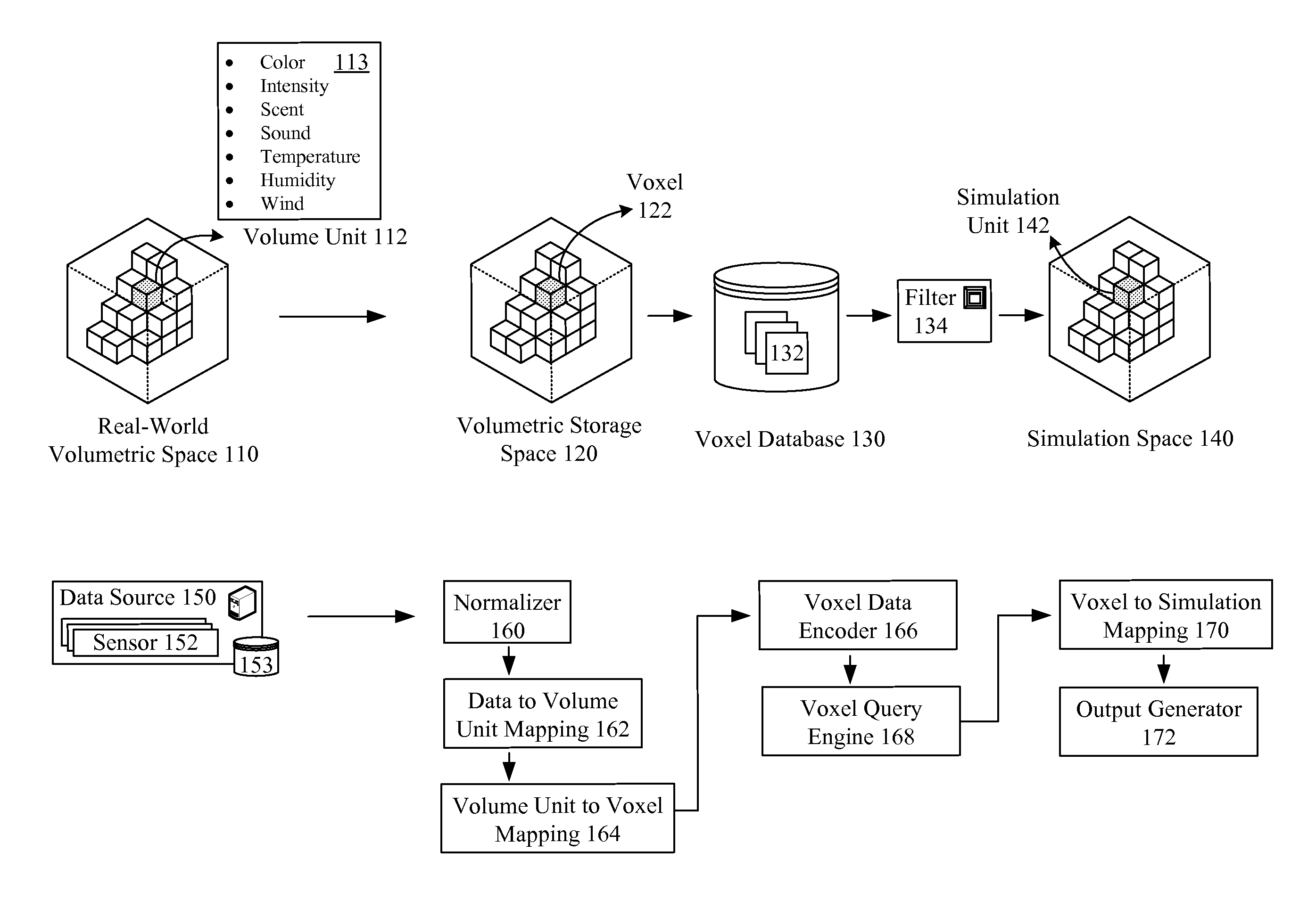
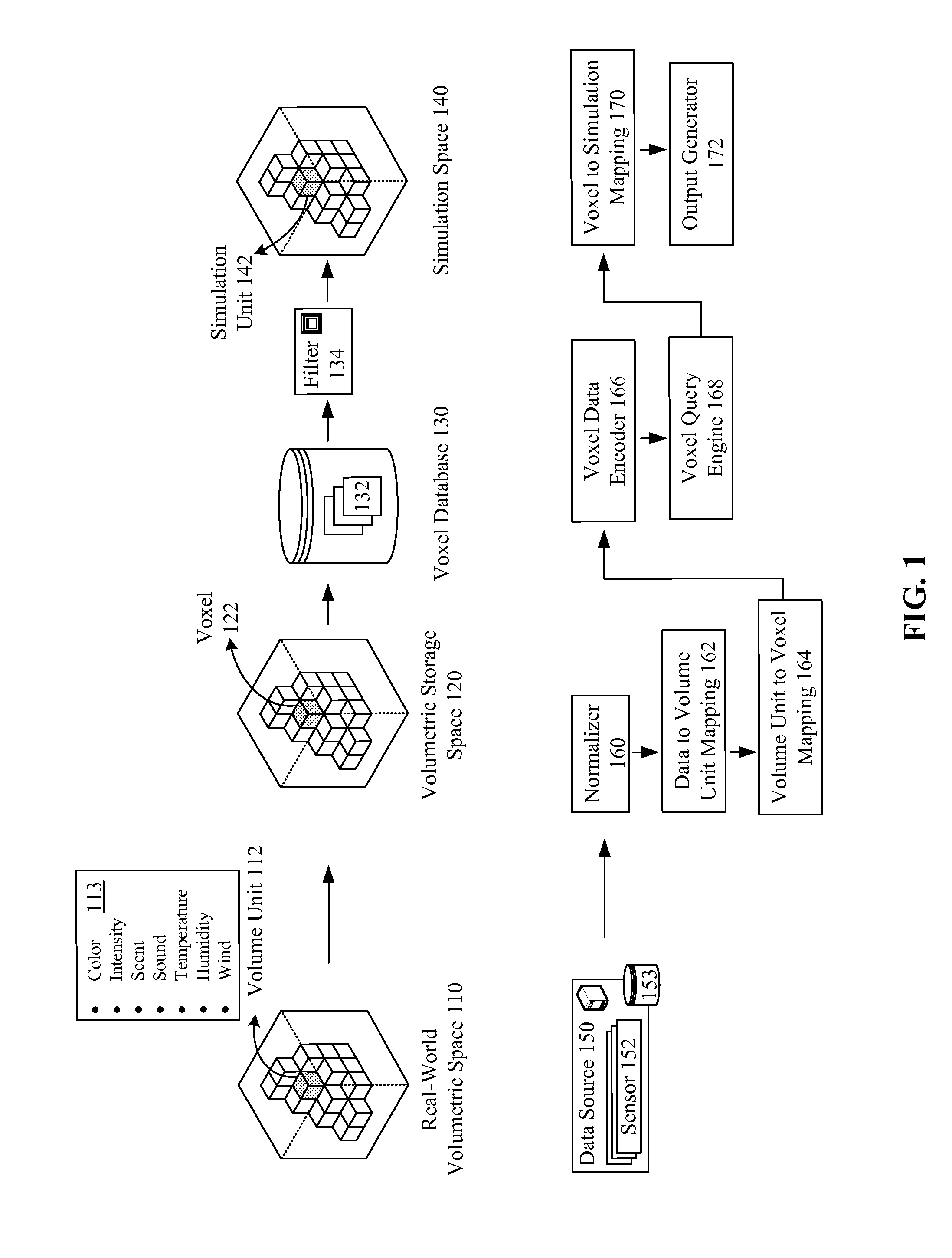
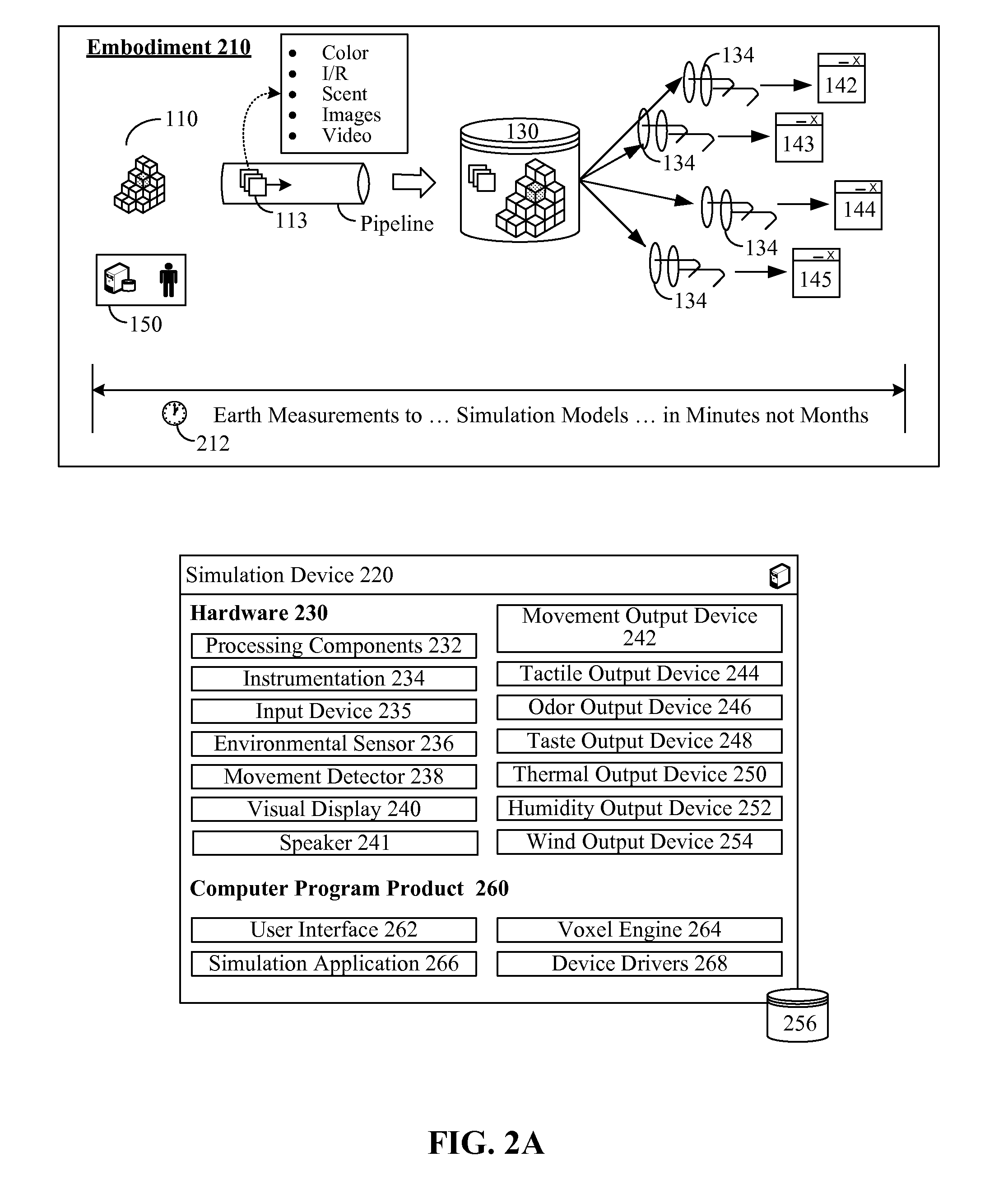
[0020]The disclosure provides a volumetric storage space 120 in which multisensory data is encoded. The multisensory data can be acquired from a real-world volumetric space 110 and can be used when expressing a simulation space 140. The real-world volumetric space 110, the volumetric storage space 120, and the simulation space 140 can correspond to each other.
[0021]More specifically, the volumetric storage space 120 can be a space composed of a set of volumetric units, called voxels 122. Data elements can be directly referenced to voxels 122, which permits these data elements to be spatially placed in the volumetric storage space 120. The data elements need not have any specific identity outside their relationship to the voxels 122, which permits raw data to be inserted into the volumetric storage space 120. For example, satellite imagery, LIDAR points, and other information can all be inserted into the volumetric storage space 120 and referenced to voxels 122. The other information...
PUM
 Abstract
Description
Claims
Application Information