
Automatic matching method for remote sensing satellite data ground control point based on knowledge learning

A technology for ground control points and remote sensing satellites, which is applied in the direction of re-radiation of electromagnetic waves, utilization of re-radiation, measurement devices, etc., can solve the problems of lack of abundance, difficulty in automatic matching of ground control points, and unsuitability for remote sensing satellites.

Inactive Publication Date: 2009-06-03
NAT SATELLITE METEOROLOGICAL CENT
View PDF1 Cites 6 Cited by
  • Summary
  • Abstract
  • Description
  • Claims
  • Application Information

AI Technical Summary

Problems solved by technology

[0005] However, the above-mentioned prior art still has certain limitations, which are mainly manifested in: 1. When it is necessary to process a large amount of remote sensing satellite data that is not rich in historical data, the automaticity of the ground control point matching method is difficult to satisfy
The requirement for the automaticity of the method is the prerequisite for the application of a large number of remote sensing satellite data; 2. The existing replacement method is to replace it manually or semi-automatically, and then return the obtained landmark offset to the system to obtain the relevant Therefore, the time and accuracy of image navigation calculations will have large deviations due to manual influence; 3. Existing methods require experts to formulate a large number of template libraries. Due to historical data accumulation and other factors, my country's remote sensing Satellite ground detection data is not rich, so the landmark navigation method suitable for foreign remote sensing satellites is not suitable for remote sensing satellites designed by my country

Method used


Image

  • Automatic matching method for remote sensing satellite data ground control point based on knowledge learning
  • Automatic matching method for remote sensing satellite data ground control point based on knowledge learning
  • Automatic matching method for remote sensing satellite data ground control point based on knowledge learning

Examples


Embodiment Construction

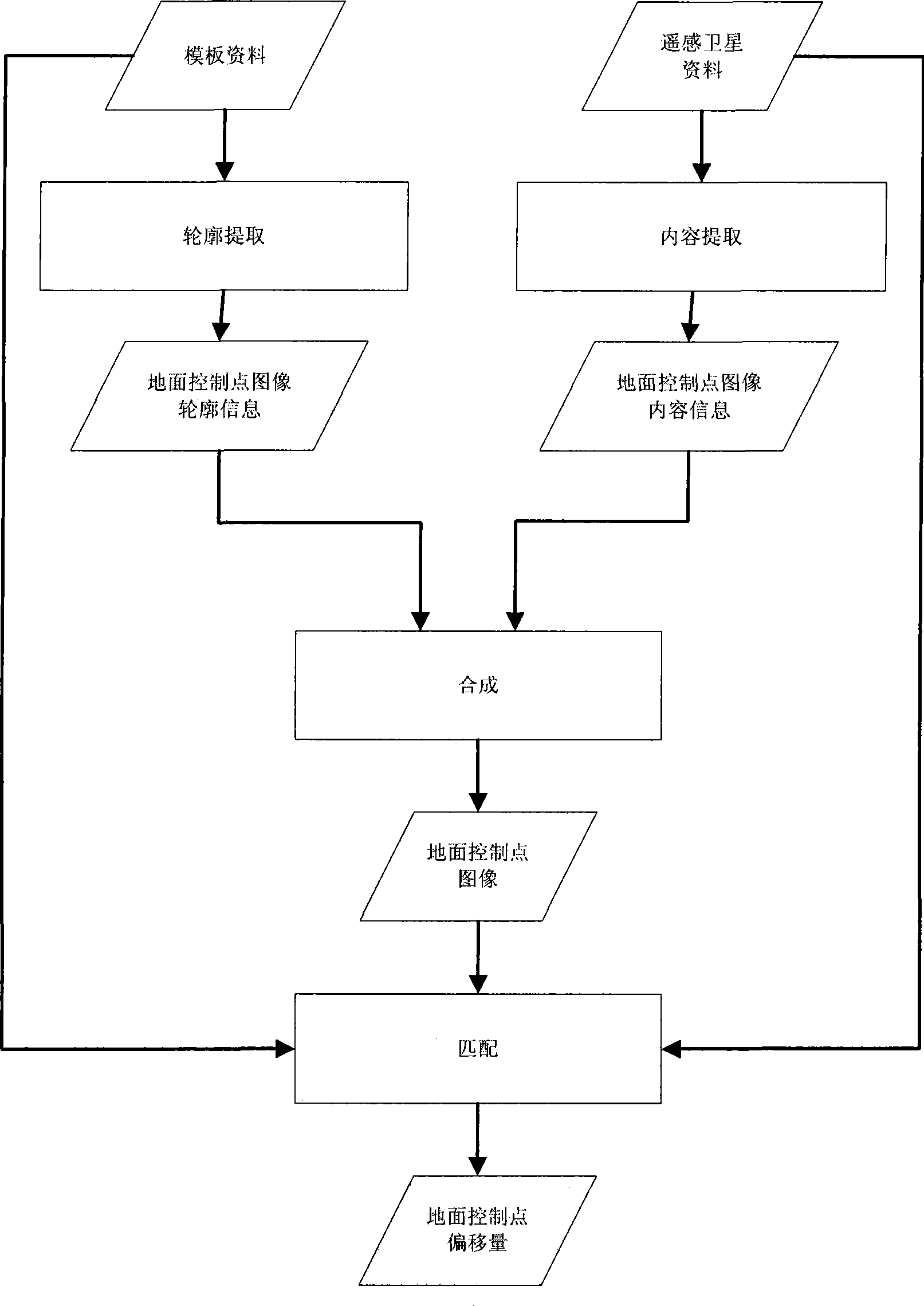
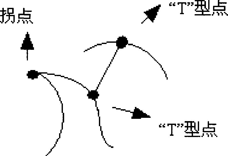
[0028] The core idea of ​​this automatic matching method for ground control points of remote sensing satellite data is to make full use of the existing knowledge base system to replace the role of historical data, and use computer simulation to operate manually. When manually matching ground control points with remote sensing satellite data, two kinds of prior knowledge are generally used, one is the contour characteristics of the ground control points, and the other is the content information of the ground control points. It is possible for these two kinds of information to be represented on a computer. Therefore, this automatic matching method is in the form of learning, based on people's understanding of the ground control points of remote sensing satellite data (ie, structure information and content information) to automatically complete the matching process.

[0029] see figure 1 As shown, the main steps of the remote sensing satellite data ground control point automatic...


PUM


Abstract

The invention provides an automatic matching method for a remote sensing satellite data ground control point based on knowledge learning, comprising the following steps: contour extraction: contour information of the remote sensing satellite data ground control point is obtained according to an image of a template; content extraction: content information of the remote sensing satellite data ground control point is obtained according to image information of remote sensing satellite data; synthesis: the obtained contour information and content information are synthesized to obtain complete information of the remote sensing satellite data ground control point; matching: the obtained complete information of the remote sensing satellite data ground control point is matched with the template to obtain the offset of the remote sensing satellite data ground control point. By adopting the method, errors brought by the attitude of the remote sensing satellite can be accurately estimated, thereby having important application value in the processing work of the remote sensing satellite data.

Description

technical field [0001] The invention relates to a method for automatically matching ground control points of remote sensing satellite data, in particular to a method for automatically matching ground control points of remote sensing satellite data based on a knowledge learning mechanism, and belongs to the field of remote sensing technology. Background technique [0002] At present, remote sensing satellite images have become an important data source for people to obtain ground information. In the process of processing remote sensing satellite data, there are still some problems to be solved. The first of these problems is: where is the observation object remotely sensed by the satellite? That is, what is the corresponding relationship between each pixel in the remote sensing satellite image and the geographic longitude and latitude on the ground. This problem needs to be solved by remote sensing satellite image navigation technology. [0003] The general process of remot...

Claims


Application Information

Patent Timeline
IPC IPC(8): G01S17/89
Inventor 杨磊杨忠东
Owner NAT SATELLITE METEOROLOGICAL CENT
Learn More