SRG (sphere rhombus grid) subdivision code and geographic coordinate converting algorithm
A technology of subdividing coding and conversion algorithms, which is applied in computing, electrical digital data processing, special data processing applications, etc., and can solve problems such as insufficient conversion accuracy
- Summary
- Abstract
- Description
- Claims
- Application Information
AI Technical Summary
Problems solved by technology
Method used
Image
Examples
Embodiment Construction
[0104] Examples of conversion between latitude and longitude coordinates and SRG subdivision address codes
[0105] Conversion of SRG codes to latitude and longitude coordinates
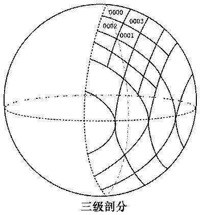
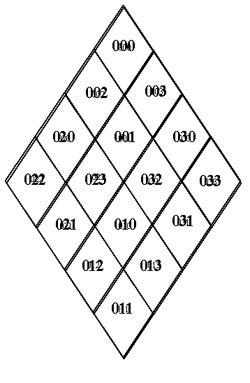
[0106] For example, the quadrilateral numbered 0012301 is generated by 6-level subdivision, and its latitude is recorded as w 0112301 , longitude recorded as j 0012301 , the calculation process is as follows:
[0107] w 0012301 =w 001230 -45 / 5 5
[0108] =w 00123 +45 / 24 -45 / 2 5
[0109] =w 0012 +45 / 2 4 -45 / 2 5
[0110] =w 001 +45 / 2 4 -45 / 2 5
[0111] =w 00 -45 / 2+45 / 2 4 -45 / 2 5
[0112] =45-45 / 2+45 / 2 4 -45 / 2 5
[0113] =24.25
[0114] j 001 =1×(90 / 3)+45 / 3
[0115] j 0012 =2×(90 / 6)+45 / 6
[0116] j 00123 =5×(90 / 12)+45 / 12
[0117] j 001230 =10×(90 / 23)+45 / 23
[0118] j 0012301 =21×(90 / 47)+45 / 47=41.17
[0119] Conversion of latitude and longitude coordinates to SRG code
[0120] Given the latitude and longitude coordinates (...
PUM
 Abstract
Description
Claims
Application Information
 - R&D
- Intellectual Property
- Life Sciences
- Materials
- Tech Scout
- Unparalleled Data Quality
- Higher Quality Content
- 60% Fewer Hallucinations
Browse by: Latest US Patents, China's latest patents, Technical Efficacy Thesaurus, Application Domain, Technology Topic, Popular Technical Reports.
© 2025 PatSnap. All rights reserved.Legal|Privacy policy|Modern Slavery Act Transparency Statement|Sitemap|About US| Contact US: help@patsnap.com


