Digital mine tunneling search prediction method
A technology of digital mine and prediction method, which is applied in the direction of electrical digital data processing, image data processing, special data processing applications, etc., can solve problems such as waste of space, lack of, and inability to reflect, and achieve the effect of reducing risks and saving funds
- Summary
- Abstract
- Description
- Claims
- Application Information
AI Technical Summary
Problems solved by technology
Method used
Image
Examples
specific Embodiment 1
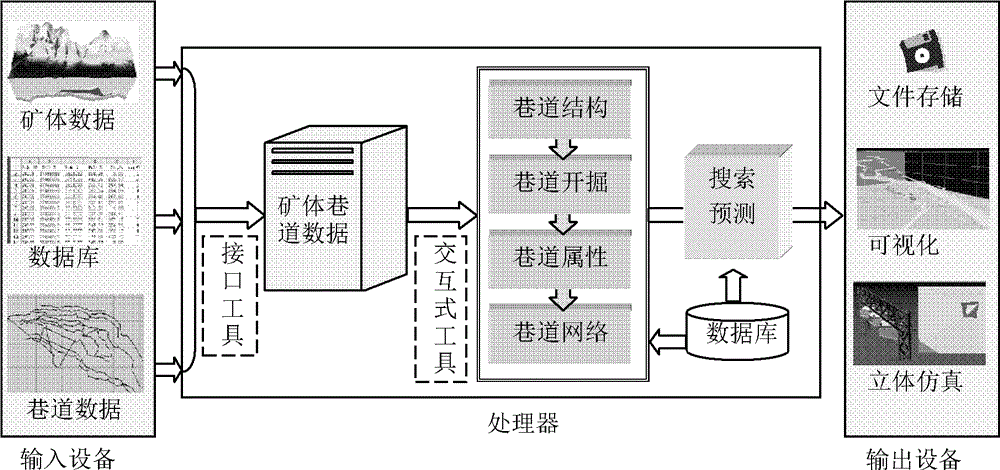
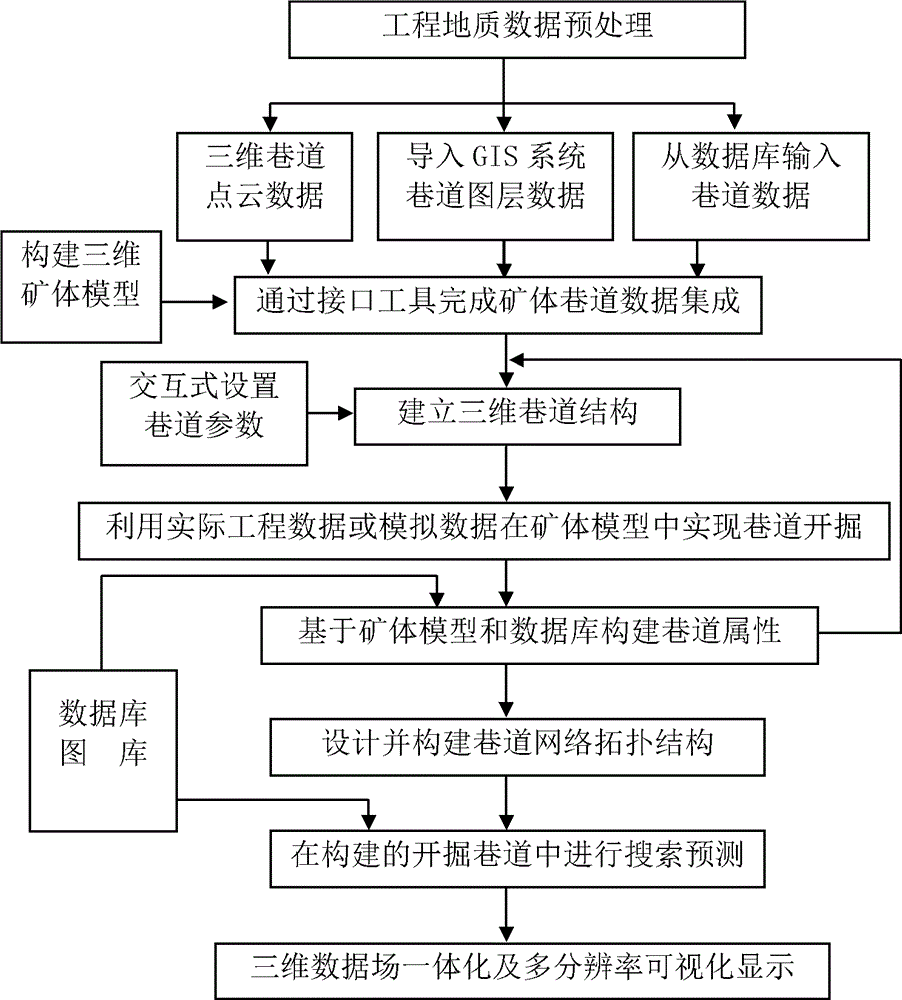
[0074] Refer to attached Figure 5-9 , taking a gold mine as an example, the roadway excavation search and prediction method in the digital mine of the present invention includes:
[0075] Step 101: Preprocessing the engineering geological data from mines in different periods, formats and sources.
[0076] Step 102: Carry out vectorization processing through the GIS system to generate roadway layer data, which can be abstracted into line data. Store roadway attribute data, lithology attribute data, water inrush, gas gushing, etc. in databases such as SQL Server and Access. Using the existing drilling, profile, geological map and other data in the mining area, construct a 3D ore body model. Through the interface tool, the preprocessed roadway data is imported into the cache area *pLBuffer of the processor through the input device, and integrated with the constructed 3D ore body model. Table 2 shows the partial data list of the mining area after integration, Figure 5 In ord...
specific Embodiment 2
[0088] Take the roadway excavation search and prediction method in a digital mine as an example.
[0089] Step 201: Preprocessing the engineering geological data from mines in different periods, formats and sources.
[0090] Step 202: Construct a three-dimensional orebody model by using the existing drilling, profile, geological map and other data in the mining area. Design 3D roadway structures with interactive tools. Table 4 shows the roadway data of the designed Segment class, Figure 10 To simulate the excavation of three intersecting roadways between strata.
[0091] Table 4 Roadway data of Segment class designed by interactive tools
[0092]
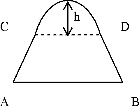
[0093] Step 203: Design the roadway section as an arch, construct the roadway section by using three-dimensional space geometry and analytical geometry to meet the structural characteristics and excavation requirements of the designed roadway, and divide it into a limited number of combinations of triangular prisms by using t...
PUM
 Abstract
Description
Claims
Application Information
 - R&D
- Intellectual Property
- Life Sciences
- Materials
- Tech Scout
- Unparalleled Data Quality
- Higher Quality Content
- 60% Fewer Hallucinations
Browse by: Latest US Patents, China's latest patents, Technical Efficacy Thesaurus, Application Domain, Technology Topic, Popular Technical Reports.
© 2025 PatSnap. All rights reserved.Legal|Privacy policy|Modern Slavery Act Transparency Statement|Sitemap|About US| Contact US: help@patsnap.com


