

Construction method of three-dimensional geologic model
A technology of three-dimensional geology and construction method, which is applied in the field of construction of three-dimensional geological models, and can solve the problems of large workload, complex modeling process, and inability to update the model automatically.
- Summary
- Abstract
- Description
- Claims
- Application Information
AI Technical Summary
Problems solved by technology
Method used
Image

Examples
Embodiment Construction
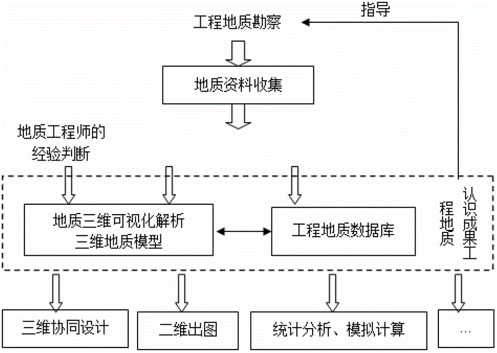
[0035] With the vigorous rise of engineering 3D design in China, the backwardness of engineering geological 3D design methods has increasingly become a restrictive factor. On the basis of effectively solving the three-dimensional interpretation and analysis of geological data, the present invention standardizes and semi-automates the internal work of key links such as the collection, management, analysis and modeling of geological data to the output of results according to the requirements of three-dimensional design, and then forms A 3D design method that is associated with engineering geological databases and 3D geological models and covers the entire life cycle of water conservancy and hydropower engineering geology.
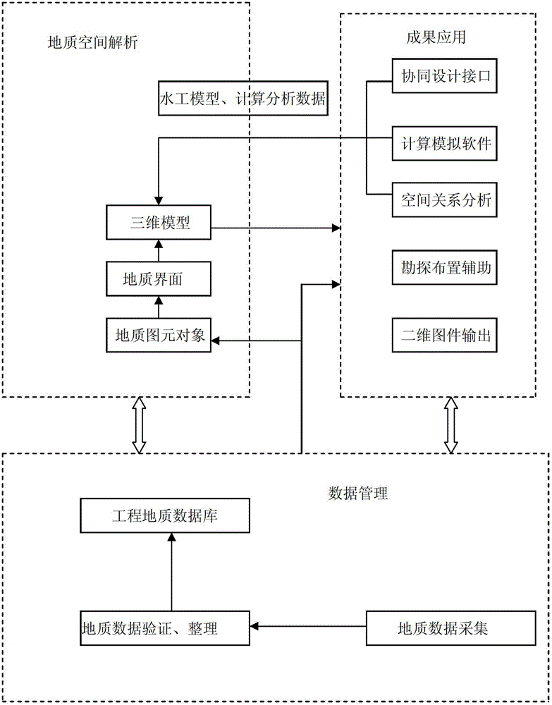
[0036] Realization principle of the present invention sees figure 1 , which mainly includes the following aspects:
[0037] 1. The engineering geological database contains not only the basic data, but also the attribute information of each engineering geolog...
PUM
 Abstract
Description
Claims
Application Information