A method and device for displaying a map in a geographic information system gis
A geographic information system and map technology, applied in the field of map display of geographic information system GIS, can solve problems such as map differences
- Summary
- Abstract
- Description
- Claims
- Application Information
AI Technical Summary
Problems solved by technology
Method used
Image


Examples
Embodiment 1
[0020] Please refer to figure 1 , the geographic information system GIS map display method that the embodiment of the present invention provides, comprises:
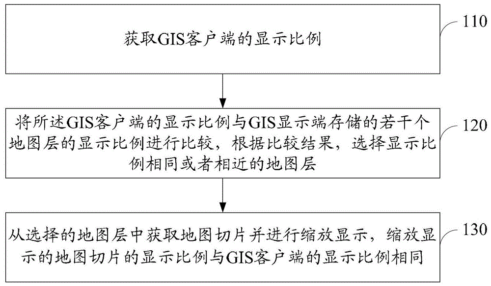
[0021] 110. Obtain the display scale of the GIS client.
[0022] Usually, the GIS display terminal runs on the processor of the video wall, and the GIS client runs on the ordinary PC, and the two communicate through the TCP / IP protocol. Wherein, the map data stored in the GIS display terminal includes several map layers with different display scales.
[0023] Suppose the map name is 3dgz, and there are four map layers "0", "1", "2", and "3", and the corresponding display scales are 1 / 128000, 1 / 64000, 1 / 32000, and 1 / 16000; Suppose the size of each map slice in the map layer is PicW*PicH, such as: 256*256, and the resolution of the video wall is WallW*WallH, such as 7680*7680.
[0024] Assuming that the display scale of the GIS client is 1 / 32001 at a certain moment, the GIS client notifies the GIS display terminal to di...
Embodiment 2
[0047] Please refer to Figure 4 , the geographic information system GIS map display device that the embodiment of the present invention provides, comprises:
[0048] Obtaining module 210, used to obtain the display scale of the GIS client;
[0049] The selection module 220 is used to compare the display ratio of the GIS client with the display ratios of several map layers stored in the GIS display terminal, and select a layer of map slices with the same or similar display ratios according to the comparison result;
[0050] The zooming and displaying module 230 is configured to acquire map slices from the selected map layer and zoom and display them, and the scaled display scale of the scaled map slices is the same as that of the GIS client.
[0051] Further, the selection module 220 can specifically be used for:
[0052] If the display scale of the client is smaller than the minimum display scale of the several map layers, select the map layer with the minimum display scale...
PUM
 Abstract
Description
Claims
Application Information