Road condition information generating method based on bus global position system (GPS) tracking data
A technology of trajectory data and road condition information, applied in the field of transportation, can solve the problems of lack of bus network topology relationship, reduced information accuracy, and low fitness.
- Summary
- Abstract
- Description
- Claims
- Application Information
AI Technical Summary
Problems solved by technology
Method used
Image
Examples
Embodiment Construction
[0072] The present invention will be further described in detail below in conjunction with the accompanying drawings, so that those skilled in the art can implement it with reference to the description.
[0073] The invention provides a method for generating road condition information based on bus GPS trajectory data, comprising:
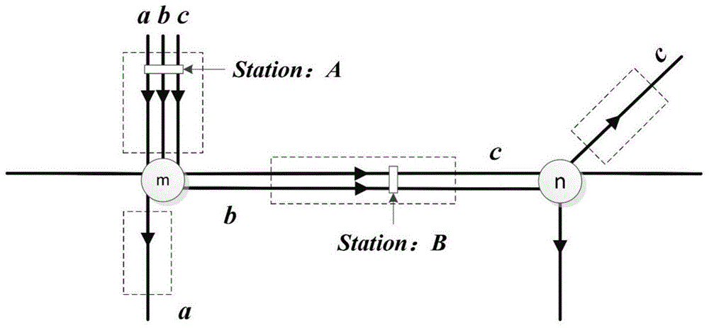
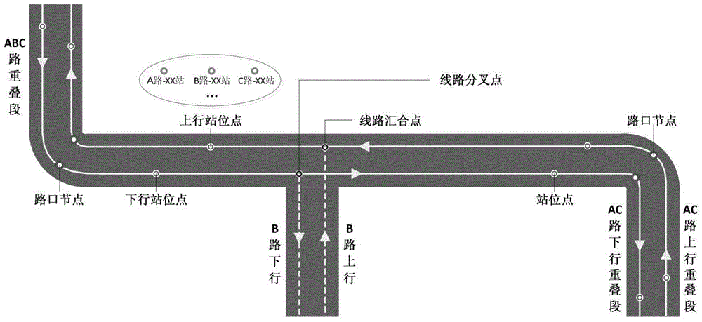
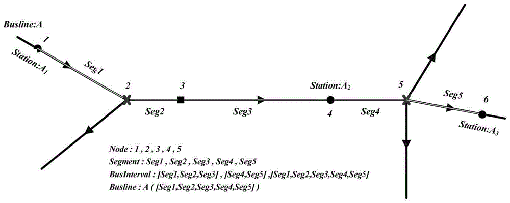
[0074] Step 1. The actual bus network includes several bus lines formed on the road network. The actual multiple bus stops with the same station number are combined and called station points, and the points where different bus lines intersect with each other are called The road intersection or the point where the road level changes is called an intersection node; the bus road network data structure is constructed with nodes and line segments, and the actual bus stops, station points, and line intersection points are used in the bus road network data structure Both nodes and intersection nodes are represented by nodes. Two adjacent nodes located in t...
PUM
 Abstract
Description
Claims
Application Information
 - R&D
- Intellectual Property
- Life Sciences
- Materials
- Tech Scout
- Unparalleled Data Quality
- Higher Quality Content
- 60% Fewer Hallucinations
Browse by: Latest US Patents, China's latest patents, Technical Efficacy Thesaurus, Application Domain, Technology Topic, Popular Technical Reports.
© 2025 PatSnap. All rights reserved.Legal|Privacy policy|Modern Slavery Act Transparency Statement|Sitemap|About US| Contact US: help@patsnap.com


