

High spatial resolution remote sensing image building detection method based on shadow and segmentation
A technology of high spatial resolution and remote sensing images, which is applied in the field of building detection of high spatial resolution remote sensing images, can solve the problems of high degree of automation and difficulty in building extraction, and achieve the effect of high degree of automation and overcoming difficulties in extraction
- Summary
- Abstract
- Description
- Claims
- Application Information
AI Technical Summary
Problems solved by technology
Method used
Image


Examples
Embodiment Construction
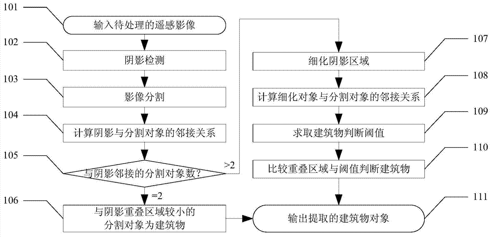
[0020] The specific embodiments of the present invention will be described in detail below with reference to the accompanying drawings.
[0021] In step 101, the input remote sensing image image1 to be processed is a high spatial resolution remote sensing image including 3 bands, the sensor is Quick bird, and preprocessing such as radiometric correction and geometric correction has been performed.
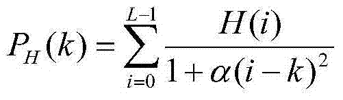
[0022] At step 102, through the histogram potential function:
[0023] P H ( k ) = Σ i = 0 L - 1 H ( i ) 1 + α ( i - ...
PUM
 Abstract
Description
Claims
Application Information