

Remote sensing spatial information teaching experiment system
A technology of spatial information and experimental system, applied in the direction of educational appliances, electric-operated teaching aids, instruments, etc., can solve the problems of being empty and boring, not being able to play a role in teaching, and a large amount of teaching knowledge, so as to achieve good teaching effects
- Summary
- Abstract
- Description
- Claims
- Application Information
AI Technical Summary
Problems solved by technology
Method used
Image

Examples
Embodiment Construction
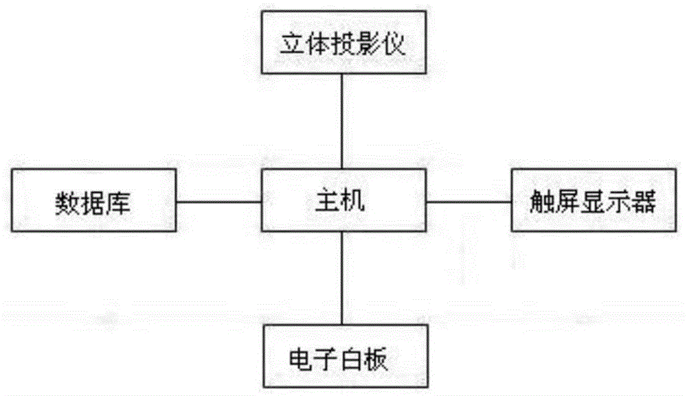
[0006] see figure 1 , the realization scheme of the present invention is as follows: it comprises main frame, touch-screen display, database, electronic whiteboard, three-dimensional projector, and described main frame is connected with touch-screen display, database, electronic whiteboard, three-dimensional projector respectively. The present invention can form a teaching resource database of aviation, satellite, radar, multi-resolution, and multi-band course content image resources, and display the teaching resources in the database by a three-dimensional projector through a host computer. The whiteboard and the host computer realize full-angle interactive operation, breaking through the traditional teaching mode, and the teaching effect is good.
PUM
 Abstract
Description
Claims
Application Information