Multi-sensor environment map building
An environmental map and sensor technology, applied in the direction of instruments, aircraft, unmanned aircraft, etc., can solve problems such as adverse effects of UAV functions and limitations of environmental data accuracy, and achieve the effect of promoting navigation and improving functionality.
- Summary
- Abstract
- Description
- Claims
- Application Information
AI Technical Summary
Problems solved by technology
Method used
Image


Examples
Embodiment Construction
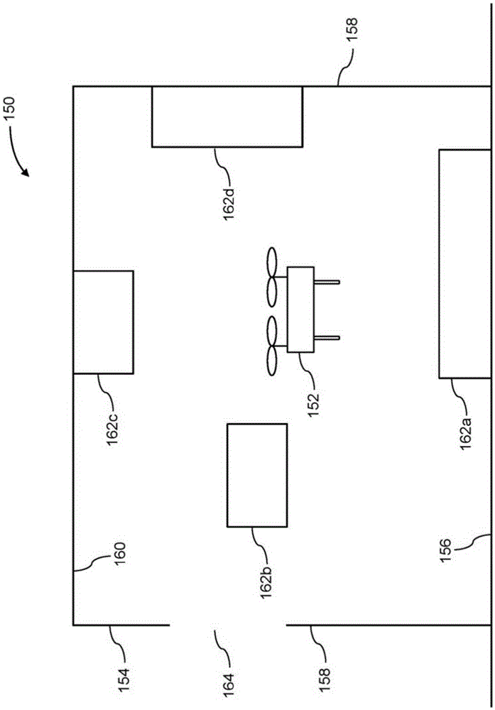
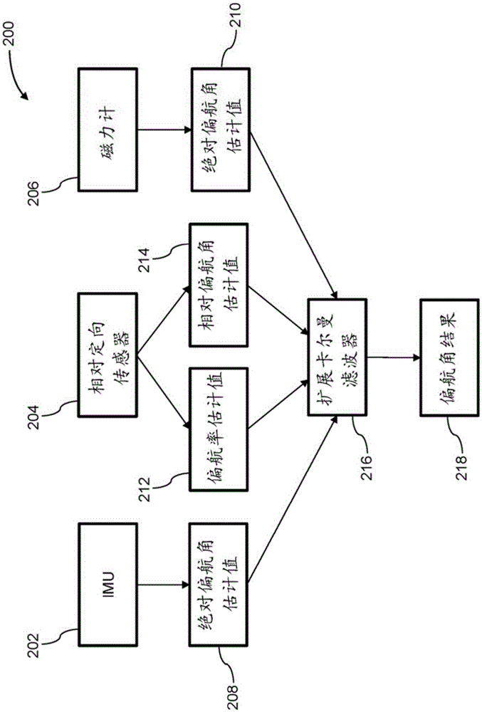
[0066] The present disclosure provides systems and methods for controlling movable objects such as unmanned aerial vehicles (UAVs). In some embodiments, the UAV may be adapted to carry a plurality of sensors configured to collect environmental data. Some of these sensors may be of different types (eg vision sensors used in combination with distance sensors). Data acquired by the plurality of sensors may be combined to generate an environmental map representing the surrounding environment. In some implementations, an environment map may include information about the location of objects in the environment, such as objects or obstacles. UAVs can use the generated maps to perform various operations, some of which can be semi- or fully automated. For example, in some implementations, a map of the environment may be used to automatically determine a flight path for the UAV to navigate from its current location to a target location. As another example, a map of the environment may...
PUM
 Abstract
Description
Claims
Application Information
 - Generate Ideas
- Intellectual Property
- Life Sciences
- Materials
- Tech Scout
- Unparalleled Data Quality
- Higher Quality Content
- 60% Fewer Hallucinations
Browse by: Latest US Patents, China's latest patents, Technical Efficacy Thesaurus, Application Domain, Technology Topic, Popular Technical Reports.
© 2025 PatSnap. All rights reserved.Legal|Privacy policy|Modern Slavery Act Transparency Statement|Sitemap|About US| Contact US: help@patsnap.com