Method and device for determining the marking position of the name of the planar primitive in the electronic map
A surface-shaped and graphic-element technology, applied in maps/plans/charts, educational tools, instruments, etc., can solve problems such as poor display effect of electronic maps, and achieve the effect of improving the display effect
- Summary
- Abstract
- Description
- Claims
- Application Information
AI Technical Summary
Problems solved by technology
Method used
Image

Examples
Embodiment 1
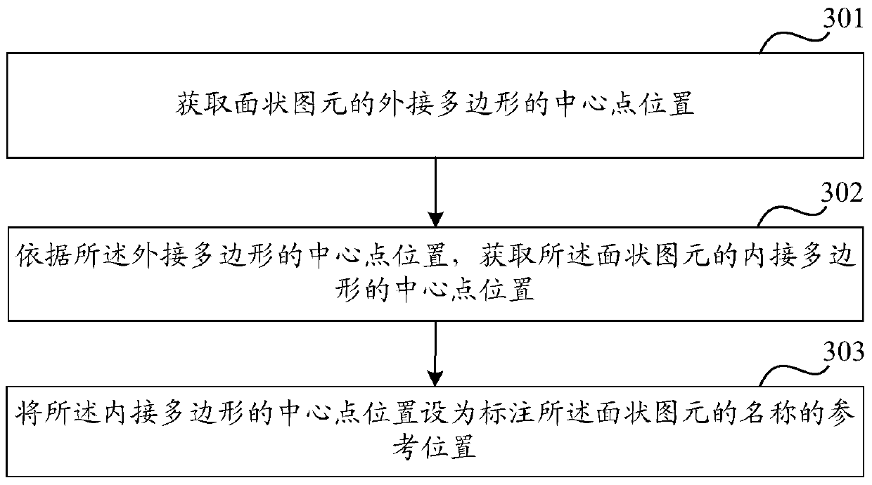
[0029] like image 3 As shown, it is an exemplary flow chart of the method for determining the labeling position of the surface primitive name in the electronic map in the embodiment of the present invention, and the method includes the following steps:
[0030] Step 301: Acquire the position of the center point of the circumscribed polygon of the surface primitive.
[0031] Step 302: According to the center point position of the circumscribed polygon, obtain the center point position of the inscribed polygon of the planar primitive.
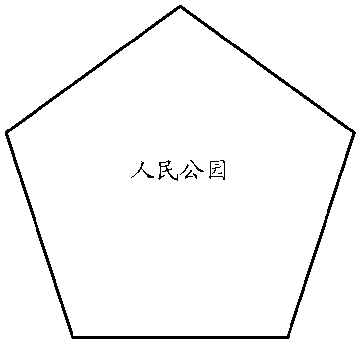
[0032] Among them, in order to find a maximum area that can be used to label the name inside the planar primitive, the inscribed polygon in step 302 can be a circle, rectangle, ellipse, etc., and the specific shape of the inscribed polygon can depend on the planar graph The shape of the element.
[0033] Step 303: Set the position of the center point of the inscribed polygon as a reference position for labeling the name of the planar primitive...
Embodiment 2
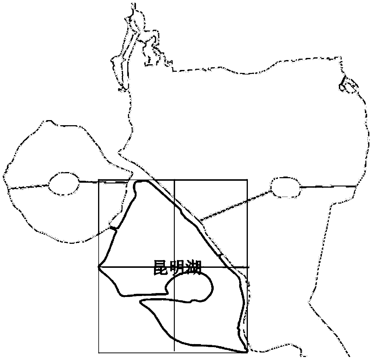
[0066] The planar primitive of Kunming Lake in the electronic map is an irregular polygon. Below, the name of the planar primitive of Kunming Lake is marked on the maximum inscribed circle of the planar primitive as an example to implement the present invention. The labeling method of the surface entity name in the electronic map in the example is described in detail, such as Figure 5 As shown, the method includes the following steps:
[0067] Step 501: Determine the position of the center point of the circumscribed polygon of the planar primitive of Kunming Lake, and use the position of the center point as the initial center position of the inscribed circle.
[0068] Step 502: Obtain the distance from the initial circle center position to each side of the circumscribed polygon.
[0069] Step 503: Obtain the vertical foot position point A and the vertical foot position point B of the first side and the second side of the circumscribed polygon from the initial center position...
Embodiment 3
[0082] Based on the same inventive concept, the present invention also provides a device for determining the labeling position of the name of the planar primitive in the electronic map, such as Figure 7 As shown, the device includes:
[0083] The outer center point position acquisition module 701 is used to acquire the center point position of the circumscribed polygon of the planar primitive;
[0084] An inner center point position acquisition module 702, configured to acquire the center point position of the inscribed polygon of the planar primitive according to the center point position of the circumscribed polygon;
[0085] A reference position determining module 703, configured to set the position of the center point of the inscribed polygon as the reference position for labeling the name of the planar primitive.
[0086] Wherein, in one embodiment, the device also includes:
[0087] A labeling module, configured to set the position of the center point of the inscribed...
PUM
 Abstract
Description
Claims
Application Information
 - R&D
- Intellectual Property
- Life Sciences
- Materials
- Tech Scout
- Unparalleled Data Quality
- Higher Quality Content
- 60% Fewer Hallucinations
Browse by: Latest US Patents, China's latest patents, Technical Efficacy Thesaurus, Application Domain, Technology Topic, Popular Technical Reports.
© 2025 PatSnap. All rights reserved.Legal|Privacy policy|Modern Slavery Act Transparency Statement|Sitemap|About US| Contact US: help@patsnap.com