A method for estimating vehicle queuing length at intersections using low sampling rate GPS data
A technology of GPS data and queue length, applied in the field of intelligent transportation, can solve the problems of large hardware loss and high construction cost, and achieve the effect of saving construction
- Summary
- Abstract
- Description
- Claims
- Application Information
AI Technical Summary
Problems solved by technology
Method used
Image
Examples
Embodiment 1
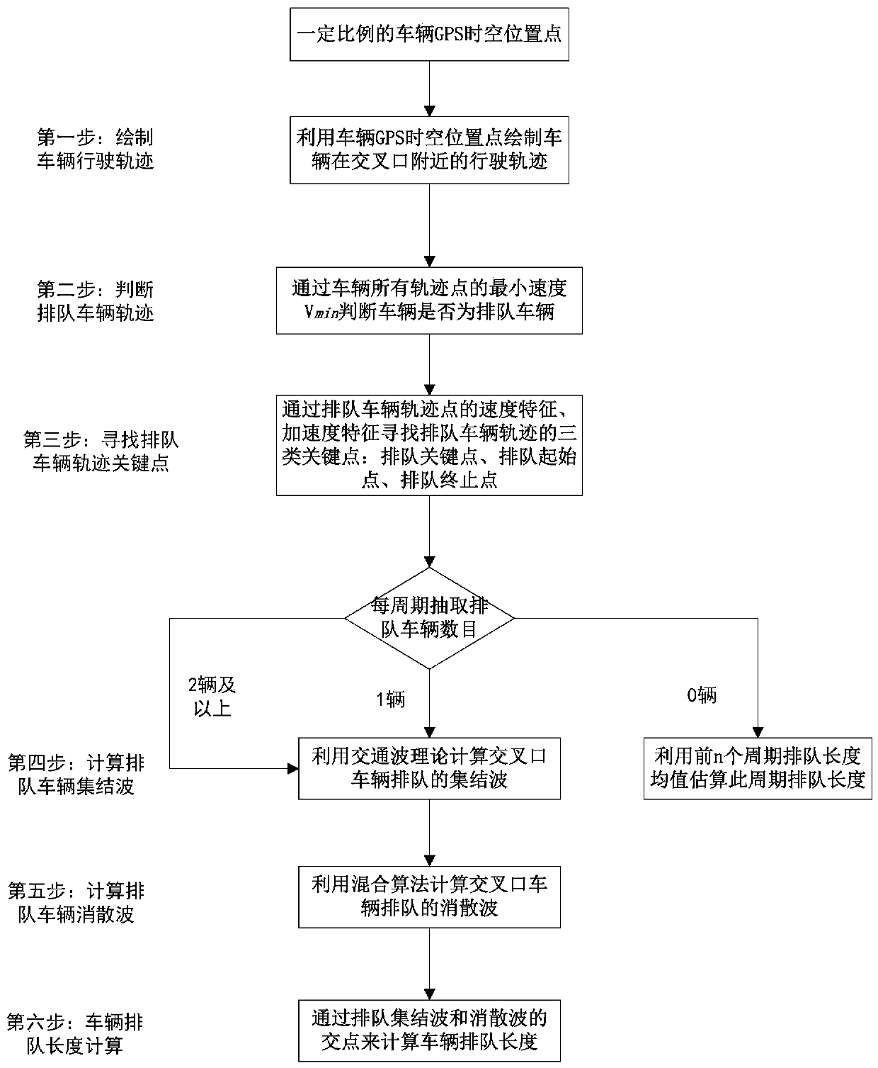
[0052] The present invention proposes a method for estimating the queuing length of vehicles at a non-saturated signal intersection using low sampling rate GPS track data, which is carried out according to the following steps:
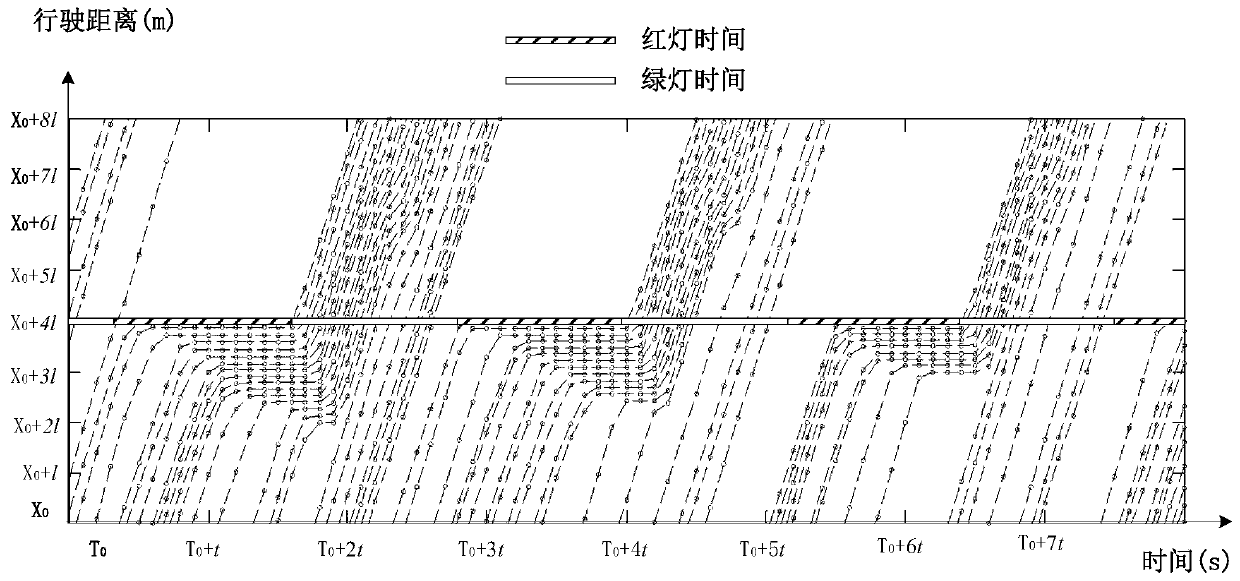
[0053] (1) Within the cycle time of an intersection, extract the GPS track data of vehicles at a certain ratio (5% to 20%) at any one of the entrances at the intersection, and make the cumulative driving distance of the extracted vehicles based on the cumulative driving distance of the vehicle distance curve;
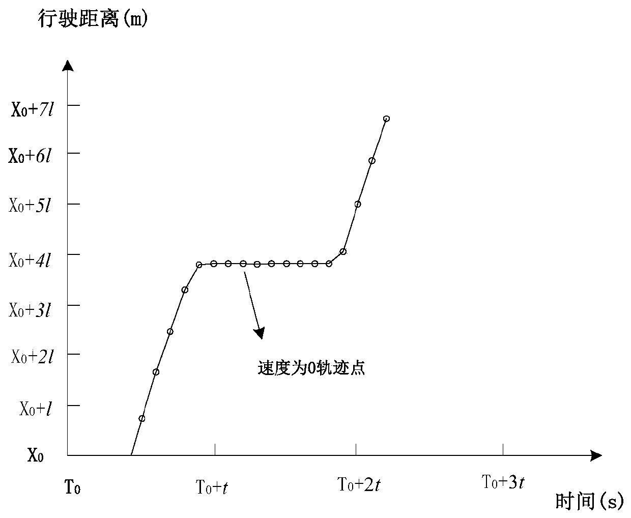
[0054] (2) Exclude all track points in the track whose velocity is greater than V min The trajectory data of , and the remaining trajectory data is the vehicle trajectory data that experienced queuing in the cycle;
[0055] (3) For the extracted trajectory data of each vehicle, the slave speed is less than V min The key point of queuing is preliminarily judged in the point of , and the speed of vehicle i at the jth track point is set to be w...
Embodiment 2
[0068] In the present invention, when a vehicle passes through an intersection, if it is equipped with a smart phone or other positioning device that can record GPS track data, the information that can be recorded includes: user ID number, longitude, latitude, recording time, movement angle, speed and other information .
[0069] The present invention utilizes the space-time track points of vehicles passing through the intersection to estimate the vehicle queuing length of each entrance road at the intersection, and the specific method flow chart is as follows figure 1 shown. The specific method of each step is introduced in detail below.
[0070] Step 1: Assuming that all vehicles passing through the intersection are equipped with mobile phones that can record GPS track data, extract the latitude and longitude information of vehicles at each time point, calculate the cumulative driving distance at each time point, and use the distance before the stop line at the intersection...
PUM
 Abstract
Description
Claims
Application Information
 - R&D
- Intellectual Property
- Life Sciences
- Materials
- Tech Scout
- Unparalleled Data Quality
- Higher Quality Content
- 60% Fewer Hallucinations
Browse by: Latest US Patents, China's latest patents, Technical Efficacy Thesaurus, Application Domain, Technology Topic, Popular Technical Reports.
© 2025 PatSnap. All rights reserved.Legal|Privacy policy|Modern Slavery Act Transparency Statement|Sitemap|About US| Contact US: help@patsnap.com


