True ground surface-based pre-stack seismic imaging method

A pre-stack seismic and imaging method technology, applied in the field of geophysical exploration, to achieve the effects of good identification of associated faults, accurate homing, and clear description capabilities

Active Publication Date: 2017-09-19
BC P INC CHINA NAT PETROLEUM CORP +1
View PDF5 Cites 3 Cited by
  • Summary
  • Abstract
  • Description
  • Claims
  • Application Information

AI Technical Summary

Problems solved by technology

[0005] For example, one of the objectives of the present invention is to provide a pre-stack seismic imaging method based on the true surface for complex mountainous seismic work areas.

Method used


Image

  • True ground surface-based pre-stack seismic imaging method
  • True ground surface-based pre-stack seismic imaging method
  • True ground surface-based pre-stack seismic imaging method

Examples


example 1

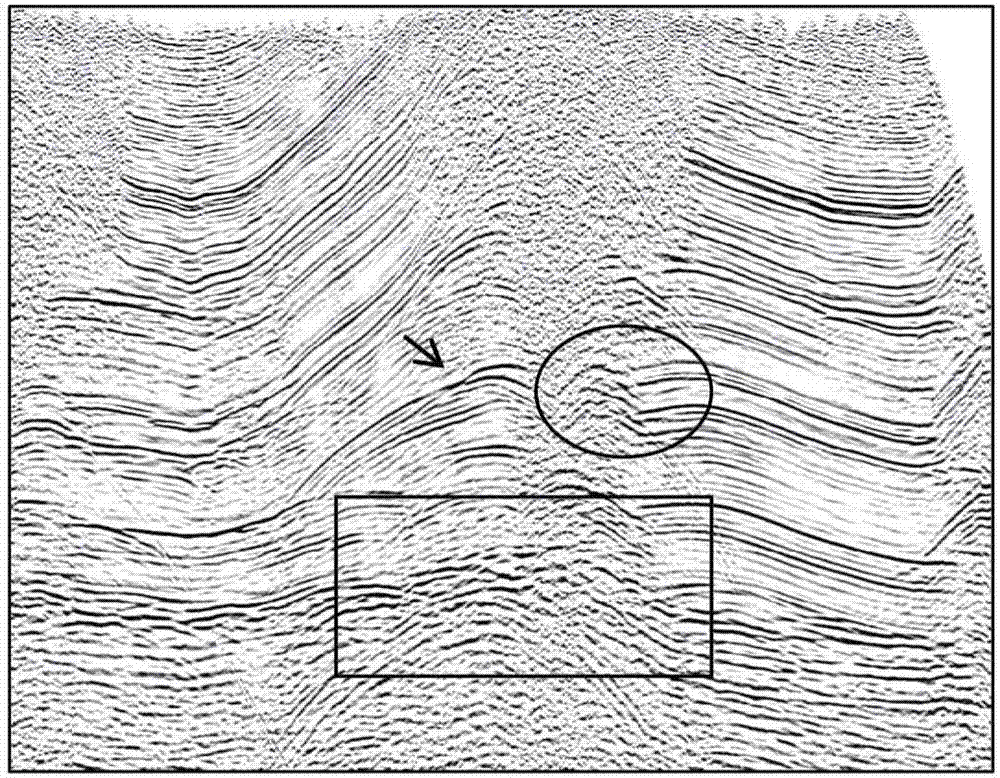
[0054] The regional structure is located in the high-steep fault-fold belt in the east of Sichuan Basin. The work area is a typical hilly-mountain landform, with a minimum altitude of 370m and a maximum altitude of 1080m. The topography of the structural main area of ​​the work area is relatively large, and the maximum relative height difference is about 700m; the underground structure is high and steep, faults are developed, and the imaging is poor.

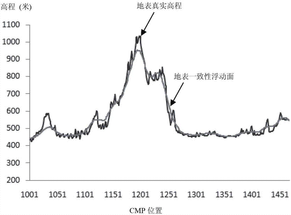
[0055] The surface consistent floating surface is calculated for the example data, and the prestack seismic gathers are corrected to the surface consistent floating surface, as shown in the attached figure 2 shown, namely figure 2 The surface consistent floating surface calculated from the example data is shown; it can be seen from the figure that the topography of the main part of the structure in the middle of the work area has severe topography fluctuations, and the topography changes at the two wings of the main structure ...


PUM


Abstract

The present invention provides a true ground surface-based pre-stack seismic imaging method. The method includes the following steps that: a pre-stressed seismic trace gather is corrected to a ground surface coherent floating surface, so that a first seismic trace gather is obtained; the first seismic trace gather is dynamically corrected, so that a second seismic trace gather is obtained; the remaining static correction amount of the second seismic trace gather is calculated, and the remaining static correction amount is applied to the first seismic trace gather, so that a third seismic trace gather can be obtained; pre-stack time migration based on a true ground surface and a true vibration amplitude is performed on the third seismic trace gather, so that a post-processing fourth seismic trace gather can be obtained; and a final migration superimposed seismic imaging result is generated according to the post-processing fourth seismic trace gather. The true ground surface-based pre-stack seismic imaging method of the invention is particularly suitable for processing seismic data imaging problems in work areas where topographic relief is severe, deep structures are complex and signal-to-noise ratios are low. The true ground surface-based pre-stack seismic imaging method of the invention has the advantages of clear imaging of structures, better performance in matching a borehole and better performance in identifying associated fractures. The imaging effect of the method of the invention can depict the small fractures of complex fault block regions more clearly.

Description

technical field [0001] The invention relates to geophysical exploration technology, more specifically, to a pre-stack seismic imaging method based on the true surface, aiming at the imaging problems of seismic data in the work area with severe terrain fluctuations, complex underground structures and low signal-to-noise ratio. Background technique [0002] Imaging research under complex surface conditions has always been a difficult problem for geophysicists. The general approach to this problem is to perform imaging on a floating datum on the basis of solving the static correction problem. Algorithms such as horizontal stack dynamic correction and migration imaging commonly used in seismic data processing all assume a horizontal surface. To realize this assumption, the static correction technique is usually used to correct the seismic data collected on the true surface to a non-surface consistent horizontal plane (common midpoint (CMP) floating datum). [0003] my country ...

Claims


Application Information

Patent Timeline
Patent Type & Authority Applications(China)
IPC IPC(8): G01V1/30G01V1/34
CPCG01V1/302G01V1/345G01V2210/74
Inventor 谢万学李亚林李德珍金德刚何光明陈丹雷虹彭文王玉华王珑胡然白静
Owner BC P INC CHINA NAT PETROLEUM CORP
Why Eureka
Try Eureka