
A Method for Identifying Maritime Artificial Facilities Using Spectral Remote Sensing Images

A technology of remote sensing images and facilities, applied in the field of intelligent recognition of remote sensing images, can solve the problems of large-scale and large-scale identification of artificial facilities, etc., and achieve the effect of good application prospects

Inactive Publication Date: 2020-10-30
北京市遥感信息研究所
View PDF4 Cites 0 Cited by
  • Summary
  • Abstract
  • Description
  • Claims
  • Application Information

AI Technical Summary

Problems solved by technology

[0004] At present, the method of detecting artificial facilities based on remote sensing mainly relies on manual image judgment, and it is impossible to identify artificial facilities on a large scale. Especially small artificial facilities are affected by the spatial resolution of remote sensing, and there may be several pixels or even sub-pixels. At this time, manual judgment is basically ineffective

Method used


Image

  • A Method for Identifying Maritime Artificial Facilities Using Spectral Remote Sensing Images
  • A Method for Identifying Maritime Artificial Facilities Using Spectral Remote Sensing Images
  • A Method for Identifying Maritime Artificial Facilities Using Spectral Remote Sensing Images

Examples


Embodiment

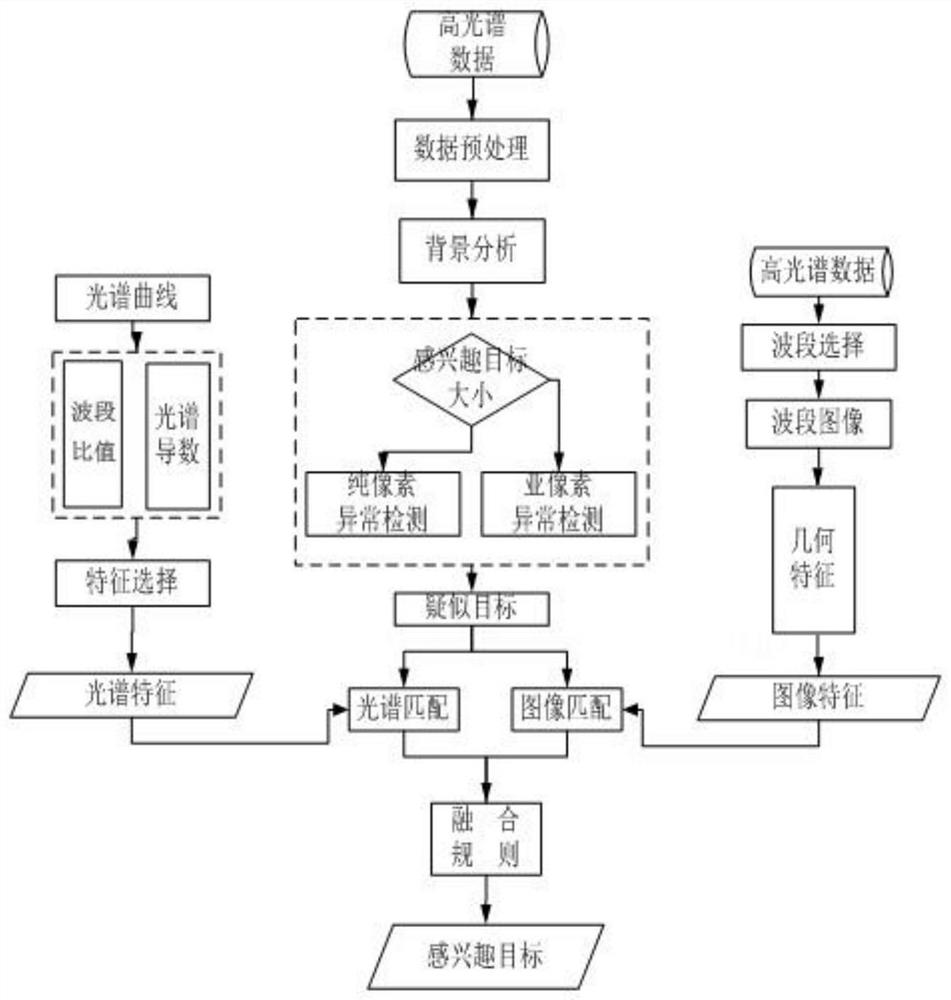
[0035] Such as figure 1 As shown, a method for utilizing spectral remote sensing images to identify artificial facilities on the sea provided by the present invention comprises the following steps:

[0036] (1) Background analysis: Obtain relevant information about the artificial facilities to be detected, including size, shape and material, etc., to provide input information for subsequent steps, and its size is used in step (2) to determine whether the result of abnormal detection is pure pixels or sub-pixels And roughly how many pixels are in the image, the shape is mainly used for image matching in step (5), and the material is mainly used for spectral matching in step (5).

[0037] Data preprocessing is performed on the hyperspectral data before the background analysis, and the method including removing the water absorption band is mainly used to remove the band with excessive noise.

[0038] (2) Anomaly detection: Considering that it takes a long time to perform feature...


PUM


Abstract

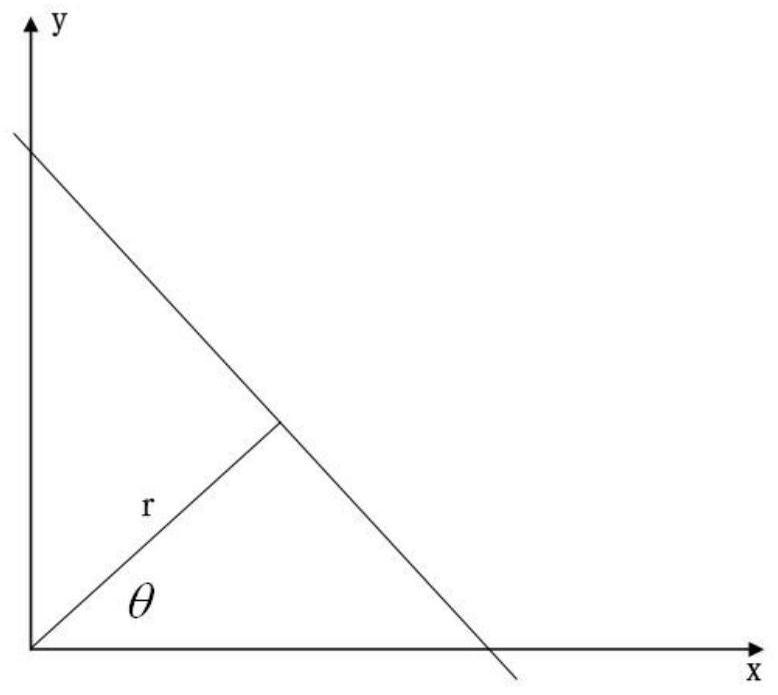
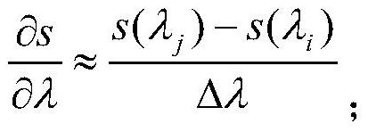
The invention discloses a method for identifying artificial facilities on the sea by using spectral remote sensing images. Anomaly detection is performed after preprocessing hyperspectral data to obtain suspected targets. Then extract spectral features such as band ratio and spectral derivative in the spectral domain, use the clear geometric texture characteristics of the red band in the image domain, extract the straight line and circle features of the target image, and finally identify the target of interest through fusion analysis. The method provided by the invention fills in the blank of using remote sensing images to automatically identify artificial facilities on the sea. It is suitable for the detection and identification of artificial facilities on the sea by hyperspectral sensors, and it is also applicable to multispectral images, and has a good application prospect.

Description

technical field [0001] The invention relates to a method for identifying artificial facilities on the sea by using spectral remote sensing images, and belongs to the technical field of intelligent identification of remote sensing images. Background technique [0002] The management, maintenance and utilization of islands and reefs in sea areas is one of the important contents of national sovereignty. Ascertaining the artificial facilities at sea in sea areas is of great significance for ensuring normal navigation at sea, development and utilization, and safeguarding national maritime rights and interests. Due to various historical reasons, my country's understanding of artificial facilities in the South China Sea is far from meeting the actual needs. As sovereignty disputes and development and utilization demands heat up in the East China Sea, South China Sea and other sea areas, the need to ascertain the situation of artificial offshore facilities in our waters is becoming ...

Claims


Application Information

Patent Timeline
Patent Type & Authority Patents(China)
IPC IPC(8): G06K9/00G06K9/46
CPCG06V20/194G06V20/13G06V10/58G06V10/462
Inventor 陈进詹明刘翔畅磊陈东
Owner 北京市遥感信息研究所
Learn More