A multi-frequency point interference imaging method and system

An interferometric imaging and multi-frequency technology, applied in the field of space detection, can solve the problem of two-dimensional imaging of objects that cannot be synchronized in orbit, and achieve the effect of improving accuracy, imaging quality, and measurement accuracy.

Active Publication Date: 2020-08-18
BEIJING INST OF RADIO MEASUREMENT +1
View PDF7 Cites 0 Cited by
  • Summary
  • Abstract
  • Description
  • Claims
  • Application Information

AI Technical Summary

Problems solved by technology

[0003] Because the geosynchronous orbit or high-orbit targets are far away from the ground observation points, and the geosynchronous orbit targets are basically stationary relative to the earth, traditional ISAR imaging methods cannot image the geosynchronous orbit targets in two dimensions.

Method used


Image

  • A multi-frequency point interference imaging method and system
  • A multi-frequency point interference imaging method and system
  • A multi-frequency point interference imaging method and system

Examples


Embodiment Construction

[0041] The principles and features of the present invention will be described below in conjunction with the accompanying drawings, and the examples given are only used to explain the present invention, and are not intended to limit the scope of the present invention.

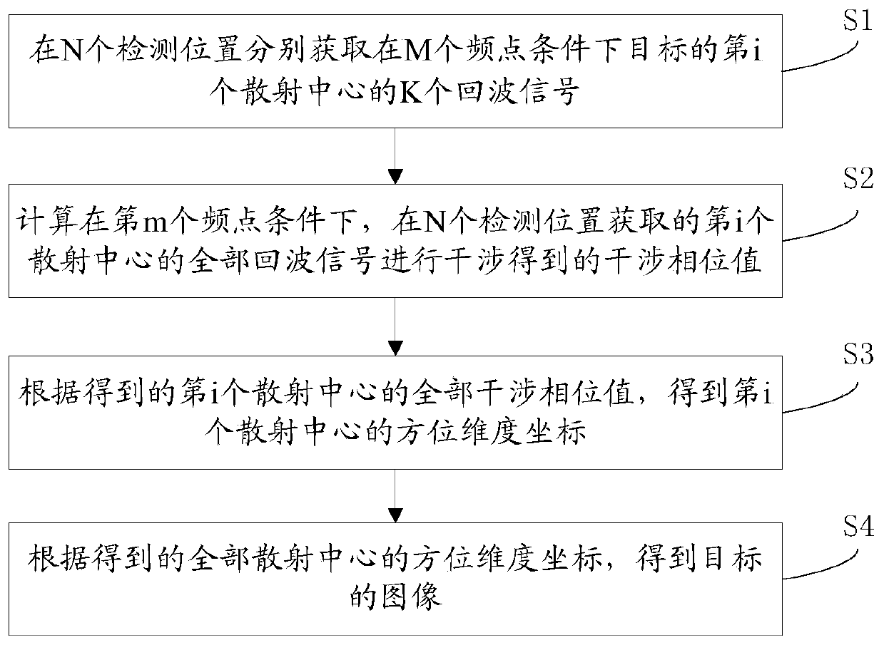
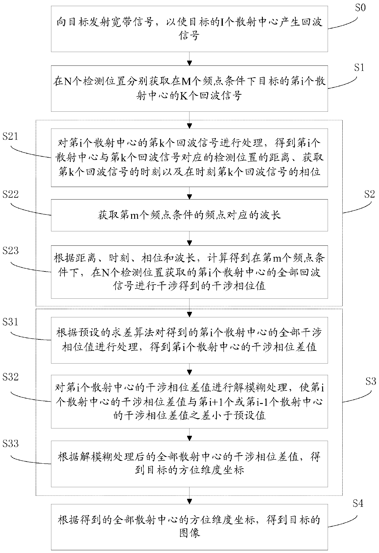
[0042] Such as figure 1 As shown, it is a schematic flow chart provided by an embodiment of a multi-frequency point interference imaging method of the present invention, the method includes:

[0043] S1. Acquire K echo signals of the i-th scattering center of the target under the condition of M frequency points at N detection positions, where the value of i is from 1 to I, I is the number of scattering centers, and N ≥2, M≥2, K=N*M.

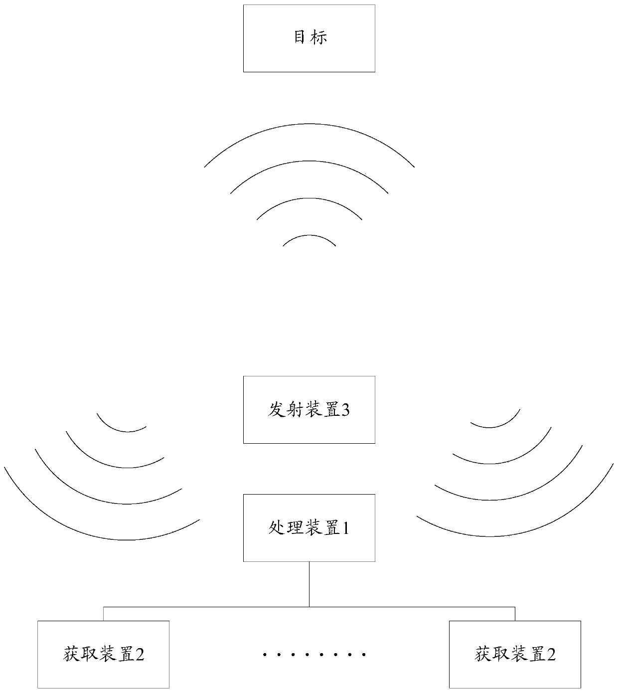
[0044] It should be noted that these N detection positions can be set according to actual needs, and these N detection positions refer to different positions with a certain distance from each other. Usually, in order to obtain a good imaging effect, these N detection positions are...


PUM


Abstract

The invention discloses a multi-frequency point interference imaging method and system, and relates to the field of space detection. The method comprises the steps that K echo signals of the i-th scattering center of a target under M frequency points are acquired at N detection positions; interference phase values acquired by interfering with all echo signals, which are acquired at N detection positions, of the i-th scattering center are calculated under the m-th frequency point; the azimuth dimension coordinate of the i-th scattering center is acquired according to all acquired interference phase values of the i-th scattering center; and according to the acquired azimuth dimension coordinates of all scattering centers, the image of the target is acquired. According to the multi-frequencypoint interference imaging method and system, the azimuth dimension coordinates of all scattering centers of the detected target can be acquired, and the two-dimensional image of a high-track target or a synchronous track target is acquired.

Description

technical field [0001] The invention relates to the field of space detection, in particular to a multi-frequency point interference imaging method and system. Background technique [0002] With the development of aerospace technology, space-based systems such as satellites have played an increasingly important role in national military and security. In high-orbit space, a large number of high-value satellites are operating, so it is very important to monitor high-orbit targets or synchronous orbit targets. [0003] Because the geosynchronous orbit or high orbit target is far away from the ground observation point, and the geosynchronous orbit target is basically stationary relative to the earth, the traditional ISAR imaging method cannot image the geosynchronous orbit target in two dimensions. Contents of the invention [0004] The technical problem to be solved by the present invention is to provide a multi-frequency point interference imaging method and system for the d...

Claims


Application Information

Patent Timeline
Patent Type & Authority Patents(China)
IPC IPC(8): G01S13/90G01S7/41
CPCG01S7/418G01S13/9023G01S13/9094
Inventor 李飞菅毛肖凯凯刘丹刘志峰
Owner BEIJING INST OF RADIO MEASUREMENT
Why Eureka
Try Eureka