A route planning method for multi-UAV cooperative area surveillance

A route planning, multi-UAV technology, applied in navigation calculation tools, 3D position/channel control, vehicle position/route/altitude control, etc. UAV conflict, collision and other problems, to achieve the optimal effect of real-time coverage area

Active Publication Date: 2021-08-03
XIDIAN UNIV
View PDF11 Cites 0 Cited by
  • Summary
  • Abstract
  • Description
  • Claims
  • Application Information

AI Technical Summary

Problems solved by technology

If there is a lack of effective coordinated flight of UAV groups, not only will it not be able to fully reflect the advantages of multiple UAVs in cooperative monitoring coverage and detection, but there will even be a risk of conflict and collision between UAVs.

Method used


Image

  • A route planning method for multi-UAV cooperative area surveillance
  • A route planning method for multi-UAV cooperative area surveillance
  • A route planning method for multi-UAV cooperative area surveillance

Examples


Embodiment Construction

[0065] The following will clearly and completely describe the technical solutions in the embodiments of the present invention with reference to the accompanying drawings in the embodiments of the present invention. Obviously, the described embodiments are only some, not all, embodiments of the present invention. Based on the embodiments of the present invention, all other embodiments obtained by persons of ordinary skill in the art without making creative efforts belong to the protection scope of the present invention.

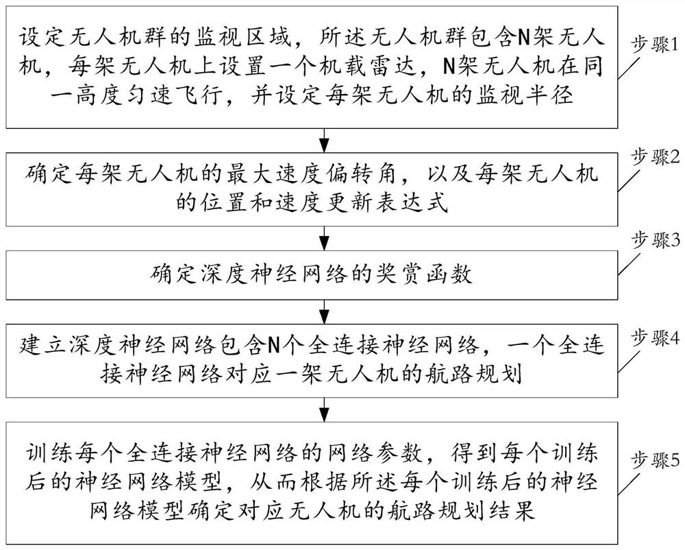
[0066] refer to figure 1 , which is a flow chart of a route planning method for multi-UAV cooperative area monitoring provided by an embodiment of the present invention, including the following steps:

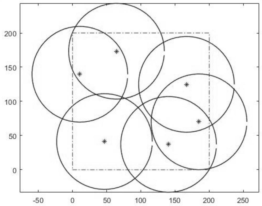
[0067] Step 1, set the simulation parameters of the route planning problem. Set the monitoring target area of ​​the drone group; set a series of drone movement parameters; the unmanned early warning fleet includes N drones, each drone is equipped with an airbo...


PUM


Abstract

The invention belongs to the field of route planning for regional surveillance of drones, and discloses a route planning method for regional surveillance of multiple drones, including: setting the target monitoring area of ​​the drone group, where the drone group includes N drones, each Set up an airborne radar on a drone, and each drone flies at a constant speed; model the route planning of the drone group; determine the state and action of the drone; set the reward function; establish a deep neural network; Plan the route of a UAV, obtain a limited number of training samples during the flight of the UAV group, and train the deep neural network through the samples. The trained neural network can predict the samples that have not been seen. When the current state of the UAV swarm is input, the neural network can know which action to take to fly, and the monitoring coverage of the next step will be the largest. The route planned in this way can enable the UAV group to effectively cover the surveillance area in real time.

Description

technical field [0001] The present invention belongs to the field of UAV area monitoring route planning, and in particular relates to a multi-UAV cooperative area monitoring route planning method, which is applicable to the continuous monitoring problem of real-time maximum coverage of a target area by a UAV group. Background technique [0002] Unmanned Aerial Vehicle (UAV) refers to an aircraft that does not require a pilot to drive, and is controlled by radio remote control equipment and its own program control device. Due to the low cost, strong mobility, zero casualty rate, strong survivability, and convenient use of drones, in recent years, drones have played an irreplaceable role in both military and civilian fields. Among the various tasks that UAVs can complete, area surveillance is a very important task for UAV systems, especially the use of UAVs to monitor combat areas has become an important means of obtaining battlefield information. However, in complex environm...

Claims


Application Information

Patent Timeline
Patent Type & Authority Patents(China)
IPC IPC(8): G01C21/20G05D1/10
CPCG01C21/20G05D1/104
Inventor 王彤李艳庆张曙光
Owner XIDIAN UNIV
Why Eureka
Try Eureka