Method and associated equipment for preparing and/or performing a ground survey in an area of interest
A ground and regional technology, applied in the field of ground survey, can solve the problem of incomplete and reliable placement of fences
- Summary
- Abstract
- Description
- Claims
- Application Information
AI Technical Summary
Problems solved by technology
Method used
Image
Examples
Embodiment Construction
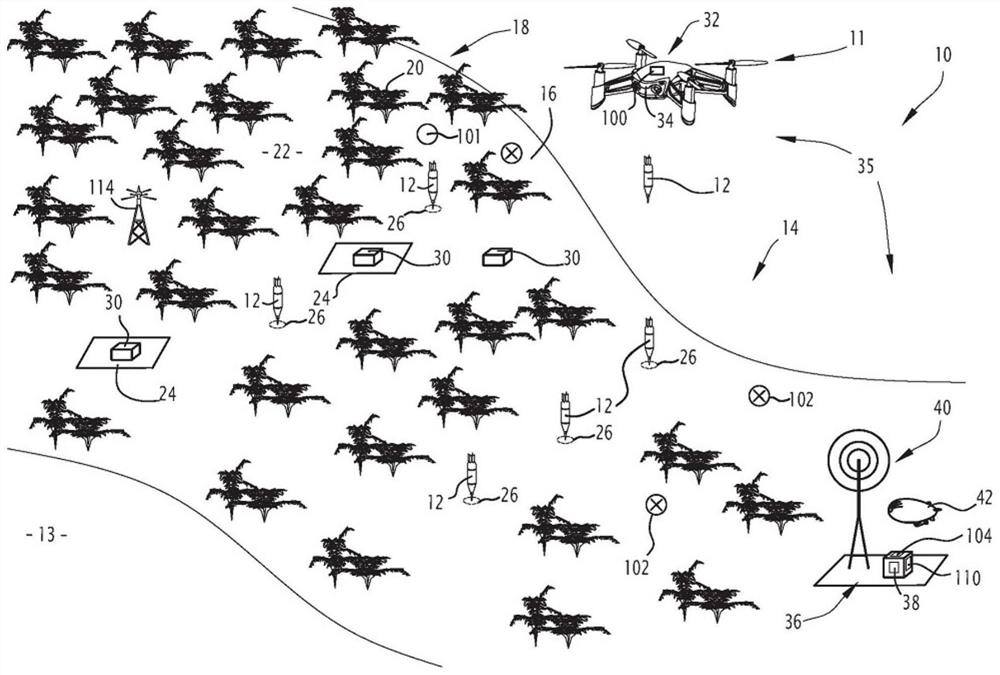
[0066] exist figure 1 A first ground survey assembly 10 according to the invention is schematically disclosed in , comprising a plurality of detectors 12 placed in place by a drop assembly 11 .
[0067] The ground survey assembly 10 is used to figure 1 A region of interest 14 on land schematically shown in Fig. 2 is geophysically surveyed.
[0068] The assembly 10 is used in particular to collect geophysical data and measurements to determine the physical properties of the subsurface 13 located in a region of interest and / or to construct an image, preferably a three-dimensional image, of the subsurface 13's geology.
[0069] The area of interest 14 is, for example, an area with uneven topography 16 . Uneven terrain 16 specifically includes hills, mountains, cliffs or any type of rough terrain. The area of interest 14 is located, for example, on the foothills of a mountain which is difficult to access.
[0070] Area of interest 14 further includes vegetation 18 . Veg...
PUM
 Abstract
Description
Claims
Application Information
 - R&D
- Intellectual Property
- Life Sciences
- Materials
- Tech Scout
- Unparalleled Data Quality
- Higher Quality Content
- 60% Fewer Hallucinations
Browse by: Latest US Patents, China's latest patents, Technical Efficacy Thesaurus, Application Domain, Technology Topic, Popular Technical Reports.
© 2025 PatSnap. All rights reserved.Legal|Privacy policy|Modern Slavery Act Transparency Statement|Sitemap|About US| Contact US: help@patsnap.com


