
A Space Single-lens Stereo Mapping Camera for Real-time Measurement of Optical Axis Pointing

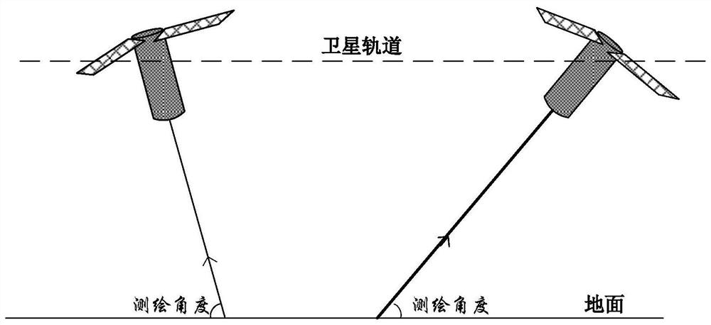
A stereo mapping camera and optical axis pointing technology, applied in the field of aerospace optical remote sensors, can solve problems such as optical axis pointing accuracy errors, and achieve the effects of improving ground positioning accuracy, facilitating lightweight design, and flexible and variable surveying and mapping angles.

Active Publication Date: 2021-09-03
WUHAN UNIV
View PDF7 Cites 0 Cited by
  • Summary
  • Abstract
  • Description
  • Claims
  • Application Information

AI Technical Summary

Problems solved by technology

However, the rotatable flat mirror will introduce errors in the accuracy of the optical axis pointing, and it is necessary to accurately measure the working angle of the mirror in real time, so as to measure the optical axis pointing of the camera in real time

Method used


Image

  • A Space Single-lens Stereo Mapping Camera for Real-time Measurement of Optical Axis Pointing
  • A Space Single-lens Stereo Mapping Camera for Real-time Measurement of Optical Axis Pointing
  • A Space Single-lens Stereo Mapping Camera for Real-time Measurement of Optical Axis Pointing

Examples


Embodiment Construction

[0026] In order to make the purpose, features and advantages of the present invention clearer, a specific implementation of the present invention will be described in more detail below in conjunction with the accompanying drawings and embodiments. In the following description, many specific details are set forth. In order to fully understand the present invention, the present invention can be implemented in many other ways than described, therefore, the present invention is not limited by the specific embodiments disclosed below.

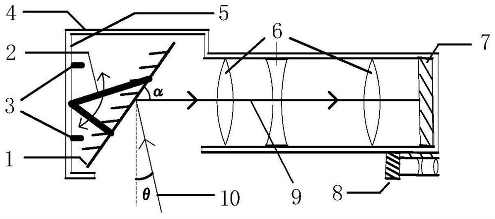
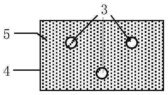
[0027] In the figure: 1. Plane mirror, 2. Mirror rotation mechanism, 3. Laser rangefinder group, 4. Lens barrel, 5. Inner wall of lens barrel, 6. Optical lens, 7. Imaging detector, 8. Star sensor 9, the optical axis inside the camera, 10, the optical axis of the camera pointing to the ground.

[0028] Such as figure 2 Shown is the schematic diagram of the structure of the present invention, and it can be seen from the figure that the single-lens s...


PUM


Abstract

The invention relates to a three-dimensional surveying and mapping camera for real-time measurement of the pointing angle of the optical axis, which includes a lens barrel and a plane reflector arranged at one end of the inner wall of the lens barrel. The distance instrument group is arranged on the inner wall of the end of the lens barrel where the plane mirror is installed; the optical lens is arranged in the lens barrel, the imaging detector is arranged on the inner wall of the end of the lens barrel where the optical lens is installed, and the optical lens is arranged on the plane reflector Between the imaging detector and the star sensor, the star sensor is arranged on the outer wall of the end of the lens barrel where the optical lens is installed. The present invention is characterized in that a lightweight single-lens surveying and mapping camera can be used to realize flexible surveying and mapping with high positioning accuracy and variable base-to-height ratio, and is especially suitable for light and small three-dimensional surveying and mapping satellites with high positioning accuracy.

Description

technical field [0001] The invention belongs to the technical field of aerospace optical remote sensors, and relates to a variable base-height ratio stereoscopic surveying and mapping camera suitable for earth observation, in particular to a space single-lens stereoscopic surveying and mapping camera technology for real-time measurement of the direction of an optical axis. Background technique [0002] Aerospace three-dimensional surveying and mapping technology is produced along with the development of aerospace photogrammetry technology in the field of space remote sensing. Its main function is to perform three-dimensional photography on the ground surface, obtain multi-dimensional image data of ground objects, and use surveying and mapping processing technology to process image data. Measure the shape, size, spatial position and other information of terrain, landform, and land features, and generate various supporting products to support battlefield operations and economic...

Claims


Application Information

Patent Timeline
Patent Type & Authority Patents(China)
IPC IPC(8): G01C11/02G01C3/00
CPCG01C3/00G01C11/025
Inventor 金光樊星皓左玉弟
Owner WUHAN UNIV
Learn More