Cluster unmanned aerial vehicle numbering method and terminal
A drone and numbering technology, applied in the field of drones, can solve the problems of tediousness and heavy workload, and achieve the effect of high numbering efficiency
- Summary
- Abstract
- Description
- Claims
- Application Information
AI Technical Summary
Problems solved by technology
Method used
Image
Examples
Example Embodiment
[0082] Example one
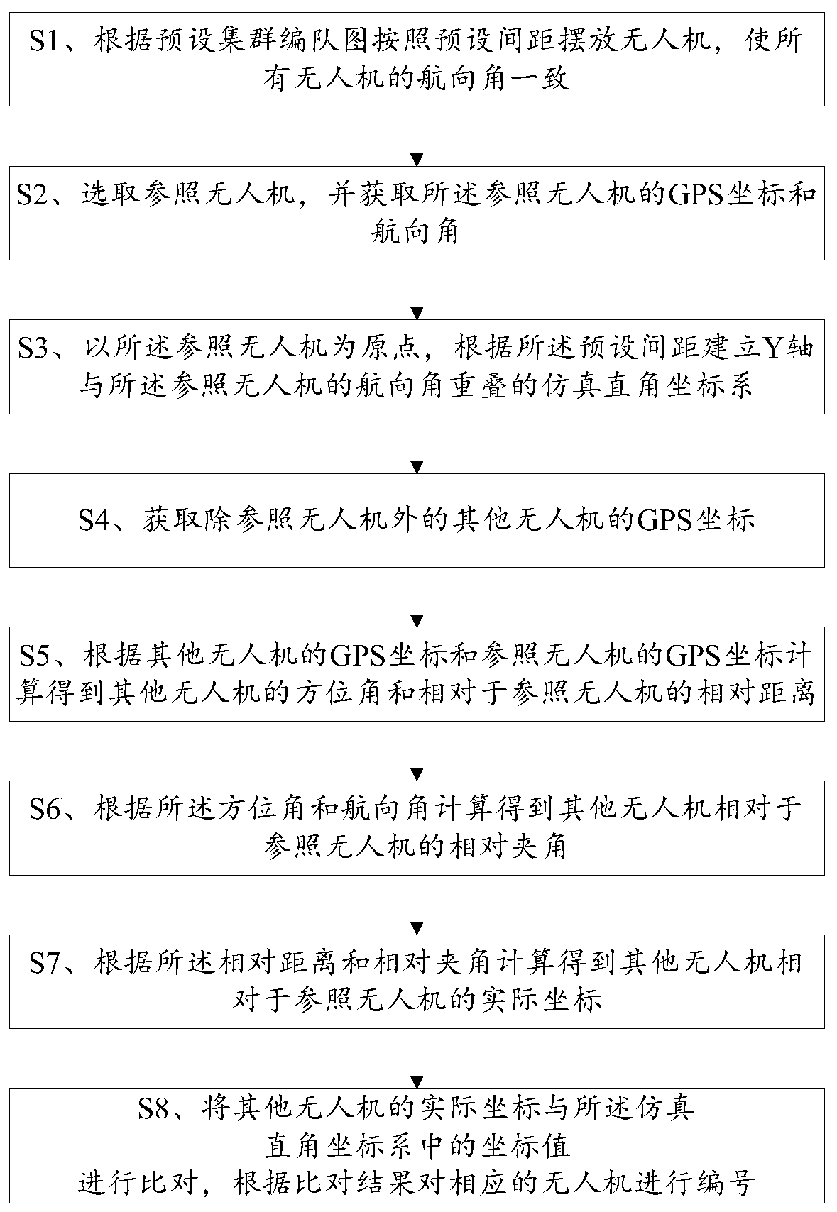
[0083] Please refer to figure 1 , The first embodiment of the present invention is a numbering method of cluster drones, which includes the following steps:
[0084] S1. Place drones at preset intervals according to the preset cluster formation map, so that the heading angles of all drones are consistent.
[0085] The UAV used in this embodiment is an RTK differential positioning UAV. Before placing the UAV, the UAV needs to be powered on. The cluster formation diagram can be designed as required. For example, it can be designed as a rectangle and preset The spacing can be set as required, for example, it can be 1 m. In addition, before step S1, the total number of drones needs to be obtained. According to the total number, the number of rows and columns of the rectangular formation chart can be designed, which is also conducive to the subsequent judgment of the completion of numbering.
[0086] S2. Select a reference drone, and obtain the GPS coordinates and hea...
Example Embodiment
[0109] Example two
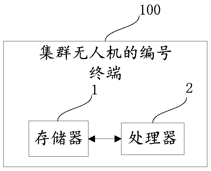
[0110] Please refer to image 3 , The second embodiment of the present invention is a numbering terminal 100 for cluster drones, which corresponds to the method of the first embodiment, and includes a memory 1, a processor 2, and is stored on the memory 1 and can be stored on the processor 2. When the processor 2 executes the computer program, the following steps are implemented:
[0111] Place drones at preset intervals according to the preset cluster formation map, so that the heading angles of all drones are consistent;
[0112] Select a reference drone, and obtain the GPS coordinates and heading angle of the reference drone;
[0113] Using the reference drone as the origin, establishing a simulated rectangular coordinate system in which the Y axis overlaps the heading angle of the reference drone according to the preset distance;
[0114] Obtain the GPS coordinates of other drones except the reference drone;
[0115] Calculate the azimuth angle of other drones ...
PUM
 Abstract
Description
Claims
Application Information
 - R&D
- Intellectual Property
- Life Sciences
- Materials
- Tech Scout
- Unparalleled Data Quality
- Higher Quality Content
- 60% Fewer Hallucinations
Browse by: Latest US Patents, China's latest patents, Technical Efficacy Thesaurus, Application Domain, Technology Topic, Popular Technical Reports.
© 2025 PatSnap. All rights reserved.Legal|Privacy policy|Modern Slavery Act Transparency Statement|Sitemap|About US| Contact US: help@patsnap.com


