
A Boundary Recognition System for Business Agglomeration Areas

A boundary recognition and boundary technology, applied in character and pattern recognition, instruments, calculations, etc., can solve the problems of relying on human experience intervention, poor objectivity, and difficulty in obtaining a large amount of data, and achieves the reduction of human intervention, reduction of constraints, The effect of improving objectivity

Active Publication Date: 2022-07-05
CHONGQING INST OF GREEN & INTELLIGENT TECH CHINESE ACADEMY OF SCI +1
View PDF8 Cites 0 Cited by
  • Summary
  • Abstract
  • Description
  • Claims
  • Application Information

AI Technical Summary

Problems solved by technology

At present, at home and abroad, many experts and scholars are trying to quantitatively identify and delineate the boundaries of business agglomeration areas. Although some people have proposed some systems for demarcating the boundaries of business agglomerations, these systems have defects: (1) most systems require There are a lot of data and it is difficult to obtain; (2) need to rely on a certain spatial evaluation unit, which affects the stability of index calculation and results; (3) does not really start from the objective laws of the data itself, and many Steps need to rely on human experience intervention, poor objectivity

Method used


Image

  • A Boundary Recognition System for Business Agglomeration Areas
  • A Boundary Recognition System for Business Agglomeration Areas
  • A Boundary Recognition System for Business Agglomeration Areas

Examples


Embodiment 1

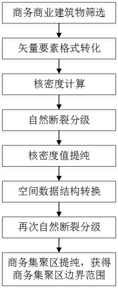
[0045] see Figure 1 to Figure 5 , a business agglomeration area boundary identification system, including building information acquisition module, target building screening module, density map generation module, agglomeration area preliminary vector boundary generation module, agglomeration area boundary identification module and database.

[0046] The building information acquisition module acquires the building outline vector polygon and attribute information in the area to be detected, and sends them to the target building screening module, the aggregation area preliminary vector boundary generation module and the aggregation area boundary identification module respectively.

[0047] The attribute information of the building outline vector patch includes building usage, building area, building name and building storey.

[0048] The target building screening module filters out the target building outline vector polygonal pattern according to the building usage in the attrib...

Embodiment 2

[0074] A method for using a business agglomeration area boundary identification system, the specific steps are as follows:

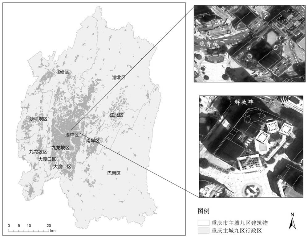
[0075] 1) First, use the env class in the Arcpy site package to obtain and set the environment value, and set the database storing the building information survey results as the workspace. The attribute table of building information survey results data includes building information such as the number of floors above ground, the number of floors below ground, the total construction area, address, name, structure, and completion year of each building, as well as the use of each floor (residential). , commercial, administrative commerce, industry, military, education and scientific research, medical and health care, etc.), floor area and other floor information, building data in the nine districts of the main city of Chongqing such as figure 2 As shown, use Python to slice and compare the attribute values ​​of the fields that record the usage of each floor...


PUM


Abstract

The invention discloses a business agglomeration area boundary identification system, which includes a building information acquisition module, a target building screening module, a density map generation module, an agglomeration area preliminary vector boundary generation module, an agglomeration area boundary identification module and a database. The kernel density algorithm and the natural fracture method solve the problems of high subjectivity and difficulty in objective quantification in the boundary delimitation of business agglomeration areas in the prior art, reduce the degree of human intervention, reduce the constraints, and can effectively improve the objectivity of boundary identification, scientific.

Description

technical field [0001] The invention relates to the technical field of space boundary delimitation, in particular to a boundary identification system of a business gathering area. Background technique [0002] Boundary identification of business agglomeration is a technology that quantitatively analyzes and identifies the boundaries of business agglomerations based on relevant data and systems. At present, at home and abroad, many experts and scholars are trying to quantitatively identify and delineate the boundaries of business agglomeration areas. Although some systems have been proposed for the boundary delineation of business agglomeration areas, these systems all have shortcomings: (1) Most systems require There is a lot of data and it is difficult to obtain; (2) it needs to use a certain spatial evaluation unit to affect the stability of index calculation and results; (3) it fails to really start from the objective laws of the data itself, and there are many problems i...

Claims


Application Information

Patent Timeline
Patent Type & Authority Patents(China)
IPC IPC(8): G06F16/29G06V10/762G06K9/62
CPCG06F16/29G06F18/23
Inventor 刘建李思悦叶胜
Owner CHONGQING INST OF GREEN & INTELLIGENT TECH CHINESE ACADEMY OF SCI
Learn More