Spatial graphical user interface and method for using the same
a user interface and graphical technology, applied in the field of spatial graphical user interfaces, can solve the problems of time-consuming integration code, inability to modify the first image file to add links to these related data files, and often non-intelligent raster format of basic image files
- Summary
- Abstract
- Description
- Claims
- Application Information
AI Technical Summary
Problems solved by technology
Method used
Image
Examples
Embodiment Construction
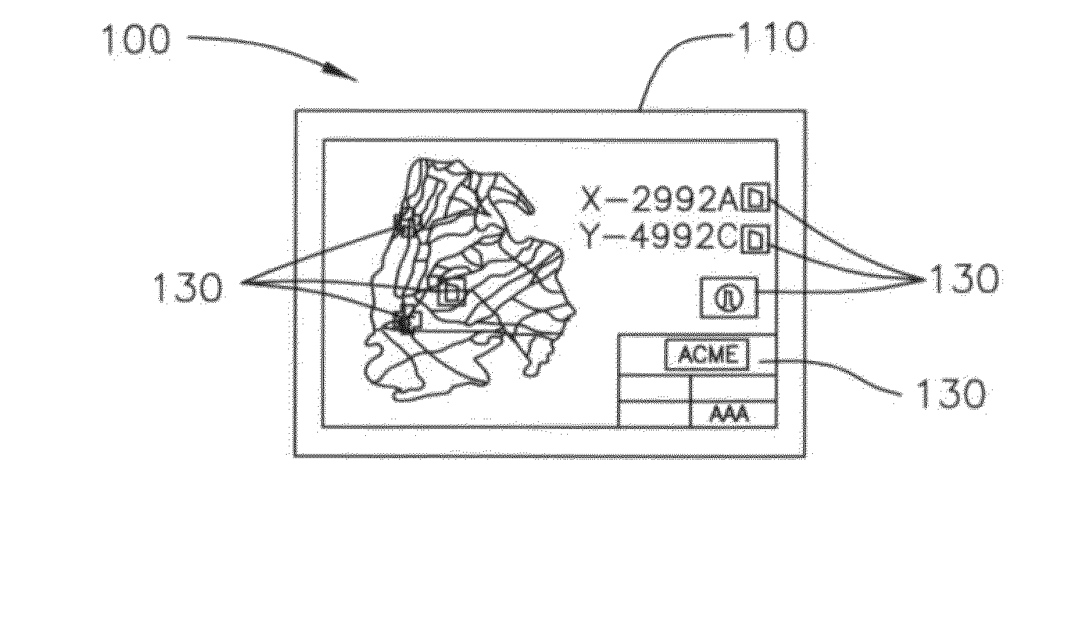
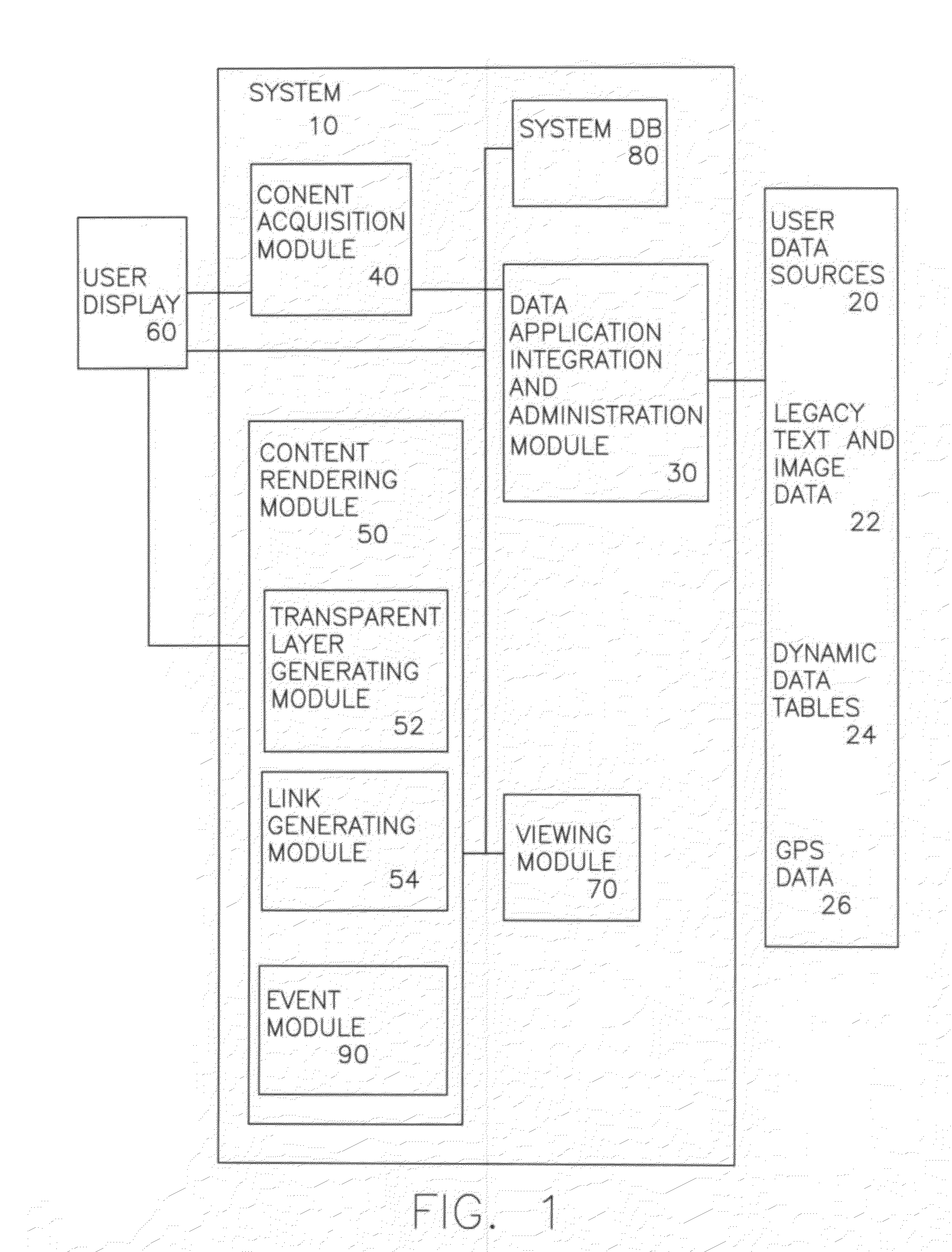
[0022]In a first embodiment of the present invention illustrated in FIG. 1, a spatial graphical user interface system 10 is shown. As discussed in more detail below, system 10 allows a user to retrieve a primary image, such as a map, chart, image or other spatial representation from data sources 20, and then generate a transparent layer or grid to be overlaid upon and registered to the underlying primary image. The transparent layer generated by system 10 then serves as a platform for arranging and linking to data, again from legacy data sources 20, corresponding to certain locations or objects on the underlying image, without the need for modifying or re-processing the underlying primary image.
[0023]As illustrated in the accompanying figures, the present invention maintains the ability to create a transparent digital layer that can be overlaid upon and registered to a large number of document image formats. Each such transparent digital layer can contain an unlimited number of link...
PUM
 Abstract
Description
Claims
Application Information
 - R&D
- Intellectual Property
- Life Sciences
- Materials
- Tech Scout
- Unparalleled Data Quality
- Higher Quality Content
- 60% Fewer Hallucinations
Browse by: Latest US Patents, China's latest patents, Technical Efficacy Thesaurus, Application Domain, Technology Topic, Popular Technical Reports.
© 2025 PatSnap. All rights reserved.Legal|Privacy policy|Modern Slavery Act Transparency Statement|Sitemap|About US| Contact US: help@patsnap.com


