

Method and apparatus for inferring the geographic location of captured scene depictions
- Summary
- Abstract
- Description
- Claims
- Application Information
AI Technical Summary
Benefits of technology
Problems solved by technology
Method used
Image


Examples
Embodiment Construction
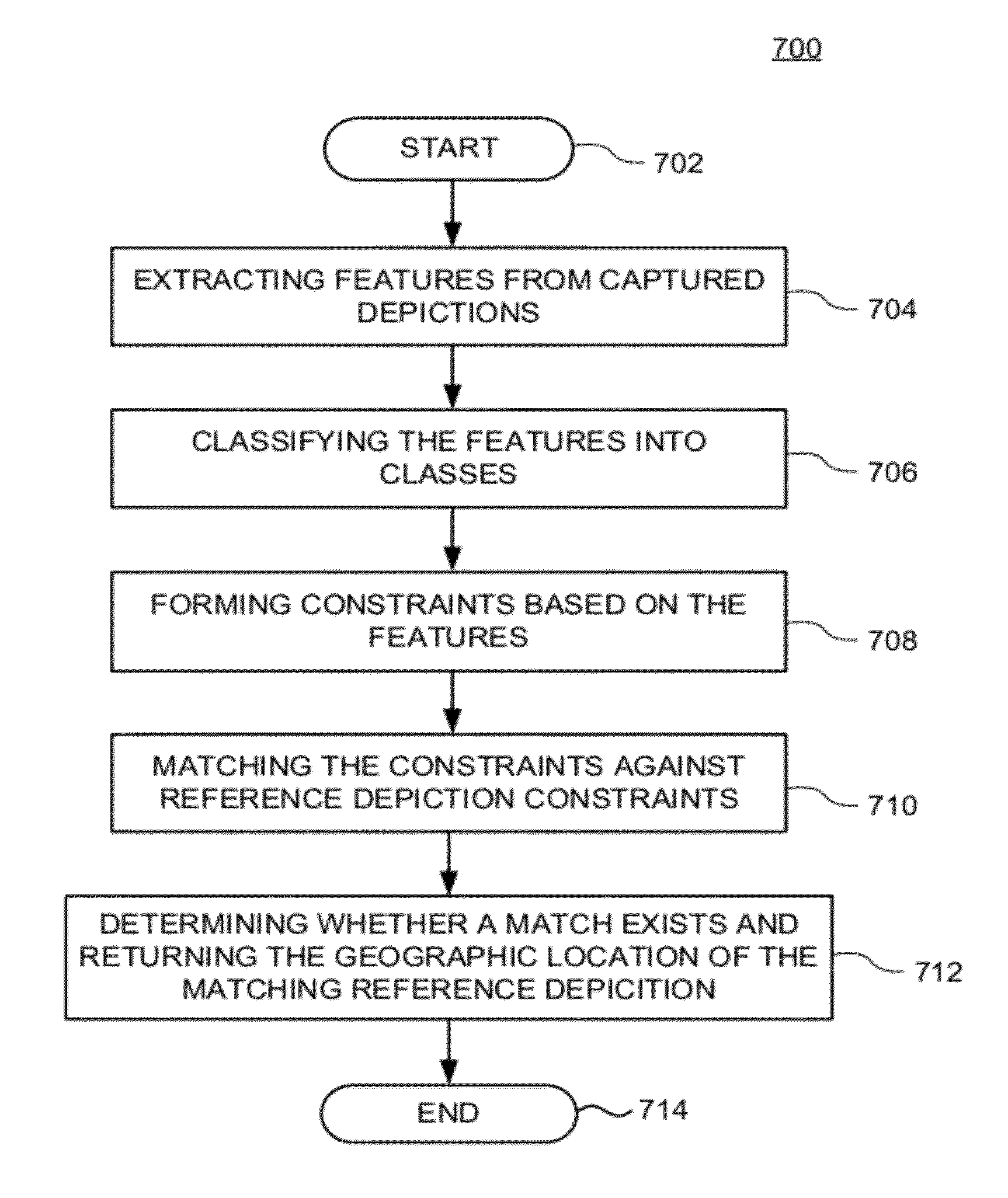
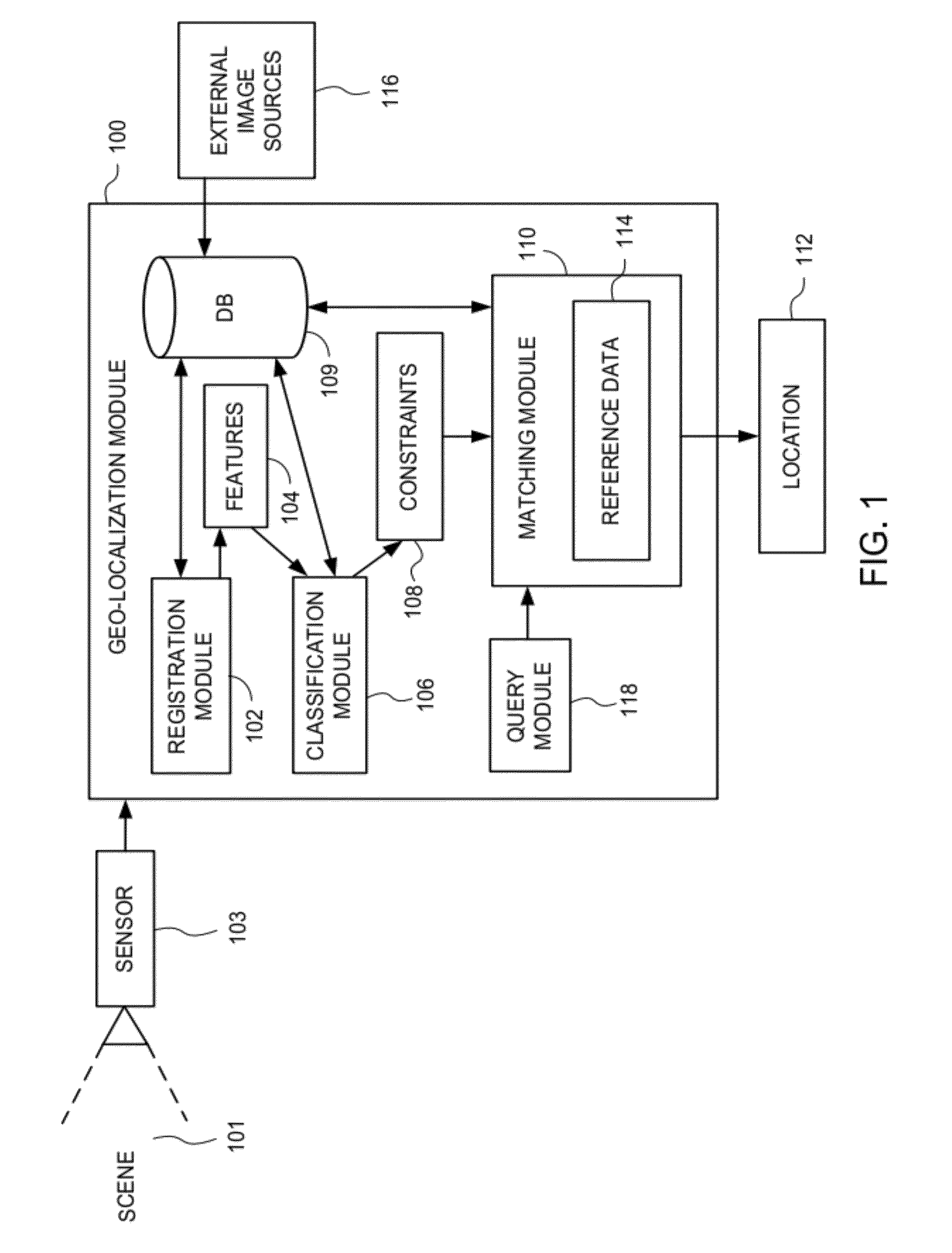
[0028]Embodiments of the present invention generally relate to determining the geographic location of a captured depiction whose location is unknown, using other geo-referenced depiction data captured from a different perspective. According to one embodiment, the captured depictions are narrow field of view (NFOV), ground plane, and / or street view (SV) images, and the method determines the geographic location of the scene depicted in a captured image by extracting a set of features from a database of reference depictions, which, according to some embodiments include satellite (SAT) imagery, three-dimensional (3D) model data and oblique bird's eye view (BEV) images, i.e., oblique aerial imagery, of an area of interest. In an exemplary embodiment, feature extraction includes annotating those images with the objects that they are determined to contain such as trees, bushes, houses, and the like. In some embodiments, the database includes hyperspectral (HS), multispectral (MS) as well a...
PUM
 Abstract
Description
Claims
Application Information