
Techniques for Spatial Semantic Attribute Matching for Location Identification

a technology of spatial semantic attribute and location identification, applied in scene recognition, instruments, computing, etc., can solve the problem of difficult to achieve robust matching of images of different types and across different views based on purely low level features

Inactive Publication Date: 2014-06-12
IBM CORP
View PDF8 Cites 24 Cited by
  • Summary
  • Abstract
  • Description
  • Claims
  • Application Information

AI Technical Summary

Benefits of technology

The present invention provides techniques for matching image regions based on a reference dataset for location identification. It can handle different types of images and can prune potential matches based on their spatial arrangements. The invention also includes creating an inverted file index for semantic labeled regions and using a geometric hashing index to rank potential matches. These techniques can be used to improve accuracy and efficiency in identifying locations on images.

Problems solved by technology

However, robust matching of images of different types and across different views based purely on low level features is in general difficult to achieve.

Method used


Image

  • Techniques for Spatial Semantic Attribute Matching for Location Identification
  • Techniques for Spatial Semantic Attribute Matching for Location Identification
  • Techniques for Spatial Semantic Attribute Matching for Location Identification

Examples


Embodiment Construction

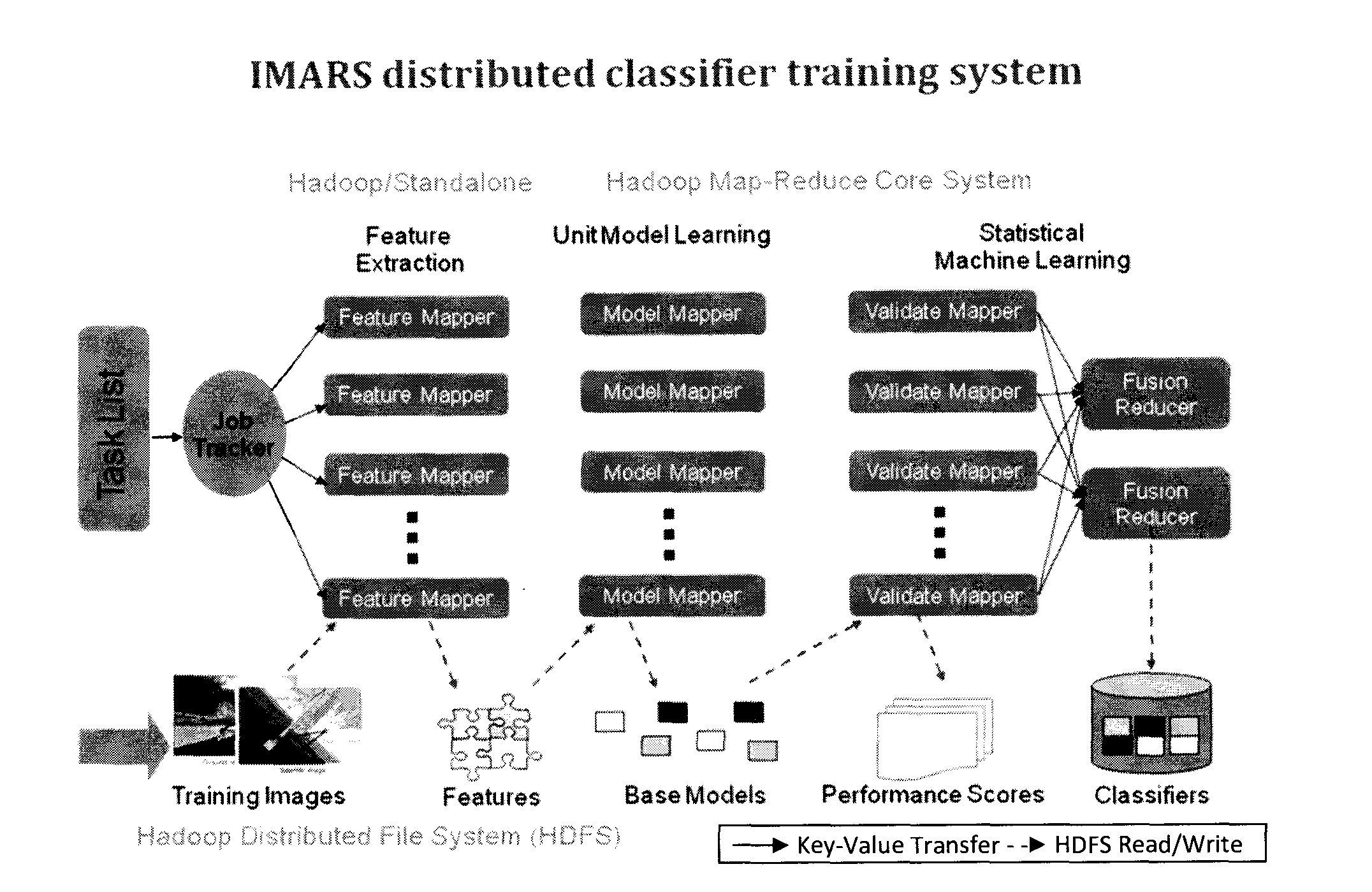
[0013]Provided herein are techniques for spatial semantic attribute matching on image regions for location identification of images in the wild based on some given reference dataset. As will be described in detail below, IMARS-based semantic classifiers may be utilized to automatically or semiautomatically parse an image from any source into semantic labeled image regions. IMARS is described, for example, in A. Natsev et al., “IBM multimedia analysis and retrieval system,” ACM International Conference on Content based Image and Video Retrieval (CIVR'2008), pp. 553-554, 2008 (herein “Natsev”), the contents of which are incorporated by reference herein.

[0014]Semantic attribute based matching has become popular for visual recognition research in the past several years. Successful applications including face recognition, image search and retrieval, action recognition, visual aesthetics appraisal, etc., to name a few. See, for example, N. Kumar et al., “Attribute and Simile Classifiers f...


PUM


Abstract

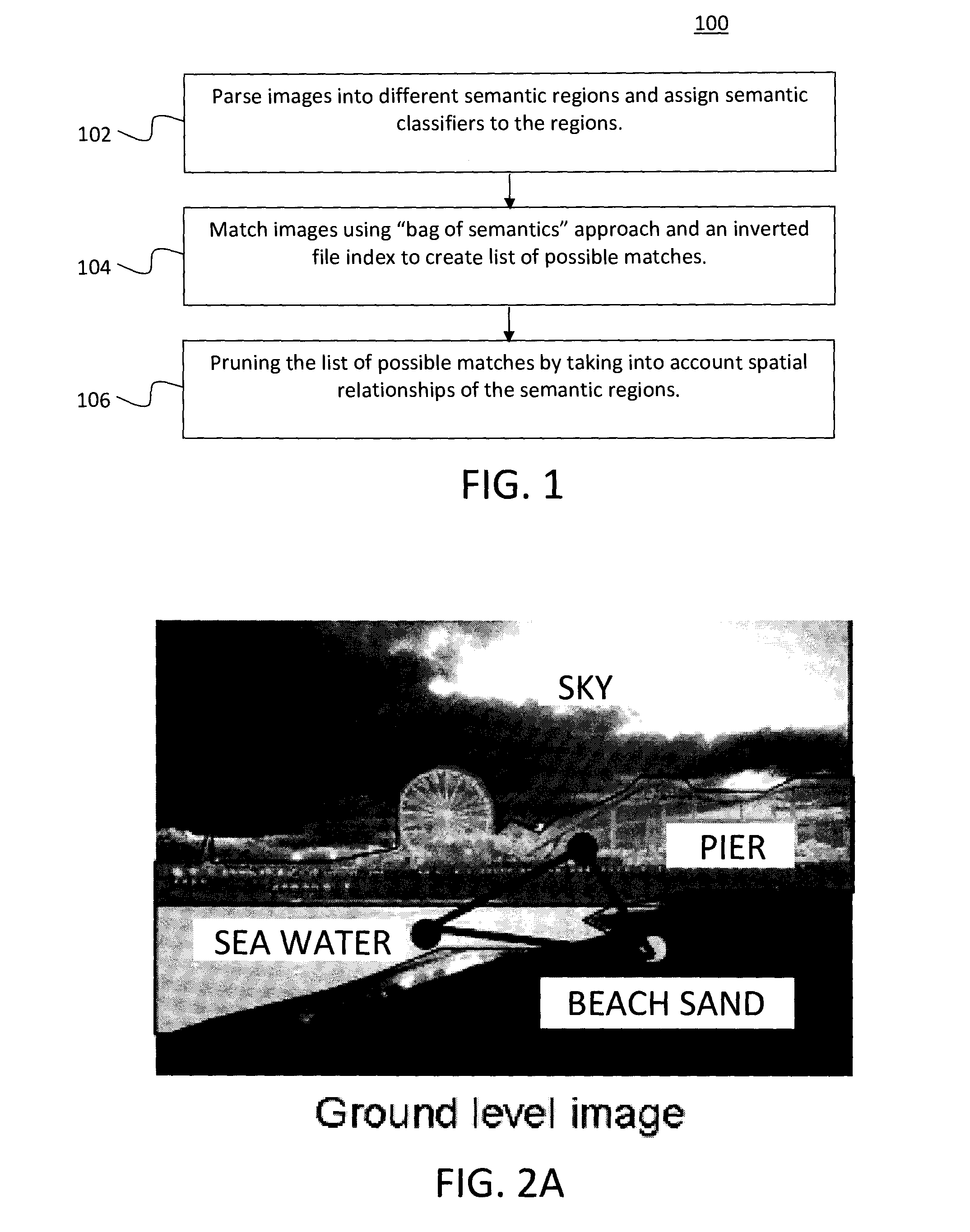
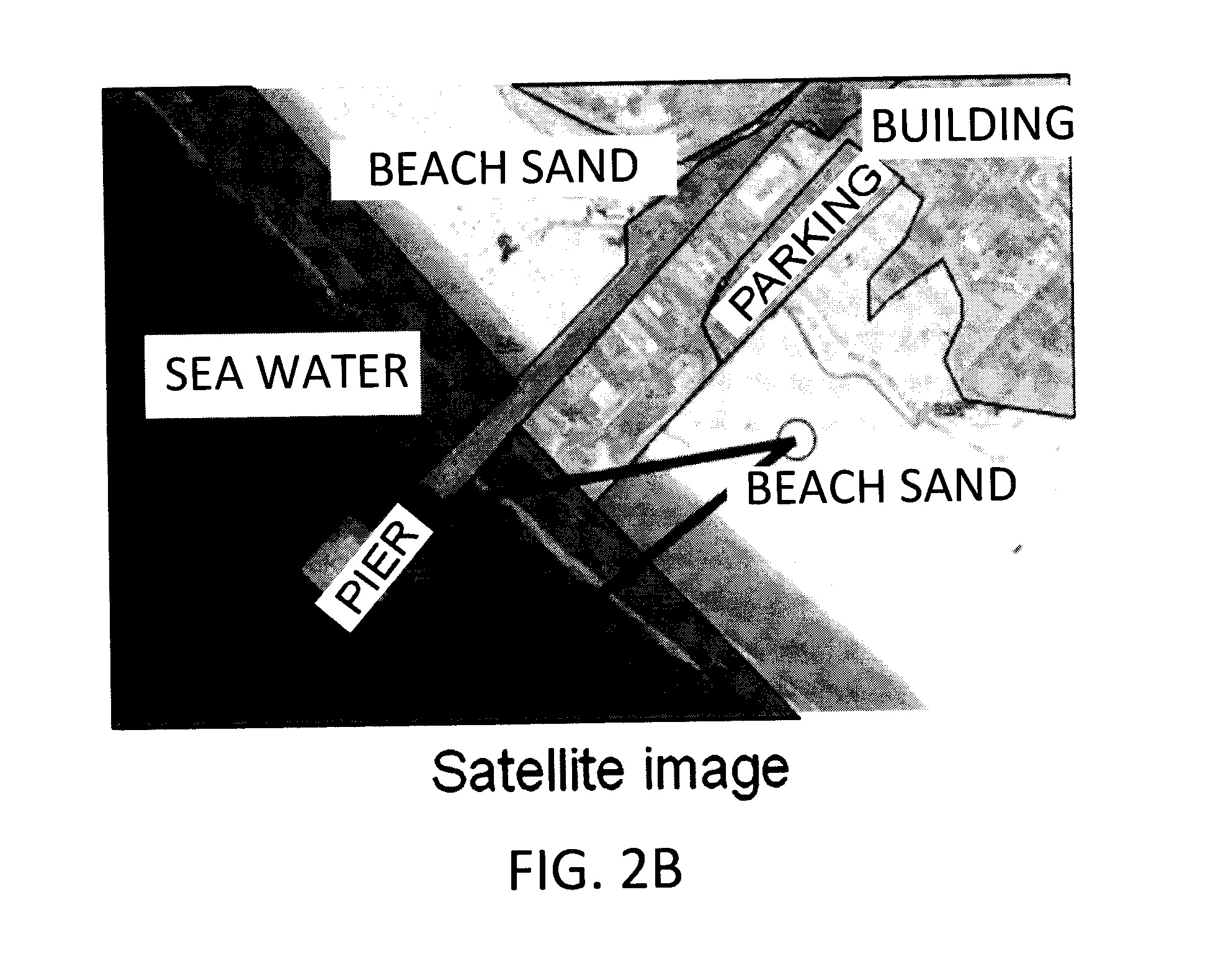
Techniques for spatial semantic attribute matching on image regions for location identification based on a reference dataset are provided. In one aspect, a method for matching images from heterogeneous sources is provided. The method includes the steps of: (a) parsing the images into different semantic labeled regions; (b) creating a list of potential matches by matching the images based on two or more of the images having same semantic labeled regions; and (c) pruning the list of potential matches created in step (b) by taking into consideration spatial arrangements of the semantic labeled regions in the images.

Description

FIELD OF THE INVENTION[0001]The present invention relates to geolocating of photos and more particularly, to techniques for spatial semantic attribute matching on image regions for location identification based on a reference dataset.BACKGROUND OF THE INVENTION[0002]The geo-localization of photos has become an emerging need. Usually the query photos are matched with a geo-referenced dataset to obtain a prediction of the geo-location. However, robust matching of images of different types and across different views based purely on low level features is in general difficult to achieve.[0003]Therefore, improved techniques for geo-locating photos would be desirable.SUMMARY OF THE INVENTION[0004]The present invention provides techniques for spatial semantic attribute matching on image regions for location identification based on a reference dataset. In one aspect of the invention, a method for matching images from heterogeneous sources is provided. The method includes the steps of: (a) pa...

Claims


Application Information

Patent Timeline
Patent Type & Authority Applications(United States)
IPC IPC(8): G06K9/00G06V10/80G06V20/13
CPCG06K9/00637G06V20/35G06V20/13G06V10/80G06V10/7784G06F18/25G06F18/2178
Inventor CAO, LIANGLIANGCODELLA, NOEL C.F.HUA, GANGLEIGUANG, GONGNATSEV, APOSTOL I.SMITH, JOHN R.
Owner IBM CORP
Learn More