Geolocating entities of interest on geo heat maps
a geo-heat map and geo-location technology, applied in the field of visualizing location and risk, can solve the problem of not providing the visual analysis required to warn businesses of risks
- Summary
- Abstract
- Description
- Claims
- Application Information
AI Technical Summary
Benefits of technology
Problems solved by technology
Method used
Image
Examples
Embodiment Construction
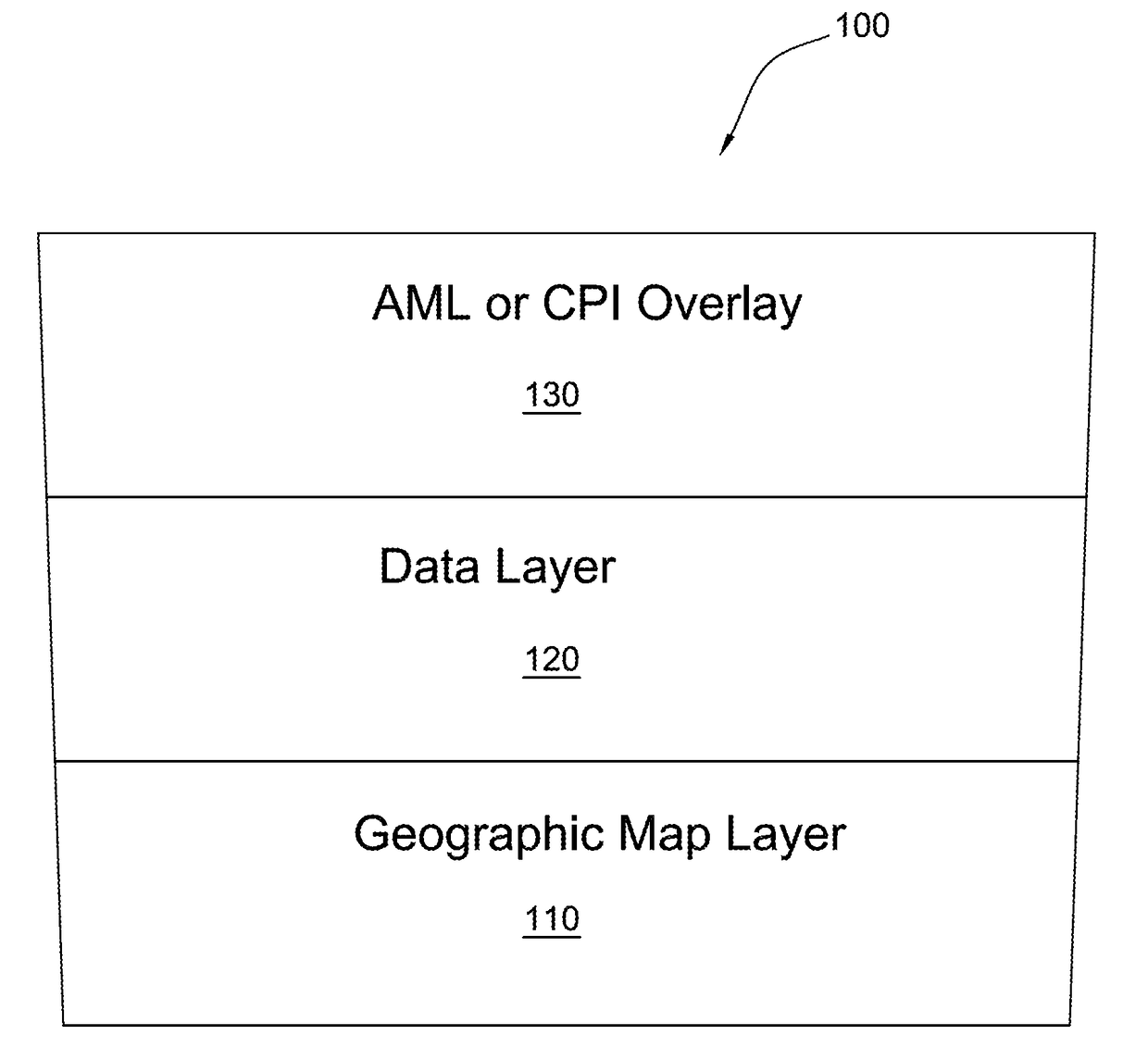
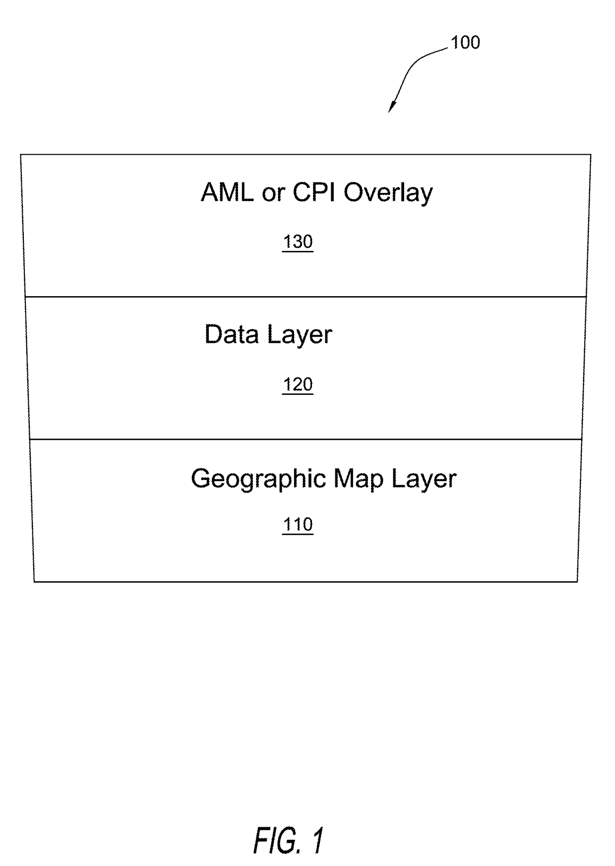
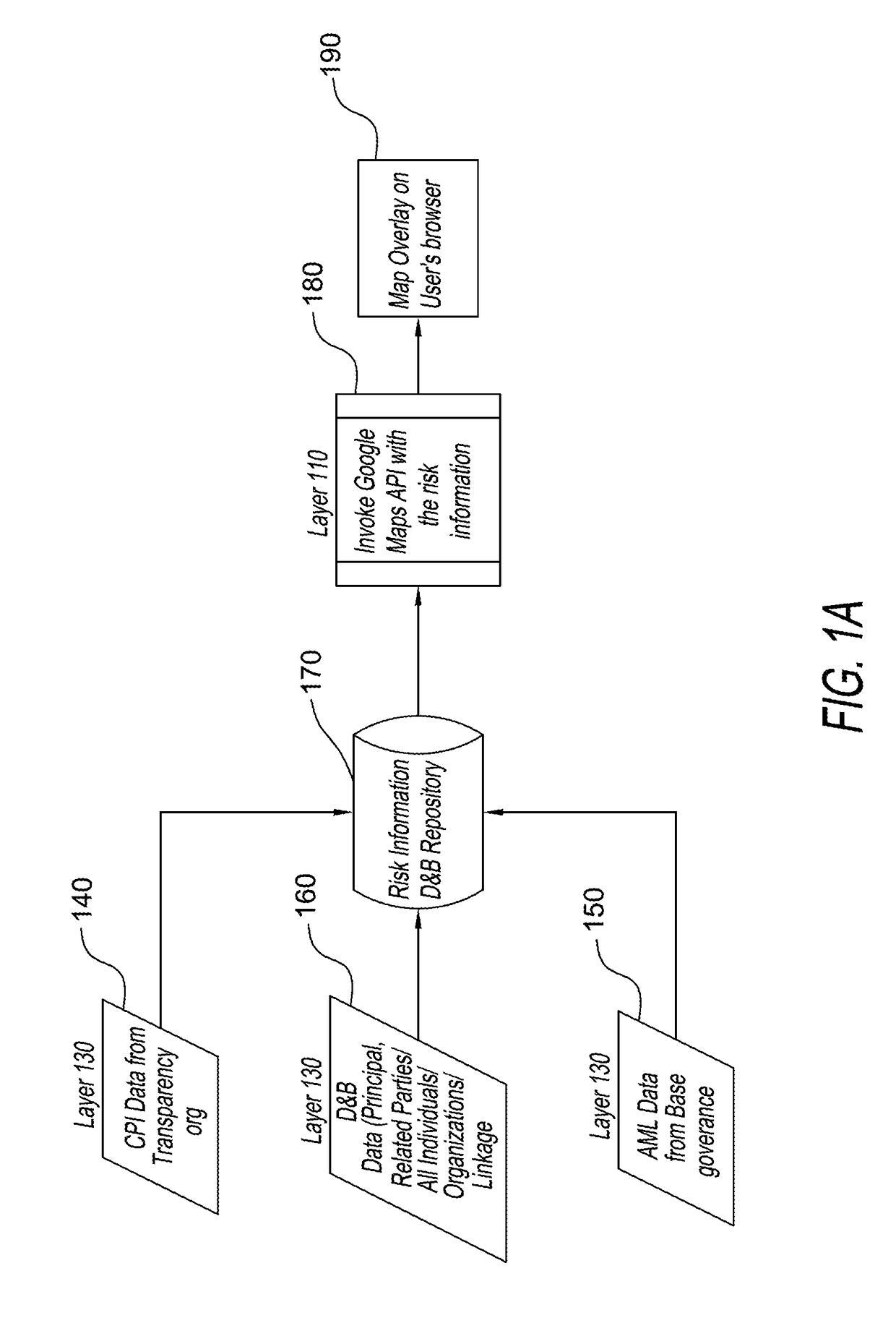
[0028]FIG. 1 shows the layers of a map 100 used to display the various layers of data to allow a user to combine data on businesses, of the type collected by The Dun & Bradstreet Corporation and data concerning the extent of risk of doing business due to money laundering or corruption in a given country in which a business organization, or a part of that organization may be located.
[0029]In general, to provide the layers discussed below, a geographic data source such as, for example, the Google-maps Javascript library and the features provided by the Google-maps library can be used. Country boundary (latitude and longitude) information for all the Country and the States of US and the provinces of Canada is available for the user interface layers, as discussed below.
[0030]A first layer 110 of map 100 is a geographic map layer (preferably of the world), or a part of the world. First layer 110 may be generated by using the Google Maps API. It will be understood that other mapping techn...
PUM
 Abstract
Description
Claims
Application Information
 - R&D
- Intellectual Property
- Life Sciences
- Materials
- Tech Scout
- Unparalleled Data Quality
- Higher Quality Content
- 60% Fewer Hallucinations
Browse by: Latest US Patents, China's latest patents, Technical Efficacy Thesaurus, Application Domain, Technology Topic, Popular Technical Reports.
© 2025 PatSnap. All rights reserved.Legal|Privacy policy|Modern Slavery Act Transparency Statement|Sitemap|About US| Contact US: help@patsnap.com


