Spatial vector data online interactive mapping method based on hierarchical-divided storage structure
A space vector and data technology, applied in the field of interactive mapping of space vector data, can solve problems such as service quality degradation, loss of response, heavy server load, etc., to avoid hierarchical division processing calculations, reduce I/O time, and reduce computing costs. Effect
- Summary
- Abstract
- Description
- Claims
- Application Information
AI Technical Summary
Problems solved by technology
Method used
Image
Examples
Embodiment Construction
[0021] Assuming that the space vector data operated by the user for online interactive mapping is D, the method provided by the present invention will be described in detail below with reference to the accompanying drawings.
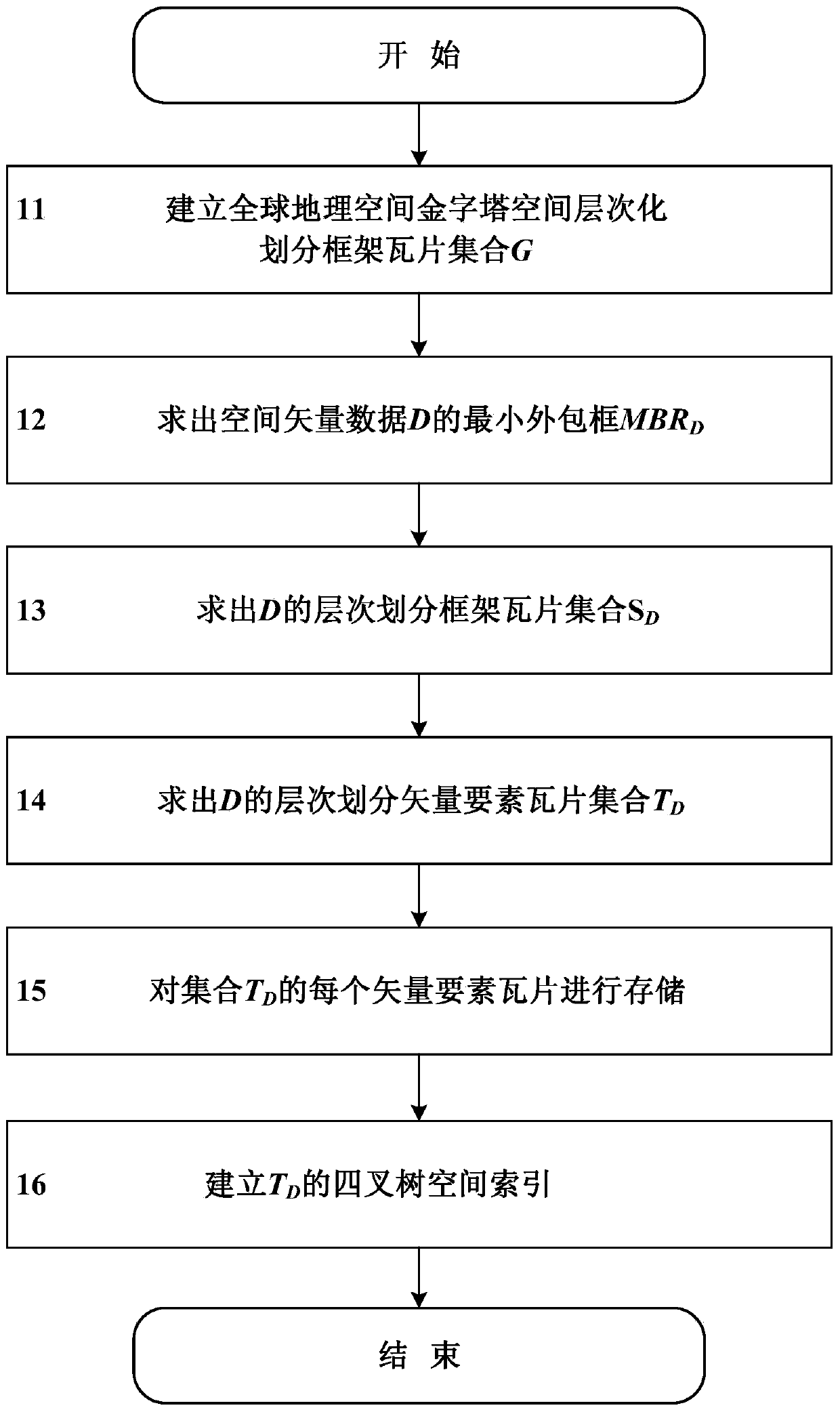
[0022] figure 1 It is a schematic flowchart of a large-scale space vector data hierarchical division storage structure generation method provided by the present invention, including six steps:
[0023] Step 11, based on the WGS1984Web Mercator global geographic space projected coordinate system, project the global geographic space onto a square surface, and establish a global geographic space pyramid hierarchically divided frame tile set G, G is a frame tile data structure covering the whole world (hereinafter referred to as tiles), described as:
[0024] G={g(l, r, c): 0≤l≤N-1; 0≤r≤2 1 -1;0≤c≤2 l -1}
[0025] Among them, the element g(l,r,c) is a tile, which is positioned by three parameters, namely:
[0026] l: layer number. l is the number of th...
PUM
 Abstract
Description
Claims
Application Information
 - R&D
- Intellectual Property
- Life Sciences
- Materials
- Tech Scout
- Unparalleled Data Quality
- Higher Quality Content
- 60% Fewer Hallucinations
Browse by: Latest US Patents, China's latest patents, Technical Efficacy Thesaurus, Application Domain, Technology Topic, Popular Technical Reports.
© 2025 PatSnap. All rights reserved.Legal|Privacy policy|Modern Slavery Act Transparency Statement|Sitemap|About US| Contact US: help@patsnap.com


