
Design method of science and art integrated mountain and river three-dimensional perspective landscape map

A design method and three-dimensional technology, applied in the field of surveying and mapping, can solve the problem of not paying attention to the aesthetics and authenticity of the map

Inactive Publication Date: 2015-03-04
SICHUAN YUHANG PLANNING DESIGN +1
View PDF5 Cites 1 Cited by
  • Summary
  • Abstract
  • Description
  • Claims
  • Application Information

AI Technical Summary

Problems solved by technology

[0003] The purpose of the present invention is to provide a method for designing a three-dimensional perspective landscape map of mountains, rivers and rivers, which aims to solve the problem that the existing graphic drawing methods do not pay attention to the aesthetics and authenticity of the map

Method used


Image

  • Design method of science and art integrated mountain and river three-dimensional perspective landscape map
  • Design method of science and art integrated mountain and river three-dimensional perspective landscape map

Examples


Embodiment Construction

[0055] In order to make the object, technical solution and advantages of the present invention clearer, the present invention will be further described in detail below in conjunction with the accompanying drawings and embodiments. It should be understood that the specific embodiments described here are only used to explain the present invention, not to limit the present invention.

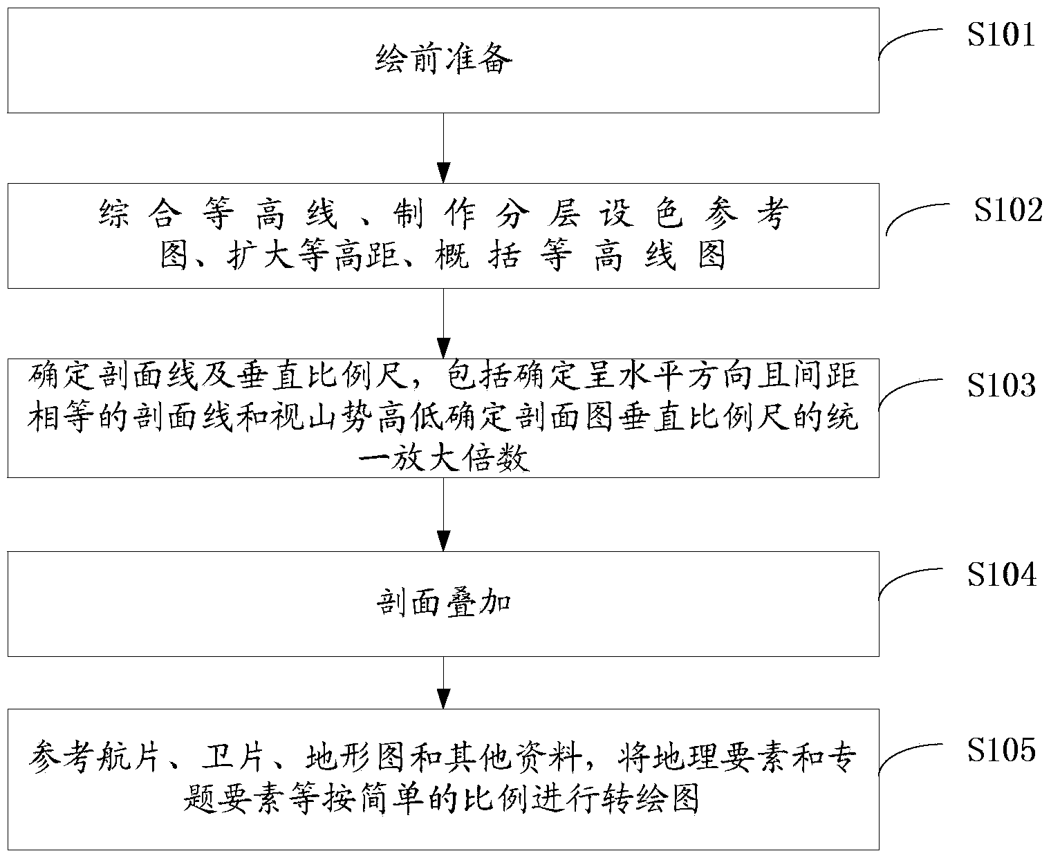
[0056] figure 1 It shows the process flow of the method for designing the three-dimensional perspective landscape map of mountains, rivers and rivers of the present invention. As shown in the figure, the present invention is realized in this way. Realized, a kind of science and art blends the three-dimensional perspective landscape map design method of mountainous rivers and rivers to comprise:

[0057] Step 1. Establish a three-dimensional perspective terrain skeleton;

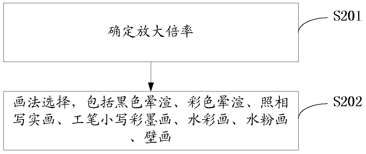
[0058] Step 2: Enlarge the base map and paint it.

[0059] Further, the specific method of establishing a stereoscopic perspe...


PUM


Abstract

The invention discloses a design method of a science and art integrated mountain and river three-dimensional perspective landscape map. The design method comprises the steps: I establishing a three-dimensional perspective terrain framework, and II carrying out colored drawing after amplifying a foundation drawing. The landscape map designed by the method can reflect elements and characteristics of a terrain visually, systemically, completely and typically, and the map becomes a comprehensive achievement integrating scientificity, knowledge, interestingness, artistry and commodity.

Description

technical field [0001] The invention belongs to the technical field of surveying and mapping, and in particular relates to a design method for a three-dimensional perspective landscape map of mountainous rivers and rivers combining science and art. Background technique [0002] In view of the complex topography, rich natural landscapes and scattered buildings in most mountainous river tourist attractions, coupled with the commodity characteristics of the landscape map itself as a popular reading material, it determines the particularity of the mountainous river panorama map and the wide range of service objects. sex. With the continuous sublimation of people's psychology of seeking things, the pure map format (flat map, shaded map) formed for a long time often gives people a rigid feeling, especially when it is used as a tourist map, quite a lot of tourists still want to use it. Unfamiliar with maps; and the overly exaggerated scatter-point composition painting style is too...

Claims


Application Information

Patent Timeline
IPC IPC(8): G09B25/06G09B29/00
CPCG09B25/06G09B29/005
Inventor 蒋云志蒋宇星
Owner SICHUAN YUHANG PLANNING DESIGN
Learn More