Initial Alignment Method for Inertial Navigation Based on istssrckf
An initial alignment and inertial navigation technology, applied in the field of navigation, can solve problems such as poor ability to deal with uncertain factors, low alignment accuracy, and inability to filter.
- Summary
- Abstract
- Description
- Claims
- Application Information
AI Technical Summary
Problems solved by technology
Method used
Image
Examples
Embodiment Construction
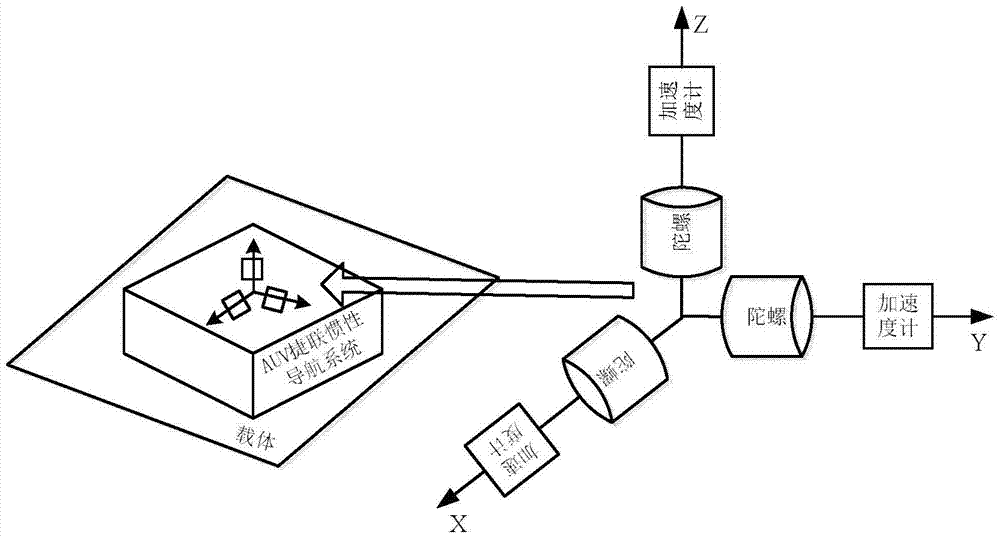
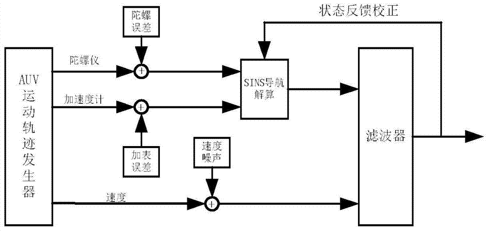
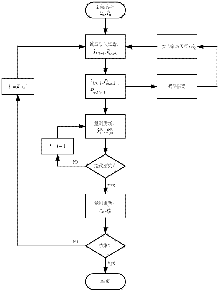
[0116] The present invention will be further described below in conjunction with the accompanying drawings.
[0117] Step 1: Establish the alignment model of the SINS shaking base under the state of large misalignment angle, the alignment model includes the nonlinear error model of SINS, the nonlinear filtering state model and the nonlinear filtering measurement model:
[0118] Among them, the process of establishing the SINS nonlinear error model is as follows:
[0119] Step 1.1: Take the northeast sky geographic coordinate system as the navigation coordinate system n, and use the carrier coordinate system b as the carrier coordinate system b with the vector right-hand rule of the right front and upper direction vector, and the real attitude angle is The real speed is The real geographic coordinates are p=[L λ H] T ; The attitude calculated by the actual solution of SINS is speed is The geographic coordinates are Note that the coordinate system established by the ge...
PUM
 Abstract
Description
Claims
Application Information
 - R&D
- Intellectual Property
- Life Sciences
- Materials
- Tech Scout
- Unparalleled Data Quality
- Higher Quality Content
- 60% Fewer Hallucinations
Browse by: Latest US Patents, China's latest patents, Technical Efficacy Thesaurus, Application Domain, Technology Topic, Popular Technical Reports.
© 2025 PatSnap. All rights reserved.Legal|Privacy policy|Modern Slavery Act Transparency Statement|Sitemap|About US| Contact US: help@patsnap.com


