Spatial entity mapping method in fuzzy linguistic environment
A mapping method and spatial technology, applied in the field of information retrieval, can solve problems such as the inability to solve the problem of accurate mapping of the semantic layer of spatial entities, and achieve the effect of high openness and strong adaptability
- Summary
- Abstract
- Description
- Claims
- Application Information
AI Technical Summary
Problems solved by technology
Method used
Image
Examples
Embodiment Construction
[0037] The present invention will be specifically introduced below in conjunction with the accompanying drawings and specific embodiments.
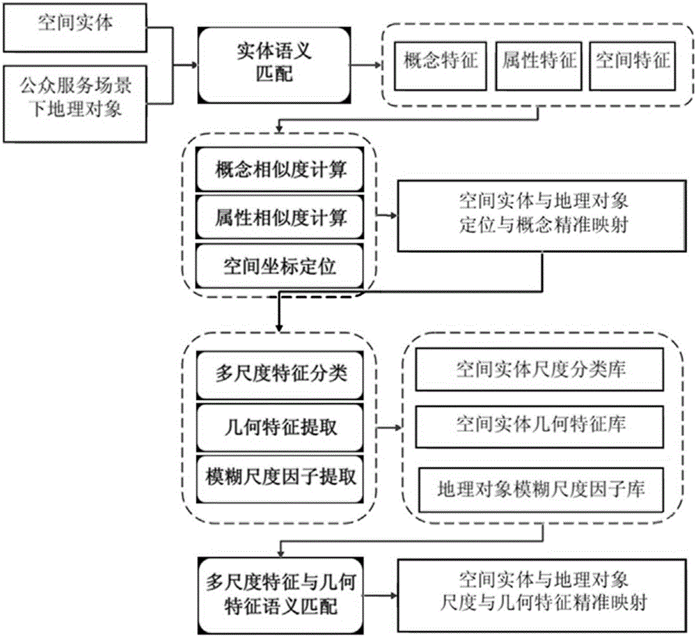
[0038] figure 1 It is a design concept diagram of the present invention. By calculating the similarity of concepts, attributes, and spatial feature parameters between spatial entities and geographic objects, construct a multi-scale classification database for spatial entities, extract fuzzy scale factors, and perform semantic matching between geographic objects and multi-scale classification databases, and finally realize fuzzy scale factor-based Semantic mapping of spatial entities to geographic objects.
[0039] The spatial entity mapping method in the fuzzy context of the present invention mainly studies the semantic matching of spatial entities and the semantic mapping of geographical objects based on fuzzy scale factors. The positioning of spatial entities and precise mapping at the conceptual level; in addition, it also extracts f...
PUM
 Abstract
Description
Claims
Application Information
 - R&D
- Intellectual Property
- Life Sciences
- Materials
- Tech Scout
- Unparalleled Data Quality
- Higher Quality Content
- 60% Fewer Hallucinations
Browse by: Latest US Patents, China's latest patents, Technical Efficacy Thesaurus, Application Domain, Technology Topic, Popular Technical Reports.
© 2025 PatSnap. All rights reserved.Legal|Privacy policy|Modern Slavery Act Transparency Statement|Sitemap|About US| Contact US: help@patsnap.com


