ArcGIS-based 1:10000 national standard topographic map making method

A production method and national standard technology, applied in the direction of graphics and image conversion, image data processing, instruments, etc., can solve the problems of not supporting the national standard requirements of Chinese map mapping, the lack of production methods and standards for mapping software, and the inconvenience of standard map production, etc., to achieve The effect of shortening drawing time and improving efficiency

Active Publication Date: 2016-07-27
SHANDONG UNIV OF SCI & TECH
View PDF0 Cites 7 Cited by
  • Summary
  • Abstract
  • Description
  • Claims
  • Application Information

AI Technical Summary

Problems solved by technology

[0003] Traditional professional drawing software does not have a unified production method and standard. For different projects and different schemas, different drawing frames must be produced according to different human requirements, resulting in a lot of repetitive work, and it is difficult to have a relatively standard product. for everyone
ArcGIS software is a relatively popular GIS software in the industry at present. It has very powerful spatial analysis functions and mapping functions, but its mapping functions do not support the national standard requirements for Chinese map mapping in terms of schema, and are not convenient for the production of standard maps.

Method used


Image

  • ArcGIS-based 1:10000 national standard topographic map making method
  • ArcGIS-based 1:10000 national standard topographic map making method
  • ArcGIS-based 1:10000 national standard topographic map making method

Examples


Embodiment Construction

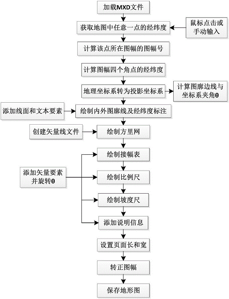
[0075] The present invention is described in further detail below in conjunction with the accompanying drawings and specific embodiments:

[0076] 1. Analysis of topographic map national standard cartography

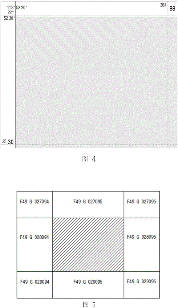
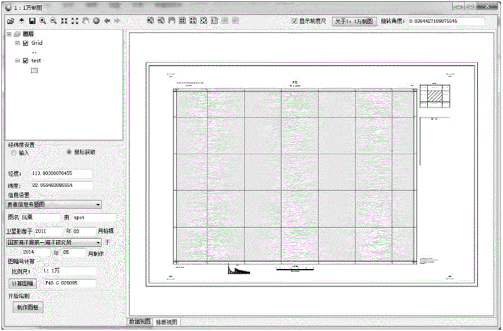
[0077] For the compilation and drawing of topographic map sheets, each country has its own standards. In 1991, my country formulated a new national standard of "framing and numbering of national basic scale topographic maps", which stipulated the division, numbering and numbering application formulas of national basic scale topographic maps. In 2006, the National Standard of the People's Republic of China GB / T20257.3-2006 (hereinafter referred to as the National Standard) was promulgated to replace the standard version of GB12342-1990. The national standard stipulates that the content of 1:10,000 topographic map outline decoration includes: internal and external map outline, square li net, square li net coordinates and annotations, geographic coordinates and annotations...


PUM


Abstract

The invention discloses an ArcGIS-based 1:10000 national standard topographic map making method and belongs to the field of standard topographic map making.One-key generation of a 1:10000 topographic mapsheet meeting the national standard is achieved, various finishing factors in the mapsheet are accurately marked, map making time is effectively shortened, and efficiency is improved.

Description

technical field [0001] The invention belongs to the field of standard topographic map mapping, in particular to a method for making a 1:10,000 national standard topographic map based on ArcGIS. Background technique [0002] With the rapid development of information technology, especially the popularization of GIS technology, our country has higher and higher requirements for topographic mapping. [0003] There is no unified production method and standard for traditional professional drawing software. For different projects and different schemas, different drawings must be produced according to different artificial requirements, resulting in a lot of repetitive work, and it is difficult to have a relatively standard product. for everyone. ArcGIS software is currently a popular GIS software in the industry. It has very powerful spatial analysis functions and mapping functions, but its mapping functions do not support the requirements of China's national standard for map mappi...

Claims


Application Information

Patent Timeline
Patent Type & Authority Applications(China)
IPC IPC(8): G06T3/00G06T3/60
CPCG06T3/00G06T3/60
Inventor 王瑞富郝滢洁李洁赵伟
Owner SHANDONG UNIV OF SCI & TECH
Why Eureka
Try Eureka