Object-oriented timing sequence remote sensing image cloud coverage area automatic detection method

An object-oriented technology for remote sensing images, applied in image enhancement, image analysis, image data processing, etc., can solve the problems of complex target prior information and lack of cloud coverage areas

Inactive Publication Date: 2016-09-21
CHANGJIANG RIVER SCI RES INST CHANGJIANG WATER RESOURCES COMMISSION
View PDF4 Cites 25 Cited by
  • Summary
  • Abstract
  • Description
  • Claims
  • Application Information

AI Technical Summary

Problems solved by technology

Although these detection methods have certain potential, the complexity of the cloud coverage area and the lack of prior information of the target cause these algorithms to have certain limitations.

Method used


Image

  • Object-oriented timing sequence remote sensing image cloud coverage area automatic detection method
  • Object-oriented timing sequence remote sensing image cloud coverage area automatic detection method
  • Object-oriented timing sequence remote sensing image cloud coverage area automatic detection method

Examples


Embodiment Construction

[0031] The technical solutions in the present invention will be clearly and completely described below in conjunction with the accompanying drawings in the present invention.

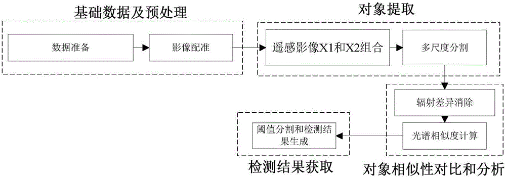
[0032] Please refer to figure 1 , the present invention provides an object-oriented time-series remote sensing image cloud coverage area automatic detection method, comprising the following steps:

[0033] (1) Data preparation

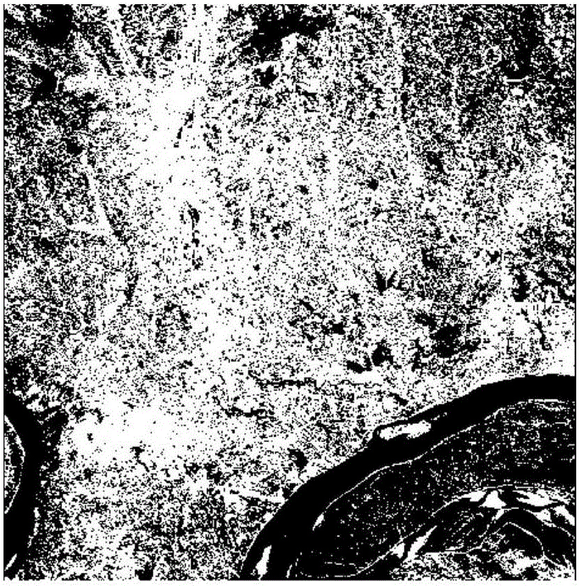
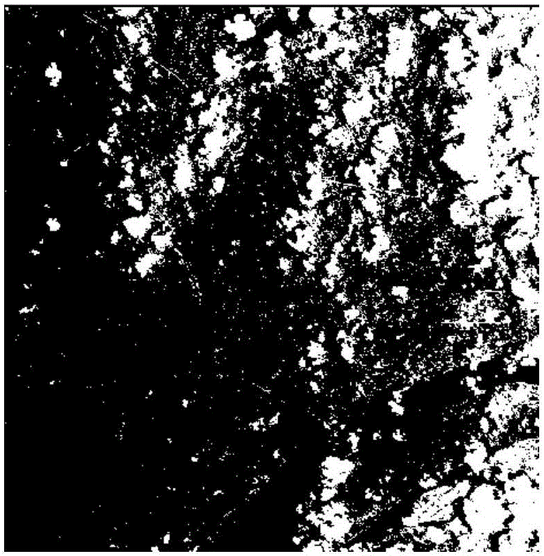
[0034] In order to comprehensively analyze the performance of the method, we compare the method of the present invention with the traditional pixel-level detection algorithm on the one hand. In addition, in order to further verify the robustness of the method of the present invention to remote sensing images, two different data sets (Fig. 2(a), Fig. 2(b)) were selected for experiments. The data set is CBERS-02B, a domestic resource satellite remote sensing image, with a spatial resolution of 20 meters. The bands are red, green and blue three visible light bands and near-infrar...


PUM


Abstract

The invention provides an object-oriented timing sequence remote sensing image cloud coverage area automatic detection method, comprising six steps of data preparation, image registering, multiscale image segmentation, radiation difference elimination, spectrum similarity calculation, threshold segmentation and detection result generation. The method employs an object-oriented interpretation method, and can effectively perform pattern classification on a cloud coverage area, fully utilize timing sequence information in timing sequence images, and effectively utilize the multi-feature advantage among the timing sequence images; in a timing sequence remote sensing image cloud coverage area detection process, the method employs a multi-feature fusion strategy, fully utilizes timing sequence and spectrum information, and makes detection results more reliable and stable.

Description

technical field [0001] The invention relates to the field of automatic and precise detection of cloud coverage areas of remote sensing images, in particular to an object-oriented automatic detection method of cloud coverage areas of time-series remote sensing images. Background technique [0002] With the continuous accumulation of multi-temporal remote sensing data and the successive establishment of spatial databases, how to extract and detect specific ground object information from these remote sensing data has become an important research topic in remote sensing science and geographic information science. According to remote sensing images of different time phases in the same area, dynamic information such as cities and environments can be extracted to provide scientific decision-making basis for resource management and planning, environmental protection and other departments. However, in areas with complex terrain, such as the mountainous areas in Southwest my country, ...

Claims


Application Information

Patent Timeline
Patent Type & Authority Applications(China)
IPC IPC(8): G06K9/00G06T3/00G06K9/36G06T7/00G06K9/40G06K9/62
CPCG06T3/0068G06T2207/10032G06T2207/30181G06V20/13G06V10/247G06V10/20G06V10/30G06F18/22
Inventor 申邵洪郑学东向大享文雄飞李喆张治中马辉张穗徐坚刘淑凤汪朝辉陈希炽
Owner CHANGJIANG RIVER SCI RES INST CHANGJIANG WATER RESOURCES COMMISSION
Why Eureka
Try Eureka