

Generation system for high-precision road map
A generation system, high-precision technology, applied in road network navigator, photo interpretation, geographic information database, etc., can solve the problems of heavy workload and high cost of high-precision map production or update, to reduce scene complexity, The effect of improving accuracy, improving recognition rate and ranging accuracy
- Summary
- Abstract
- Description
- Claims
- Application Information
AI Technical Summary
Problems solved by technology
Method used
Image

Examples
specific Embodiment approach 1
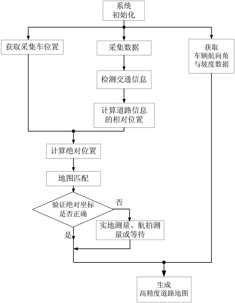
[0021] Specific implementation mode one: the following combination figure 1 and Figure 7 Describe this embodiment, the generation system of high-precision road map described in this embodiment, described generation system carries out data acquisition by collecting two pairs of vehicle-mounted cameras on the vehicle, and it comprises:
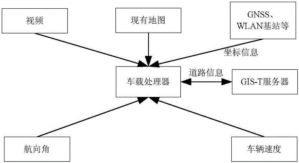
[0022] The data acquisition module is used to acquire the image data along the road obtained by two pairs of on-board cameras in the driving environment of the acquisition vehicle, the position coordinate data of the two pairs of on-vehicle cameras, the heading angle of the acquisition vehicle and the current slope data of the road;
[0023] Data processing module: used to preprocess the binocular image data obtained by two pairs of on-board cameras to obtain corrected image data; classify the corrected image data according to the deep learning algorithm; use the deep learning model to classify the corrected image data Extract and match the fe...
PUM
 Abstract
Description
Claims
Application Information