
Estimation method of urban complete surface temperature by aerial remote sensing

A technology of surface temperature and aerial remote sensing, which is applied in the research field of remote sensing estimation of urban surface temperature, can solve the problems of lack, unclearness, and difficulty in obtaining the surface temperature and its component ratio from a three-dimensional perspective, achieving strong adaptability and improving estimation accuracy. , the effect of strong practicality

Active Publication Date: 2019-04-16
NANJING UNIV
View PDF7 Cites 0 Cited by
  • Summary
  • Abstract
  • Description
  • Claims
  • Application Information

AI Technical Summary

Problems solved by technology

[0005] Although T c Preliminary progress has been made in remote sensing estimation of T c
Specifically, the following issues are still unclear: (1) In the case of a single observation angle, whether there is a general and more accurate approximation to T c The optimal remote sensing observation angle / viewshed of

Method used


Image

  • Estimation method of urban complete surface temperature by aerial remote sensing
  • Estimation method of urban complete surface temperature by aerial remote sensing
  • Estimation method of urban complete surface temperature by aerial remote sensing

Examples


Embodiment Construction

[0034] The present invention will be described in detail below according to the accompanying drawings, so as to make the technical route and operation steps of the present invention clearer.

[0035] Use the airborne thermal infrared imaging camera FLIR Zenmuse XT (its parameters are shown in Table 1) to take aerial photos of the study area according to the predetermined route, and obtain thermal infrared images (for example, Figure 4 ), thermal infrared image information includes position and temperature information.

[0036] Table 1 Parameters of thermal infrared imaging camera FLIR Zenmuse XT

[0037]

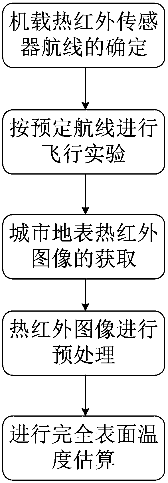
[0038] Combined flow chart ( figure 1 ), specify the implementation process of the present invention, technical scheme of the present invention comprises the following steps:

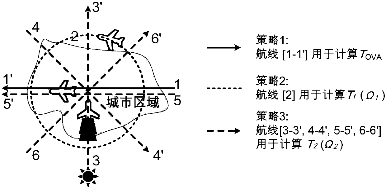
[0039] The first step is to determine the flight route according to the destination—plan the flight route on the basis of determining the location of the research destination and the flight time...


PUM


Abstract

The invention relates to an aerial remote sensing estimation method of a city complete surface temperature, and belongs to a city surface temperature remote sensing estimation research field. The aerial remote sensing estimation method comprises steps that a flight route is determined according to a destination; according to the predetermined flight route, a flight test is carried out, and a city surface thermal infrared image is acquired; the thermal infrared image is preprocessed; and the complete surface temperature estimation is carried out. By considering a complicated city three-dimensional structure and difficulty of conventional remote sensing ways of inability of acquiring the complete surface temperature directly caused by large temperature differences among underlying surface components and limited sensor visual angles, the simple and effective aerial remote sensing estimation method of the city complete surface temperature is provided. The aerial remote sensing estimation method is advantageous in that adaptability is strong, and the city complete surface temperature is estimated accurately, and therefore requirements of actual production can be satisfied.

Description

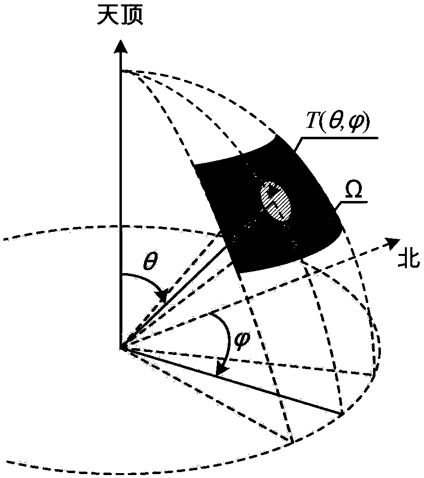
technical field [0001] The invention relates to an aerial remote sensing estimation method of urban complete surface temperature, which belongs to the research field of urban surface temperature remote sensing estimation. Background technique [0002] Urban surface temperature is a key parameter reflecting the radiation and energy balance of the underlying surface of the city, and plays an important role in the study of urban climate and environment. Thermal infrared remote sensing is an important means to obtain large-scale urban surface temperature. However, thermal infrared remote sensing can usually only obtain the thermal radiation information of the underlying surface in one or several specific directions (that is, the directional radiation temperature θ and are the observed zenith angle and azimuth angle), and the thermal radiation information obtained at different angles is quite different, it is difficult to obtain the true temperature of the complete urban unde...

Claims


Application Information

Patent Timeline
Patent Type & Authority Patents(China)
IPC IPC(8): G01J5/00
CPCG01J5/007
Inventor 姜璐占文凤高伦黄帆洪发路
Owner NANJING UNIV
Learn More