A Simulation Method of Terrain Humidity Index Based on Vector Network

A technology of terrain humidity index and vector network, which is applied in the field of simulation of terrain humidity index based on vector network, can solve the problem that the simulation algorithm of terrain humidity index cannot meet the accuracy requirements, etc.

Active Publication Date: 2020-07-10
WUHAN UNIV
View PDF8 Cites 0 Cited by
  • Summary
  • Abstract
  • Description
  • Claims
  • Application Information

AI Technical Summary

Problems solved by technology

[0031] In order to solve the problem that the existing terrain humidity index simulation algorithm cannot meet the accuracy requirements in the actual application requirements, the present invention provides a vector network-based terrain humidity index simulation method to achieve high-precision terrain humidity index simulation

Method used


Image

  • A Simulation Method of Terrain Humidity Index Based on Vector Network
  • A Simulation Method of Terrain Humidity Index Based on Vector Network
  • A Simulation Method of Terrain Humidity Index Based on Vector Network

Examples


Embodiment Construction

[0045] In order to facilitate those of ordinary skill in the art to understand and implement the present invention, the present invention will be described in further detail below in conjunction with the accompanying drawings and embodiments. It should be understood that the implementation examples described here are only used to illustrate and explain the present invention, and are not intended to limit this invention.

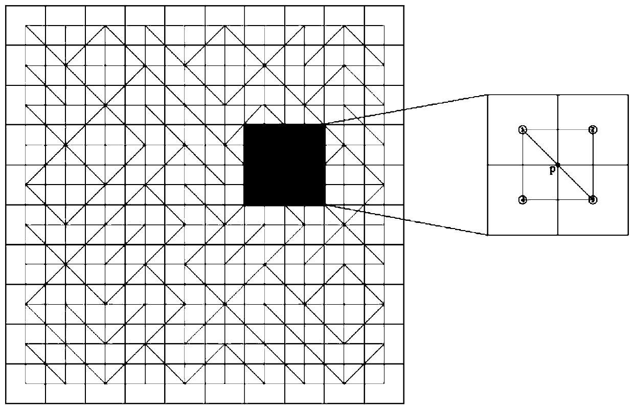
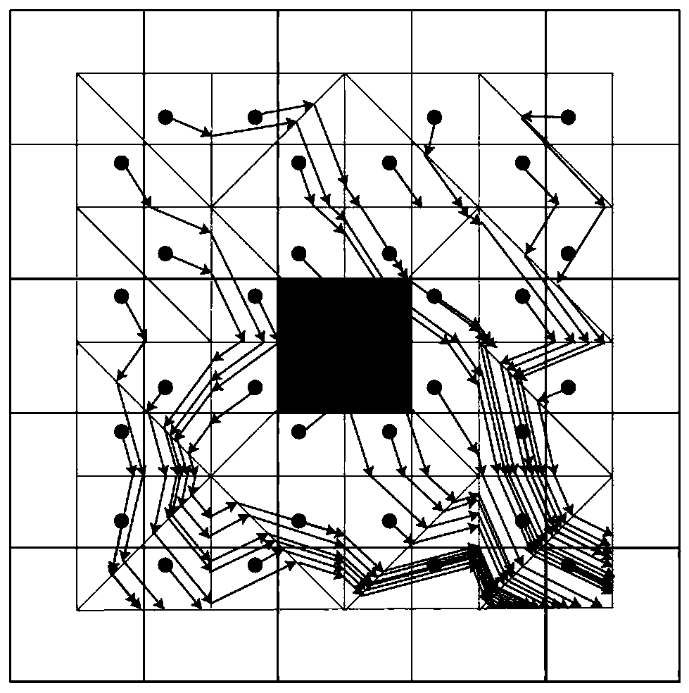
[0046] The core problem to be solved by the present invention is: using the constant slope and aspect of each triangular surface on the vector network to solve the uncertainty of the water flow path and the error problem of the calculation slope and aspect model itself, thereby obtaining a high-precision terrain humidity Exponential Simulation Method.

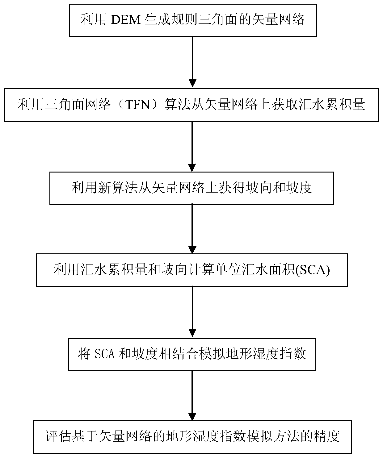
[0047] please see figure 1 , a kind of terrain humidity index simulation method based on vector network provided by the invention, comprises the following steps:

[0048] Step 1: Use DEM to generate a vector...


PUM


Abstract

The invention discloses a method for simulating a terrain humidity index based on a vector network. First a DEM is used to generate a vector network of regular triangular planes, and then a triangulation network TFN algorithm is used to obtain the water accumulation amount from the vector network; a novel algorithm is used to obtain the slope direction and slope from the vector network, and finally the unit catchment area SCA obtained by calculating the water accumulation amount and the slope direction is combined with the slope to simulate the terrain humidity index. Not only is the novel slope direction and slope calculation method provided, but also the method is combined with a TFN algorithm to obtain the novel terrain moisture index simulation method, which improves the simulation accuracy of the terrain humidity index, ensures the reasonable distribution of soil moisture, and meets the accuracy requirements in practical applications.

Description

technical field [0001] The invention belongs to the technical field of digital terrain analysis, in particular to a method for simulating terrain humidity index based on a vector network. Background technique [0002] Beven and Kirkby (Reference 1) proposed topographic moisture index, which is a commonly used topographic index to describe the spatial distribution characteristics of soil moisture and surface saturation by quantifying catchment accumulation and local topographic slope. Since the topographic moisture index was proposed, it has been widely used in hydrology (Documents 2, 3), agriculture (Documents 4, 5), ecology (Documents 6, 7) and other fields (Documents 8, 9). The simulation accuracy of topographic humidity index is very important in practical applications, and many researchers are still working on improving the simulation accuracy of topographic humidity index. [0003] The simulation of topographic moisture index mainly includes the simulation of unit catc...

Claims


Application Information

Patent Timeline
Patent Type & Authority Patents(China)
IPC IPC(8): G06F30/20
CPCG06F30/20
Inventor 陈玉敏吴钱娇张静祎陈娒杰李慧芳方涛杨帆
Owner WUHAN UNIV
Why Eureka
Try Eureka