A method for determining the early warning threshold of shallow landslide disasters induced by heavy rain
A determination method and rainstorm technology, applied in forecasting, data processing applications, climate sustainability, etc., can solve problems such as affecting the accuracy of early warning results and not considering differences in rainstorms, achieving improved accuracy, improved spatial accuracy, and broad application prospects. Effect
- Summary
- Abstract
- Description
- Claims
- Application Information
AI Technical Summary
Problems solved by technology
Method used
Image

Examples
Embodiment
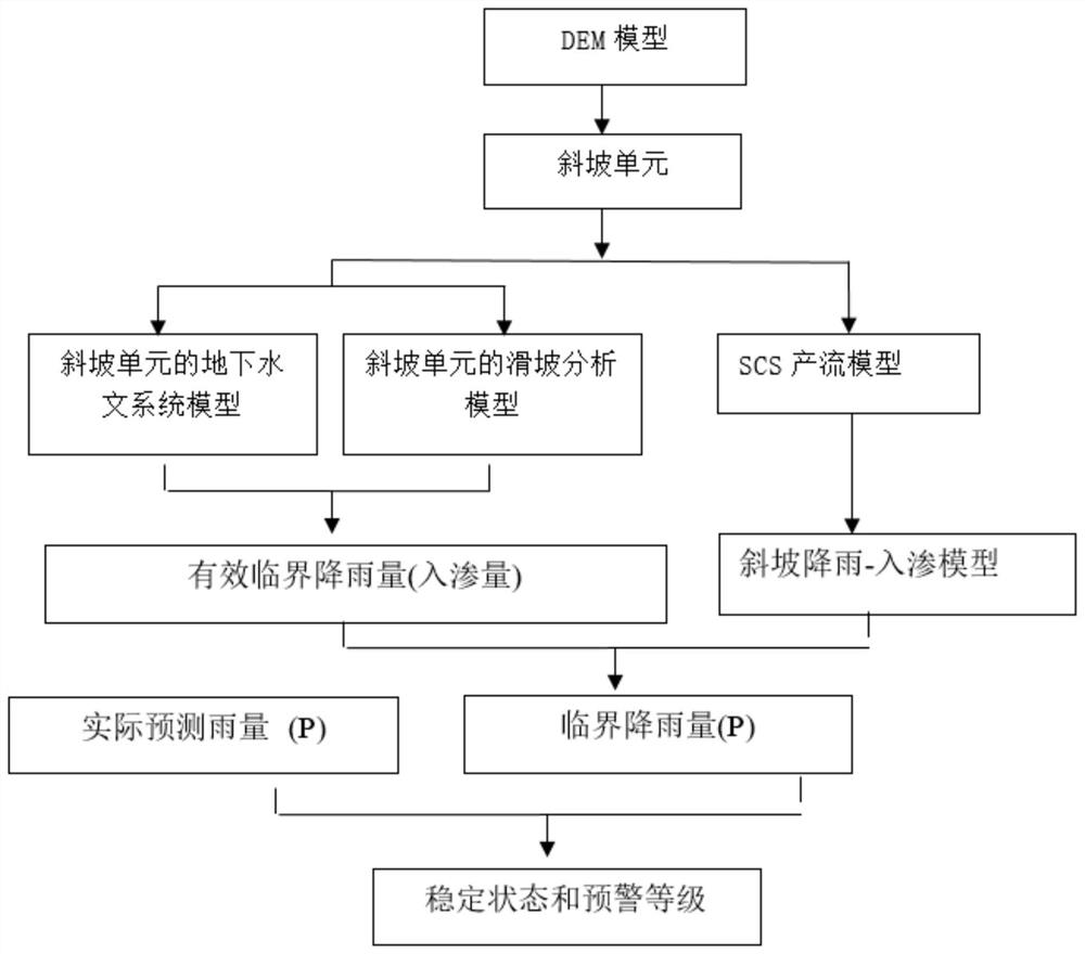
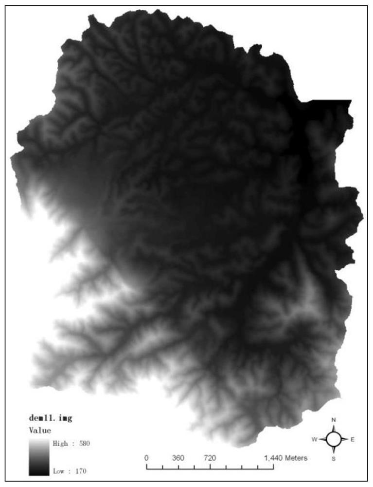
[0142] (1) Construct the DEM of the target area according to the topographic map data
[0143] The data operation of the small watershed DEM is carried out on the ArcGIS platform. The main methods of DEM establishment: 1) Vectorize a 1:10,000 topographic map to establish a spatial topology relationship; 2) Use the Triangulation Irregular Network (TIN) method to convert the vector line drawing into a TIN data structure for spatial interpolation; 3) Convert the TIN data structure into a grid structure; 4) Resampling the grid data to form a grid DEM (GRID format) to generate a small watershed DEM; 5) Re-interpolate the DEM data to generate contour lines and contour lines The scanned images are color-separated and superimposed, and the generated DEM should be checked for gross errors to check for out-of-limit shifts. The DEM of the study area is attached figure 2 .
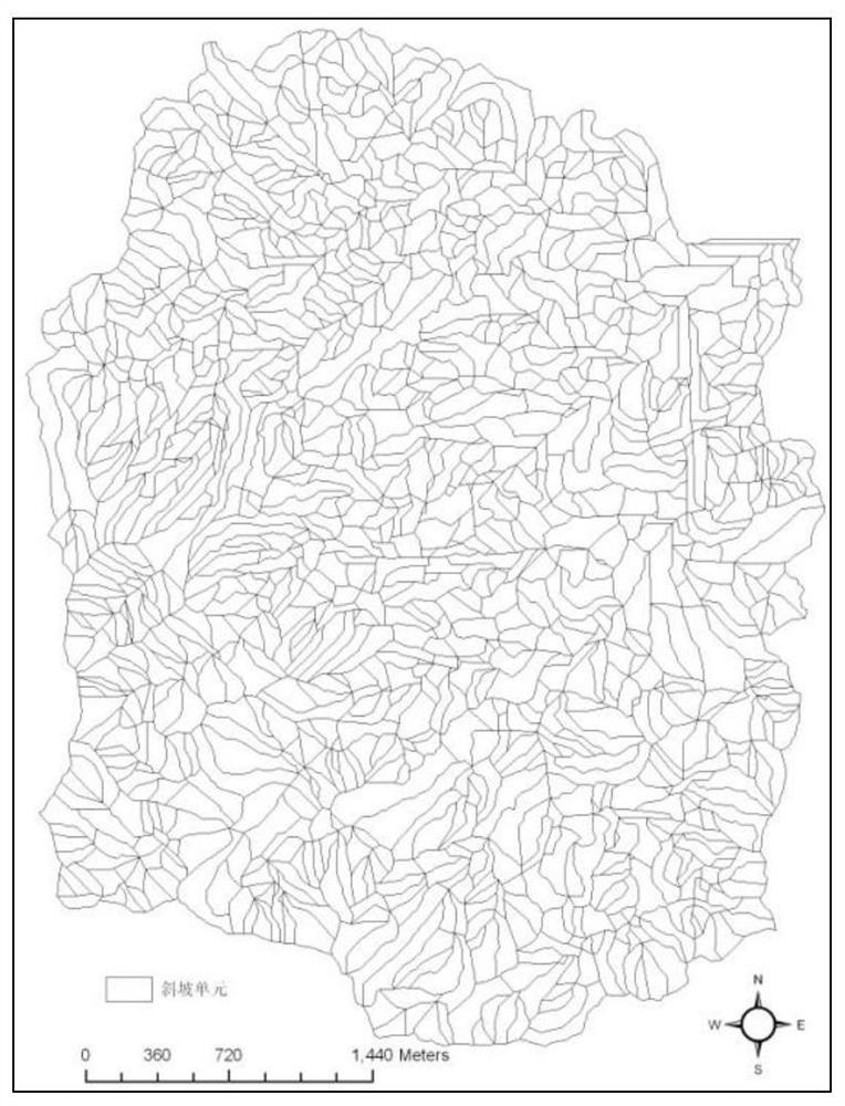
[0144] (2) Division of slope units
[0145] Using the DEM generated from the 1:10,000 topographic map as the b...
PUM
 Abstract
Description
Claims
Application Information
 - R&D Engineer
- R&D Manager
- IP Professional
- Industry Leading Data Capabilities
- Powerful AI technology
- Patent DNA Extraction
Browse by: Latest US Patents, China's latest patents, Technical Efficacy Thesaurus, Application Domain, Technology Topic.
© 2024 PatSnap. All rights reserved.Legal|Privacy policy|Modern Slavery Act Transparency Statement|Sitemap