Stable attenuation compensation reverse-time migration imaging system and method in large desert area
A technology of reverse time migration imaging and attenuation compensation, which is applied in the field of petroleum geophysical exploration, can solve the problems of difficult data acquisition, distortion and distortion, etc., and achieve the effect of correcting dispersion, reasonable design, and accurate imaging of seismic data
- Summary
- Abstract
- Description
- Claims
- Application Information
AI Technical Summary
Problems solved by technology
Method used
Image
Examples
Embodiment 1
[0073] A stable attenuation-compensated reverse time migration imaging system in large desert area, its structure is as follows Figure 10 As shown, it includes input module, coordinate transformation module, wave field forward continuation module, wave field reverse continuation module, stabilization operator module, coordinate inverse transformation module, cross-correlation imaging module and output module;
[0074] The input module is configured to input the migration velocity model of the large desert area in the physical domain, the Q model and the actual observation shot records, and establish an observation system;
[0075] a coordinate transformation module configured to transform the migration velocity model and the Q model of the large desert region into a computational domain;
[0076] The wave field forward continuation module is configured to update the wave field by forward continuation, and obtain the forward wave field snapshot of the computational domain wave...
Embodiment 2
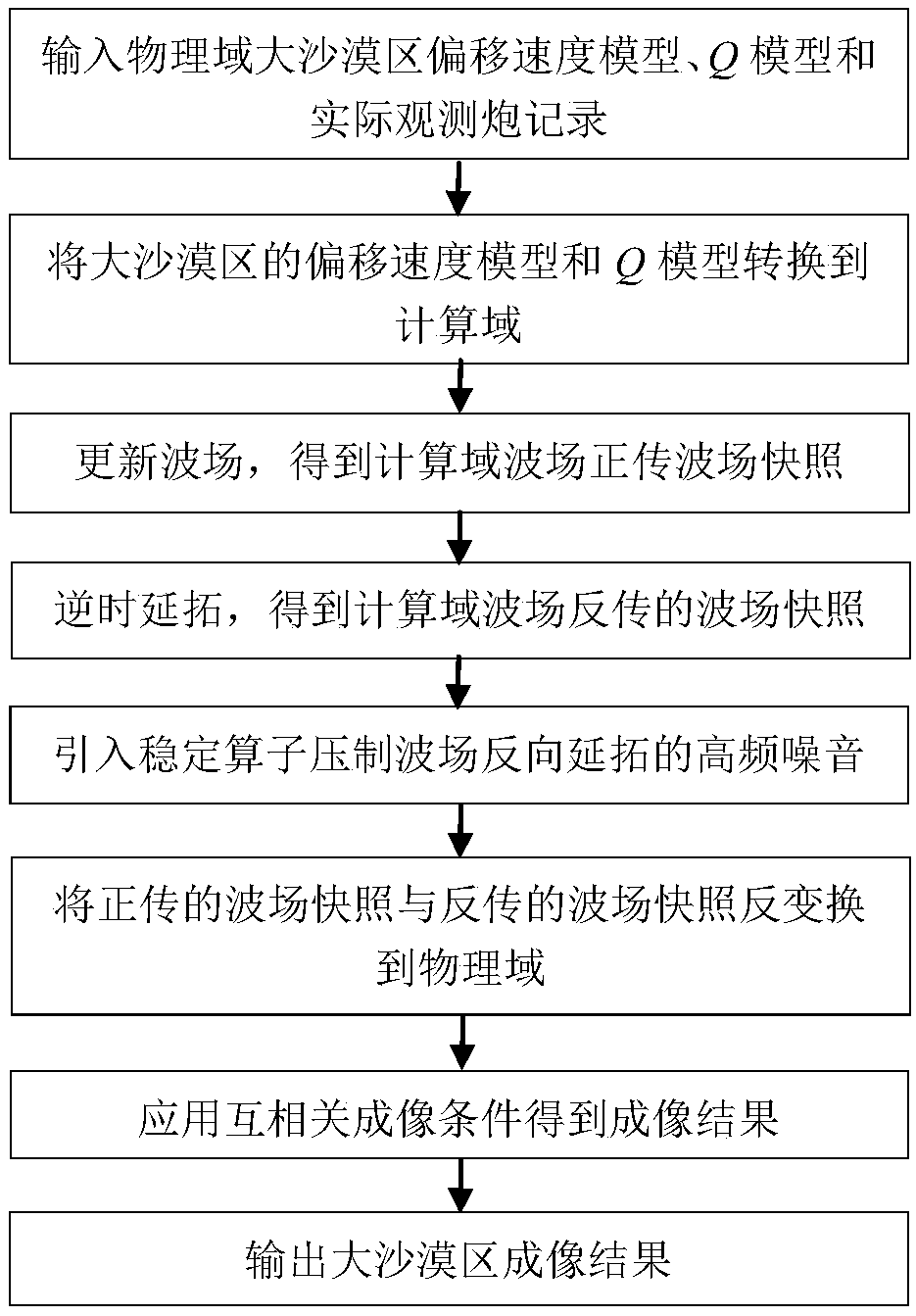
[0083] On the basis of the above embodiments, the present invention also mentions a stable large desert area attenuation compensation reverse time migration imaging method, the process of which is as follows figure 1 As shown, it specifically includes the following steps:
[0084] Step 1: Through the input module, input the migration velocity model, Q model and actual observation shot records of the large desert area in the physical domain, and establish the observation system;
[0085] Step 2: Transform the migration velocity model and Q model of the large desert area into the computational domain through the coordinate transformation module, using formula (1);
[0086]
[0087] Among them, (x, z) represents the coordinate expression of the physical domain; (ξ, η) represents the coordinate expression of the computational domain;
[0088] Step 3: Through the wave field forward continuation module, the wave equation is used to perform forward continuation to update the wave...
PUM
 Abstract
Description
Claims
Application Information
 - R&D
- Intellectual Property
- Life Sciences
- Materials
- Tech Scout
- Unparalleled Data Quality
- Higher Quality Content
- 60% Fewer Hallucinations
Browse by: Latest US Patents, China's latest patents, Technical Efficacy Thesaurus, Application Domain, Technology Topic, Popular Technical Reports.
© 2025 PatSnap. All rights reserved.Legal|Privacy policy|Modern Slavery Act Transparency Statement|Sitemap|About US| Contact US: help@patsnap.com


