

Balancing and stabilizing mechanism for geological surveying and mapping instrument
A surveying and mapping instrument and balanced technology, applied in the field of surveying and mapping instruments, can solve the problems of difficult height adjustment, difficult to carry, large volume, etc., and achieve the effect of convenient operation, reduced floor space, and increased space utilization
- Summary
- Abstract
- Description
- Claims
- Application Information
AI Technical Summary
Problems solved by technology
Method used
Image

Examples
Embodiment 1
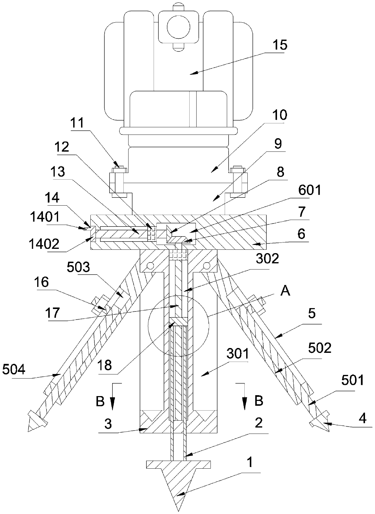
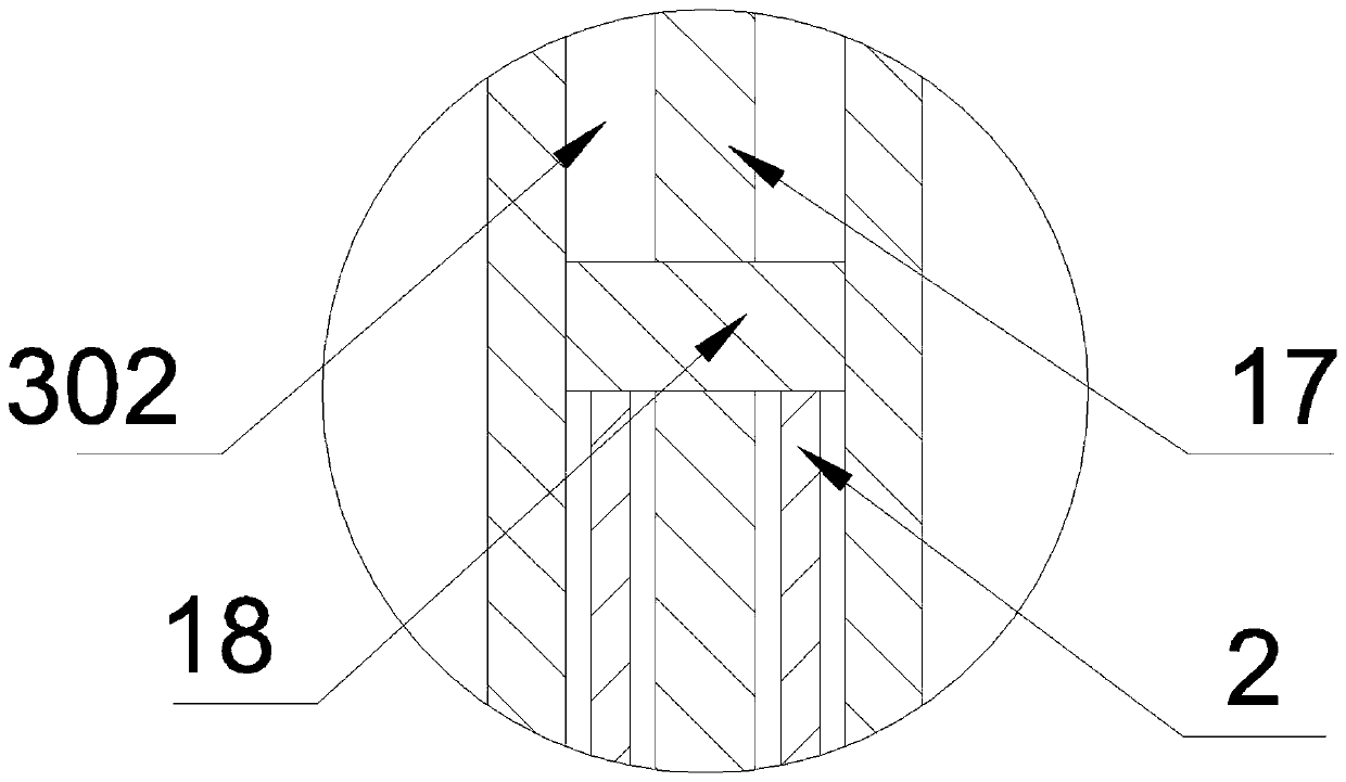
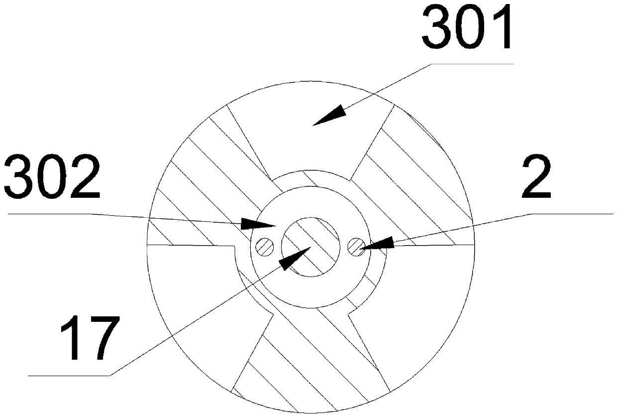
[0030] see figure 1 , figure 2 , image 3 , a balance and stability mechanism of a geological surveying instrument, including a connecting seat 6, a power chamber 601 is provided in the connecting seat 6, a fixed column 3 on the lower surface of the connecting seat 6, and a lifting chamber communicating with the power chamber 601 is provided in the fixed column 3 302, a screw rod 17 is provided in the lifting chamber 302, an adjustment mechanism that drives the screw rod 17 to rotate is provided in the power chamber 601, and a lifting block 18 matching its thread is set on the screw rod 17, and the lower surface of the lifting block 18 is symmetrically provided with connecting rods 2 One end of the connecting rod 2, the other end of the connecting rod 2 passes through the lower surface of the fixed column 3 and is connected with the first spike block 1, and the annular surface of the fixed column 3 is provided with a plurality of receiving grooves 301, and the upper sides in t...
Embodiment 2
[0033] see figure 1 , figure 2 , image 3 , a balance and stability mechanism of a geological surveying instrument, including a connecting seat 6, a power chamber 601 is provided in the connecting seat 6, a fixed column 3 on the lower surface of the connecting seat 6, and a lifting chamber communicating with the power chamber 601 is provided in the fixed column 3 302, a screw rod 17 is provided in the lifting chamber 302, an adjustment mechanism that drives the screw rod 17 to rotate is provided in the power chamber 601, and a lifting block 18 matching its thread is set on the screw rod 17, and the lower surface of the lifting block 18 is symmetrically provided with connecting rods 2 One end of the connecting rod 2, the other end of the connecting rod 2 passes through the lower surface of the fixed column 3 and is connected with the first spike block 1, and the annular surface of the fixed column 3 is provided with a plurality of receiving grooves 301, and the upper sides in...
Embodiment 3
[0039] see figure 1 , figure 2 , image 3 , a balance and stability mechanism of a geological surveying instrument, including a connecting seat 6, a power chamber 601 is provided in the connecting seat 6, a fixed column 3 on the lower surface of the connecting seat 6, and a lifting chamber communicating with the power chamber 601 is provided in the fixed column 3 302, a screw rod 17 is provided in the lifting chamber 302, an adjustment mechanism that drives the screw rod 17 to rotate is provided in the power chamber 601, and a lifting block 18 matching its thread is set on the screw rod 17, and the lower surface of the lifting block 18 is symmetrically provided with connecting rods 2 One end of the connecting rod 2, the other end of the connecting rod 2 passes through the lower surface of the fixed column 3 and is connected with the first spike block 1, and the annular surface of the fixed column 3 is provided with a plurality of receiving grooves 301, and the upper sides in...
PUM
 Abstract
Description
Claims
Application Information